You are using an outdated browser. Please
upgrade your browser to improve your experience.

Ideal for navigation onboard of your sailing yacht, motorship, canoe or longboat:

WinGPS Marine Plus
by Stentec Software


What is it about?
Ideal for navigation onboard of your sailing yacht, motorship, canoe or longboat:
App Screenshots


App Store Description
Ideal for navigation onboard of your sailing yacht, motorship, canoe or longboat:
- Always know where you are, how fast you go and what your course is using a GPS receiver (internal or Bluetooth).
- Download the chart of your sailing area and check the current depths, buoys and other nautical information.
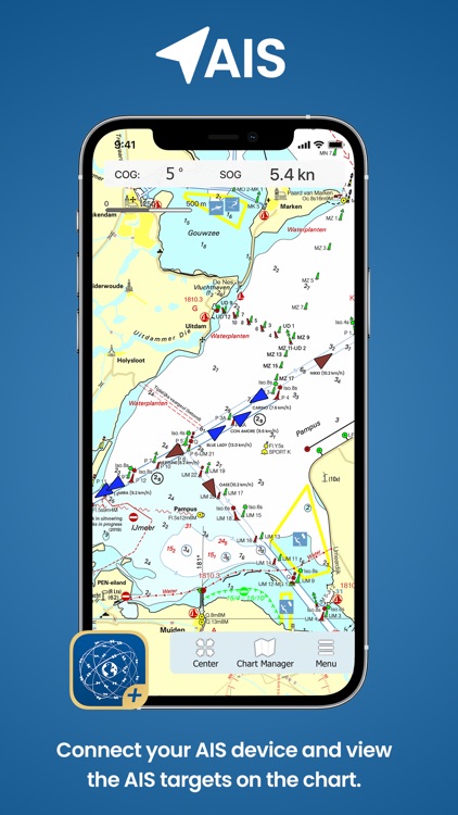
- Connect your AIS device and the AIS objects will be plotted on your chart.
- Waterway network: View the information of the bridges, locks and waterways.
- Set out a route on open waters, or plan an inland route over the waterway network taking the information of your ship and the bridges, locks and waterway into account.
- Navigate along the route points to your destination using the course line, Course to Go and Distance to Go.
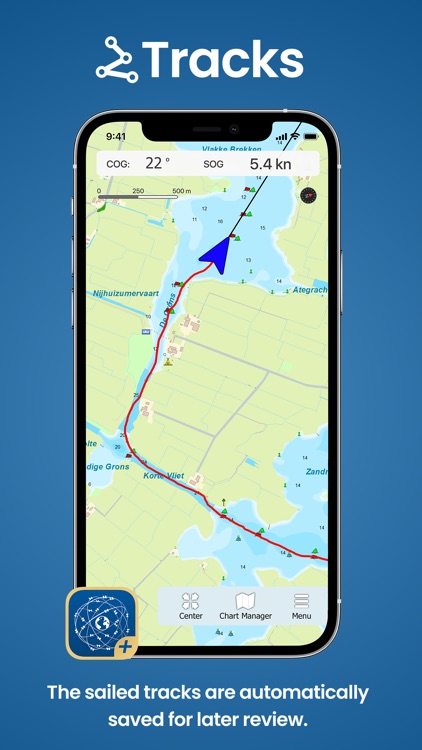
- View and save your sailed track.
More functionalities are in development, a.o. GRIB-files for weather forecast.
The charts that can be used in this app, are Stentec’s own DKW-charts and can be found at www.stentec.com. For example the free chart DKW Frisian Lakes or the well-known DKW 1800-series for the Dutch coastal waters, including weekly update services.
At the first start-up of the app, you will be asked to log in with your account. The free default online maps from Apple are available in the app for orientation. The DKW-charts of 2018 and newer, which are connected to your account, can be downloaded directly in this app and be used for navigation.
Disclaimer:
AppAdvice does not own this application and only provides images and links contained in the iTunes Search API, to help our users find the best apps to download. If you are the developer of this app and would like your information removed, please send a request to takedown@appadvice.com and your information will be removed.
AppAdvice does not own this application and only provides images and links contained in the iTunes Search API, to help our users find the best apps to download. If you are the developer of this app and would like your information removed, please send a request to takedown@appadvice.com and your information will be removed.