You are using an outdated browser. Please
upgrade your browser to improve your experience.
World Street View, Combination of Map Street View and Multivariate Latitude Data

世界街景-3d全景卫星高清世界地图
by IVORY APP SOFT
What is it about?
World Street View, Combination of Map Street View and Multivariate Latitude Data
App Screenshots
App Store Description
World Street View, Combination of Map Street View and Multivariate Latitude Data
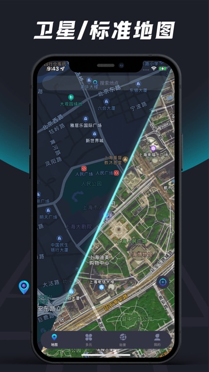
world map
A map covering the whole world, with fast update and high longitude
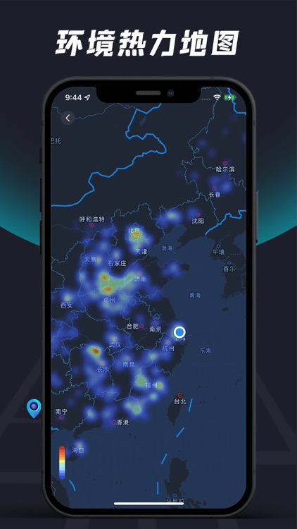
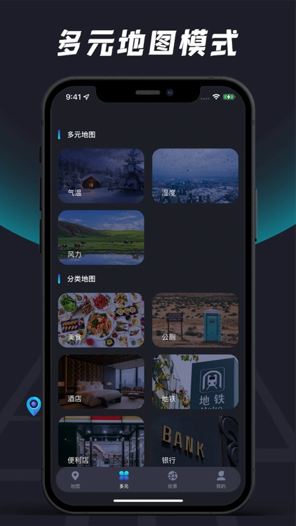
Multiple Maps
Temperature map: Using multi-point rendering technology, the temperature across the country can be seen at a glance, synchronously updated in real time, high-contrast heat map style, and the temperature distribution across the country is clear at a glance
Rainfall map: Taking the whole country as the dimension, it displays the recent rainfall and rainfall. This function relies on satellite cloud image data and dynamically analyzes it.
Environmental map: Air index is more and more important to our life. If you want to travel to a certain area, first go to see how the air quality is there
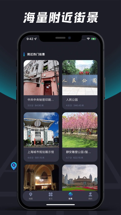
Scenic Street View
Here you can easily and quickly understand the situation of the surrounding scenic spots, all of which are real-time shooting. Not only the real scene of the scenic spot, but also the real scene of the surrounding situation of the scenic spot. A large number of tourists' experience, to avoid stepping on the pit, everyone said that it is really good.
One-click map
One-click query of practical facilities, currently supported: food, hotels, subways, convenience stores, banks, tourist attractions, parks, toilets, and more facilities are still being supported. The one-click map function not only supports search, but also supports intelligent route planning, allowing you to reach your destination with the fastest speed and the shortest distance.
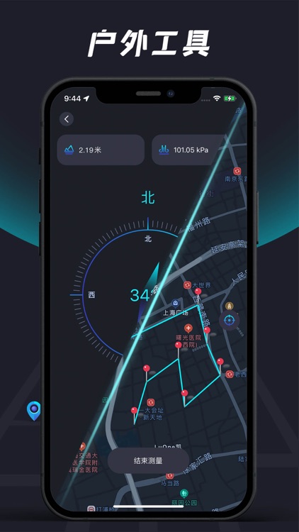
outdoor tools
Compass: Using GPS calibration technology, it is not only a compass, but also can measure altitude and atmospheric pressure. It is an essential tool for outdoor travelers
Distance measurement: measure the distance between two or more points on the map, with high precision and high speed
Disclaimer:
AppAdvice does not own this application and only provides images and links contained in the iTunes Search API, to help our users find the best apps to download. If you are the developer of this app and would like your information removed, please send a request to takedown@appadvice.com and your information will be removed.
AppAdvice does not own this application and only provides images and links contained in the iTunes Search API, to help our users find the best apps to download. If you are the developer of this app and would like your information removed, please send a request to takedown@appadvice.com and your information will be removed.