You are using an outdated browser. Please
upgrade your browser to improve your experience.

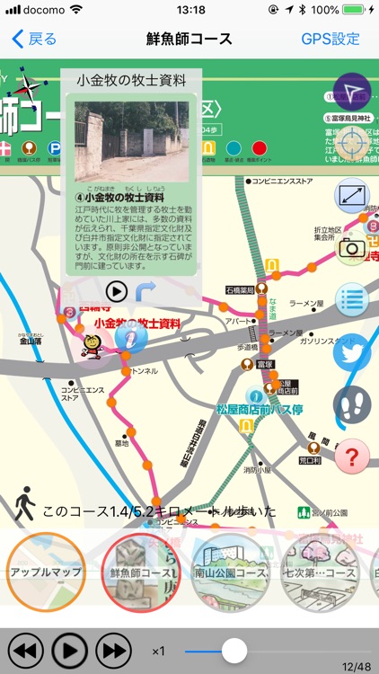
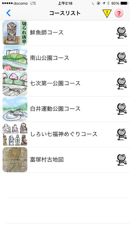
白井散策Mapは、イラストマップを使って白井市の文化財を紹介するナビゲーション・アプリです。主要機能は、イラストマップ上にユーザのGPS現在地を表示するとともに、文化財などの点情報に近づくと自動的に説明のナレーションが再生されます。このアプリでは、以下の6つの散策コースをお楽しみいただけます。

白井散策Map
by RUOCHEN SI

What is it about?
白井散策Mapは、イラストマップを使って白井市の文化財を紹介するナビゲーション・アプリです。主要機能は、イラストマップ上にユーザのGPS現在地を表示するとともに、文化財などの点情報に近づくと自動的に説明のナレーションが再生されます。このアプリでは、以下の6つの散策コースをお楽しみいただけます。
App Screenshots


App Store Description
白井散策Mapは、イラストマップを使って白井市の文化財を紹介するナビゲーション・アプリです。主要機能は、イラストマップ上にユーザのGPS現在地を表示するとともに、文化財などの点情報に近づくと自動的に説明のナレーションが再生されます。このアプリでは、以下の6つの散策コースをお楽しみいただけます。
1. 鮮魚師コース
2. 南山公園コース
3. 七次第一公園コース
4. 白井運動公園コース
5. しろい七福神めぐりコース
6. 富塚村古地図
*GPS連続利用は、バッテリー消耗をかなり早くします。
本アプリは、初期設定として、バックグラウンドで自動的にGPS軌跡データを記録する設定になっています。ユーザは、バックグラウンドでのGPS軌跡データ自動記録の設定を中止に変更できます。
Disclaimer:
AppAdvice does not own this application and only provides images and links contained in the iTunes Search API, to help our users find the best apps to download. If you are the developer of this app and would like your information removed, please send a request to takedown@appadvice.com and your information will be removed.
AppAdvice does not own this application and only provides images and links contained in the iTunes Search API, to help our users find the best apps to download. If you are the developer of this app and would like your information removed, please send a request to takedown@appadvice.com and your information will be removed.