You are using an outdated browser. Please
upgrade your browser to improve your experience.

This application of Seino area limitation of the endowment along railway lines, bicycle navigation app

養鉄サイクリングナビ by NAVITIME
by IKEDA TOWN

What is it about?
This application of Seino area limitation of the endowment along railway lines, bicycle navigation app.
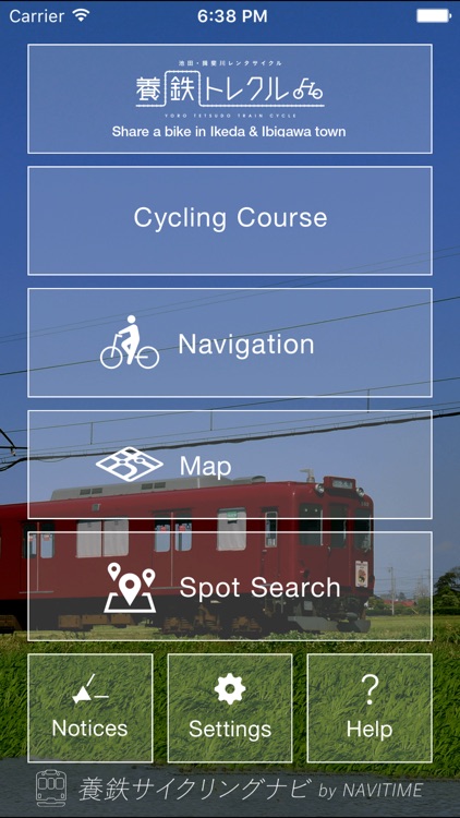
App Screenshots
App Store Description
This application of Seino area limitation of the endowment along railway lines, bicycle navigation app.
By function that specializes in cycling, more comfortable strong support!
• You can search for the destination from, recommendations attractions and the surrounding category search
- Such as the height difference graph of the voice guidance and route, equipped with many features that are specific to the bicycle!
Map of the color scheme will switch automatically between day and night!
[Corresponding area], Gifu Prefecture west district (Ikeda, ibigawa, Goudo-cho, Ogaki, Yoro-cho, kaizu, Ono-cho, Tarui-cho, Sekigahara-cho, Anpachi, Motosu, Wanouchi) and Mie Prefecture Kuwana
※ If set to a non-corresponding area in the starting-over-destination, it can not be performed the root of the search.
/ *** Function details *** /
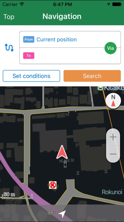
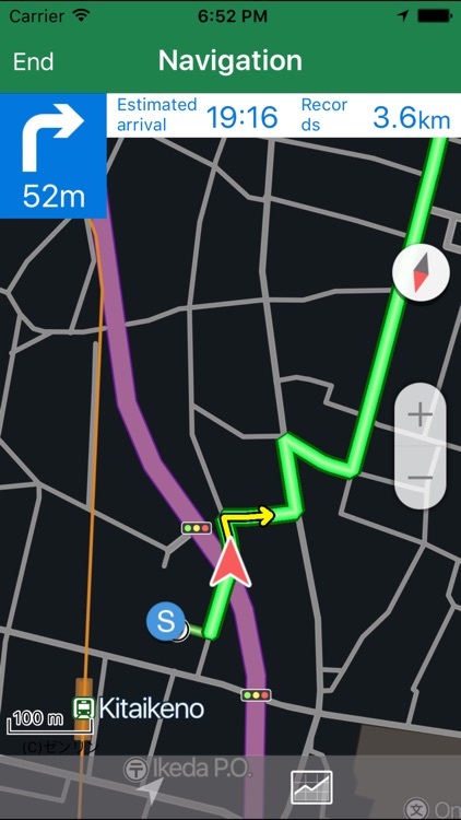
◆ [Route Search] is possible route search and-destination point via departure and the point in the corresponding area.
◆ You can voice navigation of the Voice Navigation route.
◆ to display the height difference graph] height difference graph, you can see the relief of the route at a glance.
◆ I will introduce the recommended cycling course] recommended cycling course with photos. Also voice navigation is also possible.
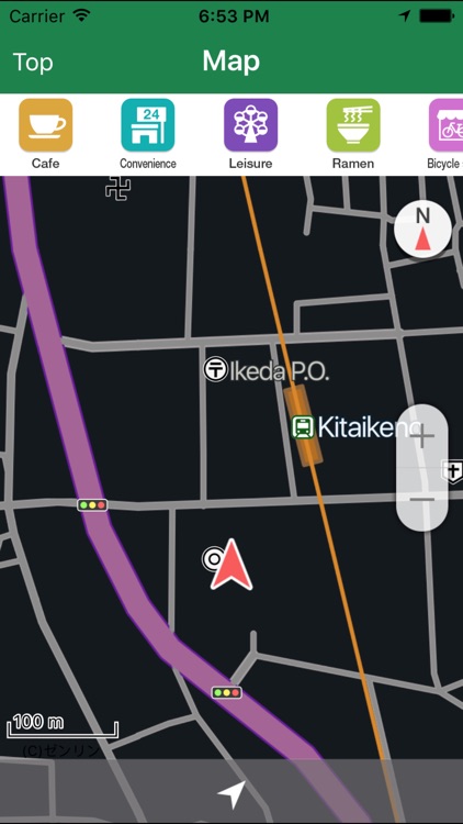
◆ [spot Search around the category search and recommendations spot, you can spot search of a free word.
◆ [easy-to-read map at night] day and night at the map color scheme will change automatically. It is also possible to fix either.
◆ fixed mode of [electronic compass] the current location of the arrow to rotate to match the orientation of the terminal, the map is available in two modes of rotation mode that rotates according to the orientation of the terminal.
[Corresponding hardware]
iPhone4S or more of the iPhone terminal
※ iPod touch, GPS non-powered devices such as the iPad Wi-Fi model is not supported.
[Supported OS]
iOS8.0 or more
【please note】
Route that is displayed you may not be able to pass a bicycle. Actual road conditions, traffic regulation signs, please follow the road display or the like.
· Gaze-operation of mobile phone while driving is very dangerous. In addition, there is a possibility to violate the Road Traffic Act and the like.
- During navigation will be exhausted quickly battery. Please use the charge kit or the like, if necessary.
When the background continue to use the GPS in, there is a possibility that much to consume the battery.
Disclaimer:
AppAdvice does not own this application and only provides images and links contained in the iTunes Search API, to help our users find the best apps to download. If you are the developer of this app and would like your information removed, please send a request to takedown@appadvice.com and your information will be removed.
AppAdvice does not own this application and only provides images and links contained in the iTunes Search API, to help our users find the best apps to download. If you are the developer of this app and would like your information removed, please send a request to takedown@appadvice.com and your information will be removed.