You are using an outdated browser. Please
upgrade your browser to improve your experience.

Aegina Hiking is a digital field guide for hiking and touring Aegina Island

Aegina topoguide
by Topoguide - T ADAMAKOPOULOS - A ADAMAKOPOULOS O.E.
What is it about?
Aegina Hiking is a digital field guide for hiking and touring Aegina Island.
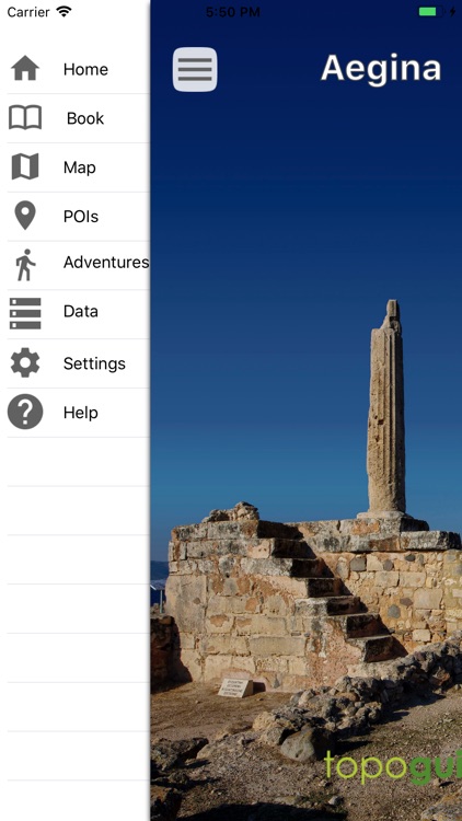
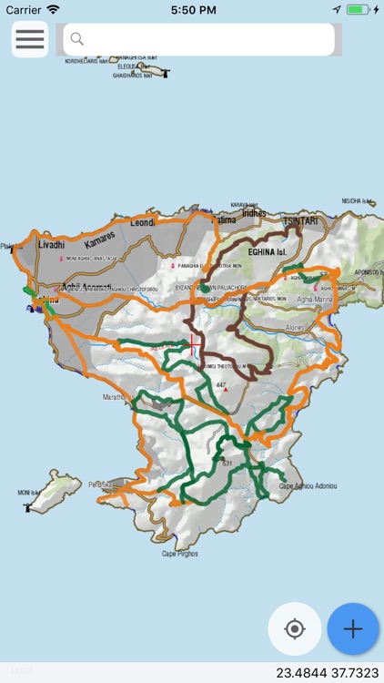
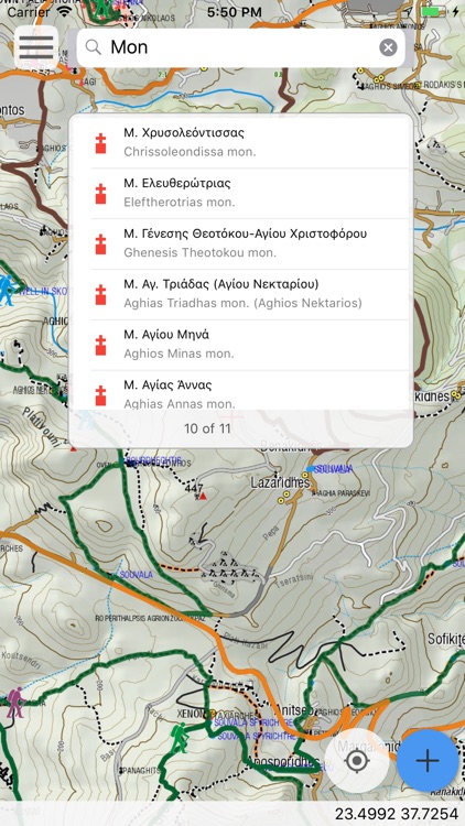
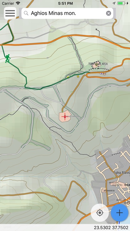
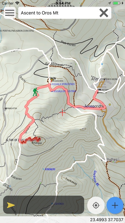
App Screenshots
App Store Description
Aegina Hiking is a digital field guide for hiking and touring Aegina Island.
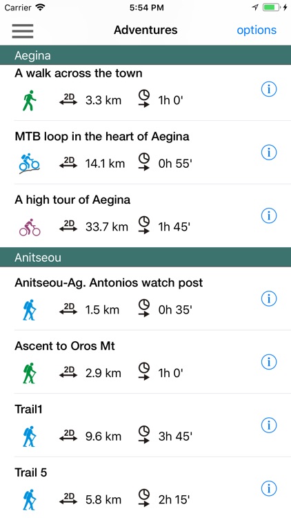
It includes routes, descriptions and photos for 13 hiking trails, 3 bike routes and 2 car tours. Each trail has a detailed description, a statistic analysis and a POIs list.
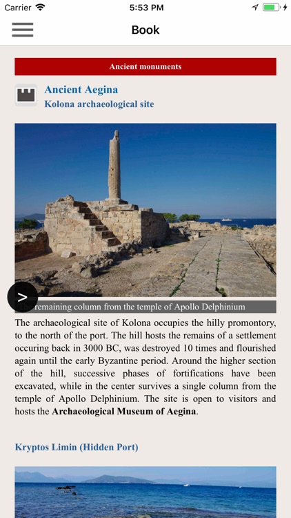
Aegina is famous for its ancient monuments, the peculiar volcanic landscape and the well preserved neoclassical buildings.
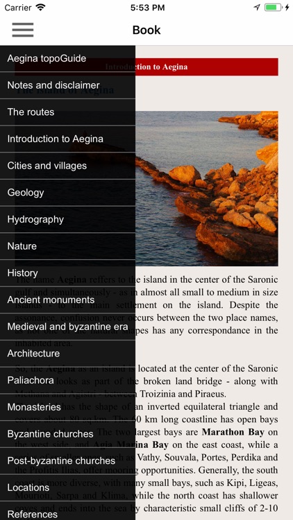
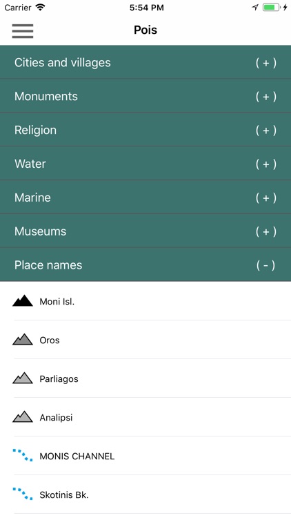
The application offers detailed offline maps and an extensive introduction on geography, geology, the most important settlements and monuments, and the nature of Aegina Island. The app also offers a list of useful POIs (most island's accommodations are included) with a search feature on the map screen.
In the field, the app identifies the nearest adventure, guides you to it and then along it by displaying messages and warnings on every junction or other important location. On each Point of Interest, photos and texts are displayed on the map. If the hiker gets off-trail, the app indicates the shorter way to get back safely.
Also, a navigation feature allows to calculate routes and distances along roads and paths anywhere on the island.
The cartographic company AnaDigit, creator of the application, has issued hundreds of hiking maps for Greece (eg. maps of Kalymnos, Santorini, Crete, Mt. Olympus, Zagori, Sifnos, Naxos and other Aegean islands). AnaDigit was the hiking expert involved in the planning and the implementation of the recently waymarked hiking network.
Disclaimer:
AppAdvice does not own this application and only provides images and links contained in the iTunes Search API, to help our users find the best apps to download. If you are the developer of this app and would like your information removed, please send a request to takedown@appadvice.com and your information will be removed.
AppAdvice does not own this application and only provides images and links contained in the iTunes Search API, to help our users find the best apps to download. If you are the developer of this app and would like your information removed, please send a request to takedown@appadvice.com and your information will be removed.