You are using an outdated browser. Please
upgrade your browser to improve your experience.

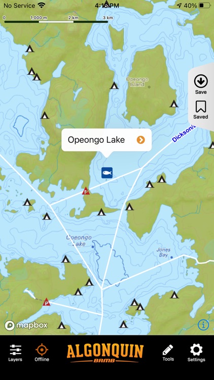
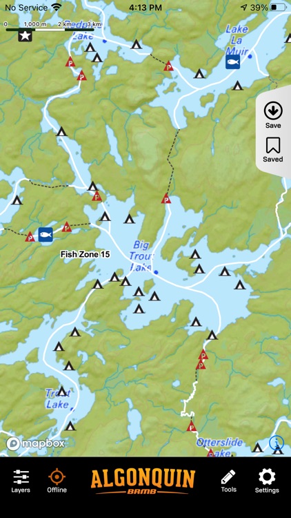
The Algonquin Park Adventure Map app is an offline navigation app showing all the paddling routes, campsites, trails, fishing locations, roadside attractions, wildlife viewing areas and more

Algonquin Park Adventure Map
by Mussio Ventures Ltd.
What is it about?
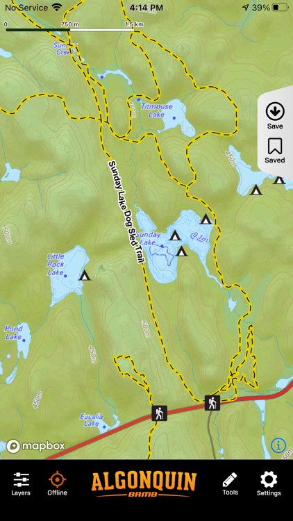
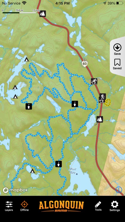
The Algonquin Park Adventure Map app is an offline navigation app showing all the paddling routes, campsites, trails, fishing locations, roadside attractions, wildlife viewing areas and more. The app allows tracking and dropping of waypoints, while thousands of points of interest provide information on everything from canoe routes to hiking and backpacking trails.
App Screenshots
App Store Description
The Algonquin Park Adventure Map app is an offline navigation app showing all the paddling routes, campsites, trails, fishing locations, roadside attractions, wildlife viewing areas and more. The app allows tracking and dropping of waypoints, while thousands of points of interest provide information on everything from canoe routes to hiking and backpacking trails.
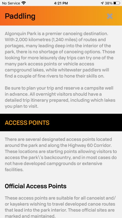
Want to know what fish are in the lake or which lakes are stocked? We have that covered too. Extra trip planning tools and park information rounds out the vast amount of value added information.
Built off of the Backroad Mapbooks industry leading topographic maps, the maps contain all the park details found on their bestselling Algonquin Provincial Park waterproof map. These include:
- Backcountry Campsites
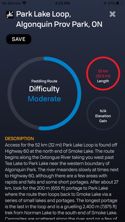
- Canoe Routes
- Cross-country Ski Trails
- Fishing Locations
- Frontcountry Campsites
- Hiking Trails
- Lake Bathymetry (lake depths)
- Mountain Biking Trails
- Outfitters and Park Service Providers
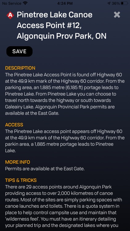
- Paddling & Park Access Points
- Picnic Sites
- Roadside Attractions
- Topographic Contours with Relief Shading
- Whitewater River Routes
- Winter Recreation
- Wildlife Viewing
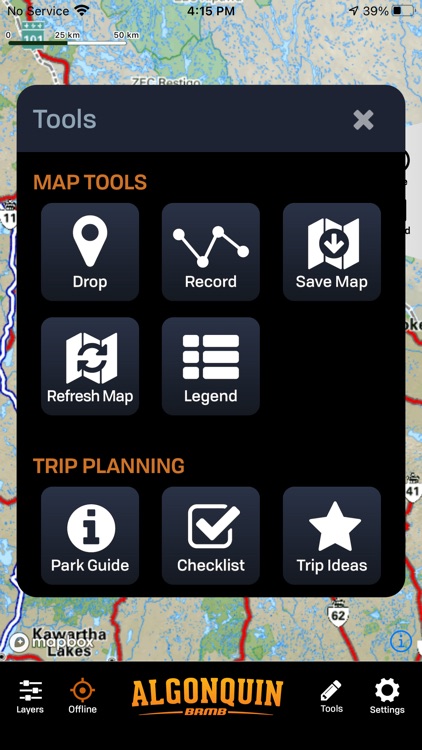
The app works fully offline, allowing you to view your current location on the map, drop waypoints and track your route. This will allow you to safely track yourself into and out of new areas or record the trip for later viewing and editing.
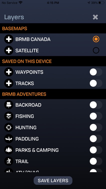
Looking for high resolution satellite imagery? We have that too. You will need cell service or wi-fi to view this layer or you can save smaller areas of the park as a separate offline map if desired.
HOW IT WORKS:
Navigating your way into Algonquin’s amazing backcountry is now easier than ever. Simply open the app and follow the instructions to download the offline map. You can also skip this download and save an offline map later.
Once the map is downloaded, you can zoom right to your current location or pan to the area of interest. The fast, seamless map interface allows you to see all the map content from the popular Backroad Mapbooks series for the area around Algonquin Park.
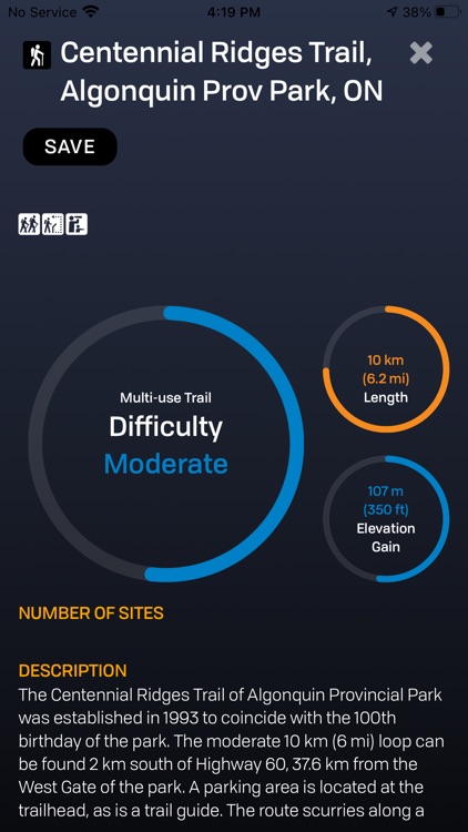
If you are not interested in certain activities, this backcountry navigation app allows you to turn the Adventure layers on and off, as well as Crown Land and Resource and Recreational Roads in and around the park. Within each Adventure are hundreds of points of interest (POI) providing descriptions of activities, access information, trail stats such as difficulty, length, elevation gain and much more. These options all overlay on top of the BRMB base map, which provides the most comprehensive collection of road and geographical information available for the park on the market.
Be your own guide and explore the backcountry of Algonquin Park like never before with this all in one navigation app.
Disclaimer:
AppAdvice does not own this application and only provides images and links contained in the iTunes Search API, to help our users find the best apps to download. If you are the developer of this app and would like your information removed, please send a request to takedown@appadvice.com and your information will be removed.
AppAdvice does not own this application and only provides images and links contained in the iTunes Search API, to help our users find the best apps to download. If you are the developer of this app and would like your information removed, please send a request to takedown@appadvice.com and your information will be removed.