You are using an outdated browser. Please
upgrade your browser to improve your experience.
The Alpe-Adria-Trail connects the three regions of Carinthia, Slovenia and Friuli-Venezia Giulia, and covers a total of 43 stages

Alpe Adria Trail
by Outdooractive AG

What is it about?
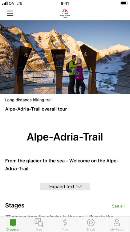
The Alpe-Adria-Trail connects the three regions of Carinthia, Slovenia and Friuli-Venezia Giulia, and covers a total of 43 stages. The long distance hiking route leads from the foot of the highest mountain in Austria, the Grossglockner, through the beautiful Carinthian mountain and lake districts near where the three countries – Austria, Italy and Slovenia – meet. The Triglav National Park, the Soča Valley, the wine-growing regions of Colli Orientali and Goriška Brda and the Karst are further unique areas you will pass before finally reaching Muggia at the Adriatic Sea.
App Screenshots


App Store Description
The Alpe-Adria-Trail connects the three regions of Carinthia, Slovenia and Friuli-Venezia Giulia, and covers a total of 43 stages. The long distance hiking route leads from the foot of the highest mountain in Austria, the Grossglockner, through the beautiful Carinthian mountain and lake districts near where the three countries – Austria, Italy and Slovenia – meet. The Triglav National Park, the Soča Valley, the wine-growing regions of Colli Orientali and Goriška Brda and the Karst are further unique areas you will pass before finally reaching Muggia at the Adriatic Sea.
An essential component of the app is the detailed information that is provided for each stage: the course of the stages, attractions and establishments.
The tours/stages, including all tour details and relevant map sections, can be stored on a smartphone and can be accessed offline, if required (for example, if you are in another country, in areas with weak network coverage, or when data roaming would be too expensive).
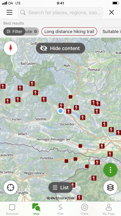
The tour descriptions contain all the facts, images and elevation profiles you might need. As soon as a tour is started, you can determine your own position (including determining which direction you are facing) easily in the topographic map and, in this way, follow the course of the route.
Please note: In other countries high roaming costs can occur, therefore, when using the app, make sure all necessary information can be accessed offline by downloading it at a flat rate or via Wi-Fi before starting your journey.
Background use of the app with activated GPS reception can drastically shorten battery life!
Apple Health:
When you record a cycling, hiking, walking or running track you are able to save work outs to Apple Health. Data from HealthKit will not be used for marketing or promotional purposes.
Disclaimer:
AppAdvice does not own this application and only provides images and links contained in the iTunes Search API, to help our users find the best apps to download. If you are the developer of this app and would like your information removed, please send a request to takedown@appadvice.com and your information will be removed.
AppAdvice does not own this application and only provides images and links contained in the iTunes Search API, to help our users find the best apps to download. If you are the developer of this app and would like your information removed, please send a request to takedown@appadvice.com and your information will be removed.