You are using an outdated browser. Please
upgrade your browser to improve your experience.
Alta & Snowbird GPS, brought to you by SNOCRU, is a GPS app for the iPhone

Alta & Snowbird GPS: Ski and Snowboard Trail Maps
by SNOCRU, LLC
What is it about?
Alta & Snowbird GPS, brought to you by SNOCRU, is a GPS app for the iPhone.
App Store Description
Alta & Snowbird GPS, brought to you by SNOCRU, is a GPS app for the iPhone.
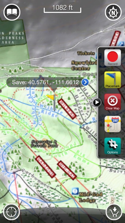
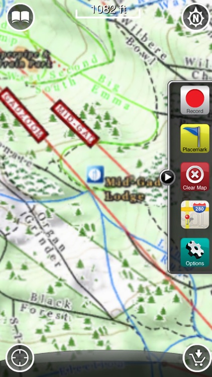
Set within the Wasatch-Cache National Forest in Utah, these two ski resorts offer over 4,700 acres of bowls, trees, glades, and steeps for every type of skier. With over 500 inches of annual snowfall, Little Cottonwood Canyon is powder skiing at its finest. The Accuterra Alta & Snowbird GPS app gives you highly detailed maps of the ski area that are EMBEDDED on your iPhone, so you can find your GPS location whether you have a network connection or not.
Track your progress throughout the day on AccuTerra maps, or, if you have a cell signal, switch to Google Maps™ and check your location on a satellite map. Take geo-coded photos to create a multi-dimensional capture of your day on the hill. Then replay your saved tracks and photos Après-ski via AccuTerra’s unique Walking Tour, or share your stats via Facebook™ and email. Don’t fumble with a paper map anymore!
Alta & Snowbird GPS features include:
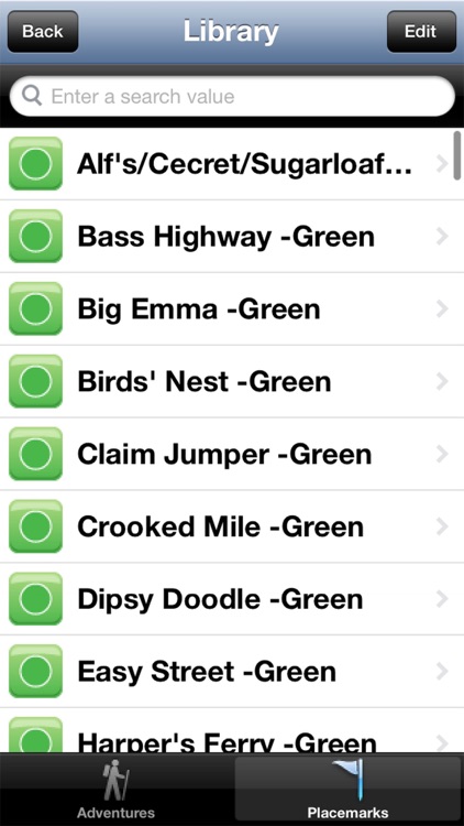
► Includes the entire ski area boundary; including the base area, lodges, runs, bowls, lifts, and trails by difficulty.
► Unlimited Tracks! There is no limit to the number of tracks that can be recorded.
► Unlimited Waypoints! There is no limit to the number of geo-located points that can be recorded.
► Unlimited Geo-coded pictures! Photos taken within AccuTerra are linked to your adventures and can be displayed in the location in which they were taken.
► Real-time elevation profile and travel statistics.
► Easily toggle and track between AccuTerra and Google Maps™
► Share your adventure. Upload directly from AccuTerra into your Facebook™ account, or send your tracks and photos via an email link for viewing in Google Maps™ or Google Earth™
All other trademarks are the property of their respective owners, and are used for identification purposes only.
Have a question, or want to leave feedback? Follow us on http://twitter.com/SNOCRU
Disclaimer:
AppAdvice does not own this application and only provides images and links contained in the iTunes Search API, to help our users find the best apps to download. If you are the developer of this app and would like your information removed, please send a request to takedown@appadvice.com and your information will be removed.
AppAdvice does not own this application and only provides images and links contained in the iTunes Search API, to help our users find the best apps to download. If you are the developer of this app and would like your information removed, please send a request to takedown@appadvice.com and your information will be removed.