You are using an outdated browser. Please
upgrade your browser to improve your experience.
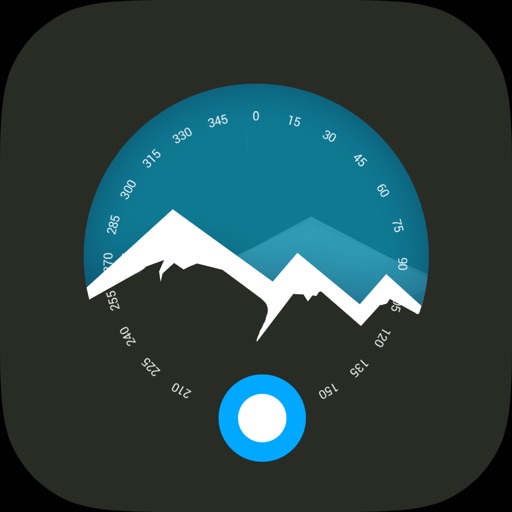
Modern Altimeter GPS+ app is for folks who care for hiking and biking in mountainous terrain

Altimeter Ler
by Elen Bekzadyan
What is it about?
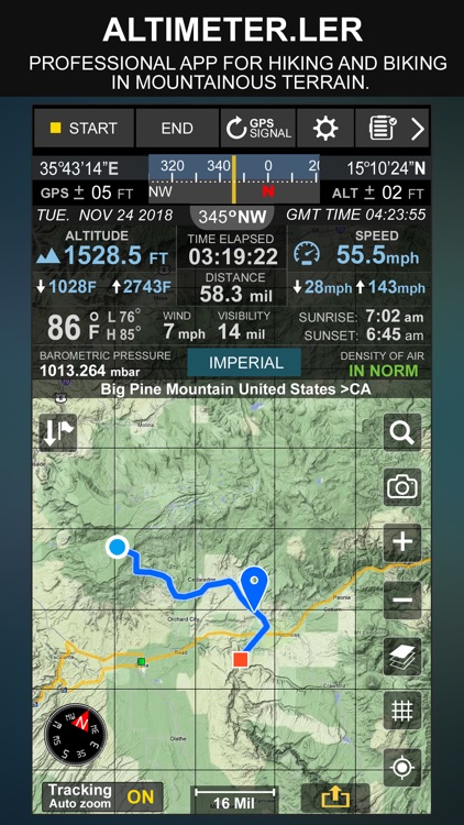
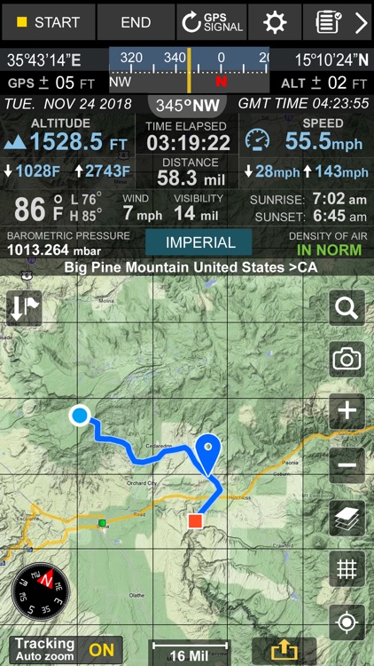
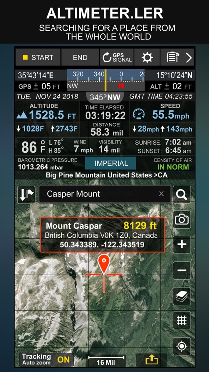
Modern Altimeter GPS+ app is for folks who care for hiking and biking in mountainous terrain. GPS is getting very accurate in terms of distance indication. The choice between unit system is perhaps an important thing, just for your convenience the app is being equipped with both of them (Imperial and Metric). Surprisingly strong barometer measures the weight of the air pressure above a given point and determines elevation of two points.
App Screenshots
App Store Description
Modern Altimeter GPS+ app is for folks who care for hiking and biking in mountainous terrain. GPS is getting very accurate in terms of distance indication. The choice between unit system is perhaps an important thing, just for your convenience the app is being equipped with both of them (Imperial and Metric). Surprisingly strong barometer measures the weight of the air pressure above a given point and determines elevation of two points.
This app has a creative and user-friendly style design, simple and comprehensive functionalities. Features included
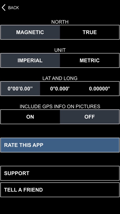
- Imperial and Metric unit settings.
- GPS accuracy indicator.
- GPS distance accuracy indicator.
- Density of air , indicator.
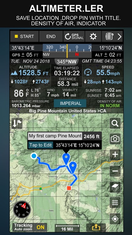
Search any place and drop search pin with place info.
Built in library
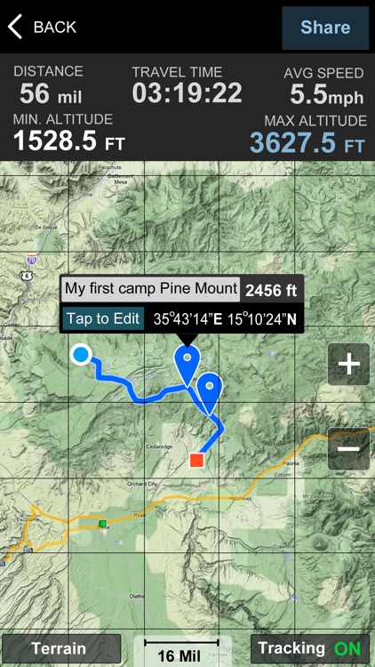
Map integration
- iOS maps
- Satellite maps mode.
- Hybrid maps mode.
- Standard maps mode.
- Terrain maps mode.
- Tracking location changes trajectory.
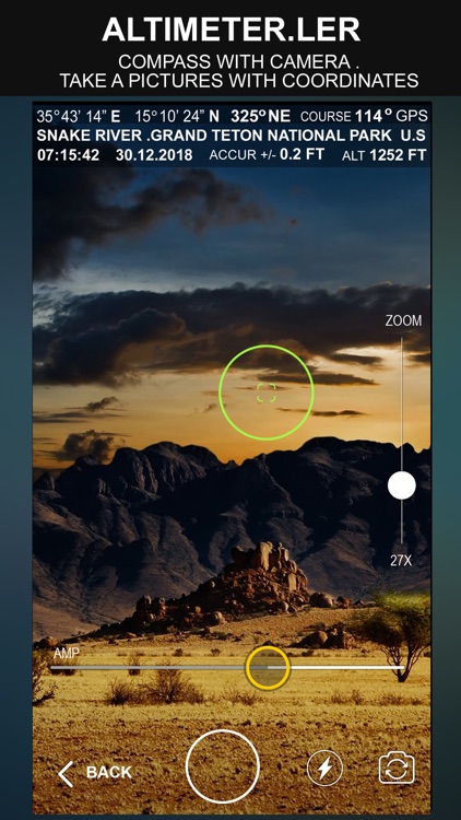
Compass
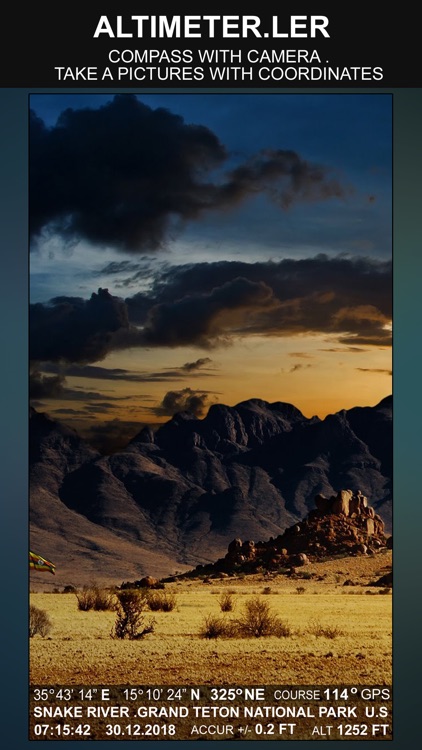
- Compass with camera
- Take a pictures with coordinates
- Shows device real-time orientation to magnetic fields.
- Ability to switch between true and magnetic North.
- Location coordinates (longitude, latitude).
- Course
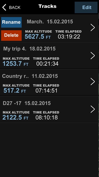
Track information
- Time elapsed.
- Distance.
- Average speed.
- Max speed.
- Altitude.
Tracking
- Speed tracking in mph or km/h based on MPH or KM/H mode.
- Distance tracking in miles or kilometers based on MPH or KM/H mode.
- Time tracking.
- Longitude, latitude coordinates.
- Save locations drop a pin
Weather
-- Temperature information.
-- Wind
-- Visibility
-- Sunrise,Sunset
-- High/Low Temperature.
-- Ability to switch between Celsius and Fahrenheit.
Disclaimer:
AppAdvice does not own this application and only provides images and links contained in the iTunes Search API, to help our users find the best apps to download. If you are the developer of this app and would like your information removed, please send a request to takedown@appadvice.com and your information will be removed.
AppAdvice does not own this application and only provides images and links contained in the iTunes Search API, to help our users find the best apps to download. If you are the developer of this app and would like your information removed, please send a request to takedown@appadvice.com and your information will be removed.