You are using an outdated browser. Please
upgrade your browser to improve your experience.

Aviation navigation made simple and affordable

AviNavi, navigation for pilots
by Candidus LLC
What is it about?
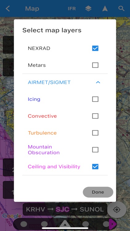
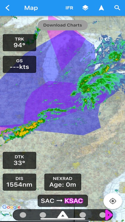
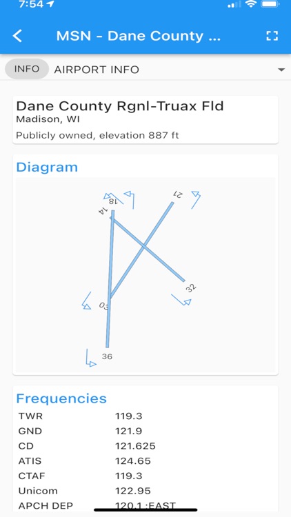
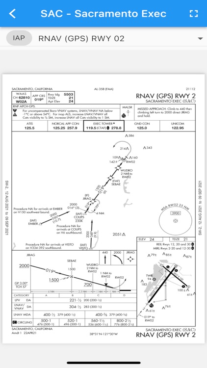
Aviation navigation made simple and affordable. All VFR, low-altitude IFR and instrument approach charts for the continental United States, with full flight planning, including support for airway navigation. Overlays for Nexrad, METARs and AIRMETS/SIGMETS improve flight safety, and detailed airport information (runways, frequencies, fuel, weather) is at your fingertips.
App Screenshots
App Store Description
Aviation navigation made simple and affordable. All VFR, low-altitude IFR and instrument approach charts for the continental United States, with full flight planning, including support for airway navigation. Overlays for Nexrad, METARs and AIRMETS/SIGMETS improve flight safety, and detailed airport information (runways, frequencies, fuel, weather) is at your fingertips.
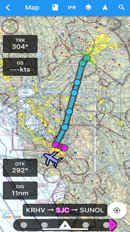
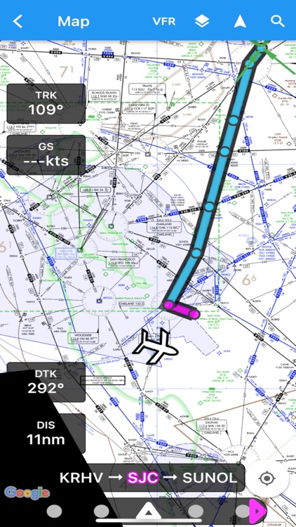
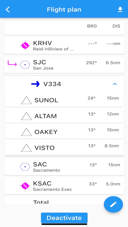
Use the moving map to search or select an airport, VOR, NDB or intersection and start direct-to navigation, or add to the flight plan. Alternatively enter the flight plan in text, e.g. KPAO SUNOL V334 SAC KSAC will load the full flight plan, including all airway navigation points.
Instrument approach charts include the airport diagram, STARS, DPs and minimums, as well as the legend.
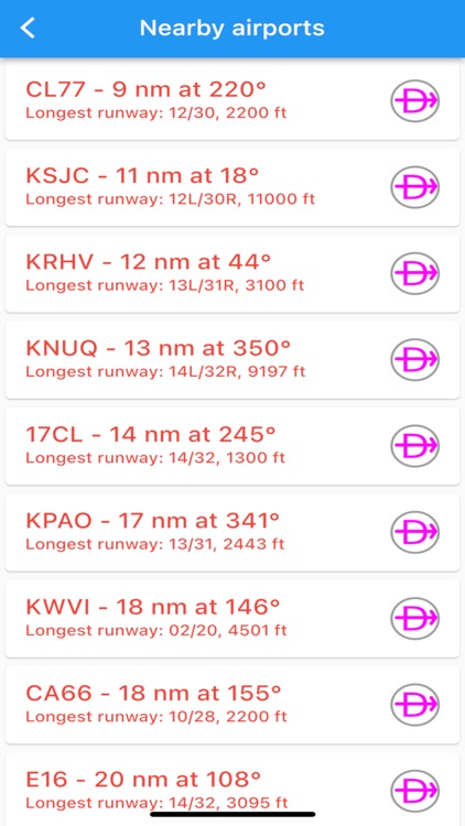
Nearby airports are shown in green or red to indicate whether or not those airports are likely reachable in a no-wind glide.
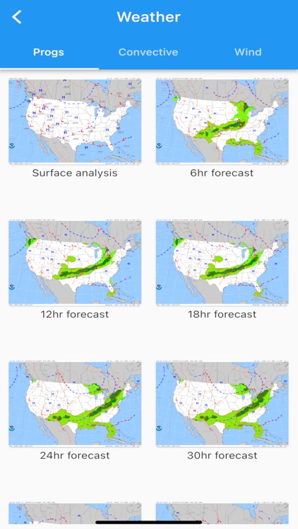
METAR, TAF, AIRMET, SIGMET, Prog charts, Convective Outlook and Wind are available as graphical and/or textual information. METARs and AIRMETS/SIGMETS can be overlayed on the map using the Layers button. Airport information shows METARs and TAFs in plain English, and Prog charts, Convective Outlook and Wind graphics for different times and altitudes are available as full screen graphics.
AviNavi requires a monthly or annual subscription, following a free trial period.
Disclaimer:
AppAdvice does not own this application and only provides images and links contained in the iTunes Search API, to help our users find the best apps to download. If you are the developer of this app and would like your information removed, please send a request to takedown@appadvice.com and your information will be removed.
AppAdvice does not own this application and only provides images and links contained in the iTunes Search API, to help our users find the best apps to download. If you are the developer of this app and would like your information removed, please send a request to takedown@appadvice.com and your information will be removed.