You are using an outdated browser. Please
upgrade your browser to improve your experience.

Our company's identity, AwasBencana, means 'disaster warning' in Indonesian

AwasBencana
by RainbirdGEO


What is it about?
Our company's identity, AwasBencana, means 'disaster warning' in Indonesian. This app utilizes the latest satellite-based technology to predict disasters in advance and provides a service for quickly sharing disaster information within the community. It offers a user experience optimized for Indonesia and contributes to creating a safe society.
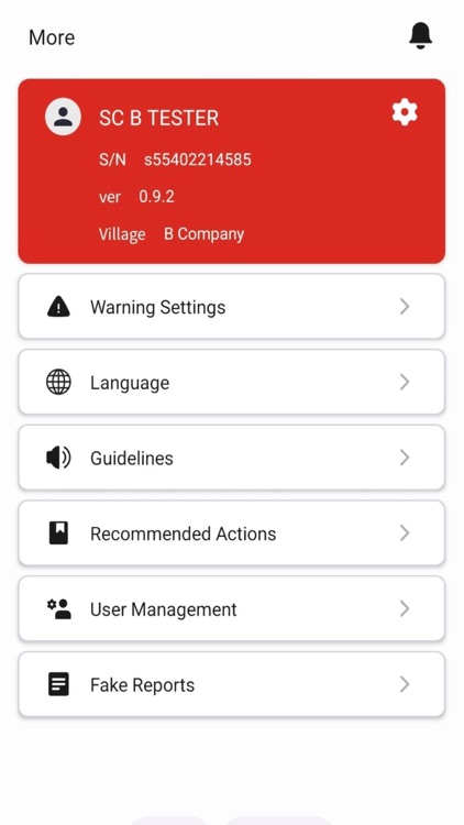
App Screenshots

App Store Description
Our company's identity, AwasBencana, means 'disaster warning' in Indonesian. This app utilizes the latest satellite-based technology to predict disasters in advance and provides a service for quickly sharing disaster information within the community. It offers a user experience optimized for Indonesia and contributes to creating a safe society.
Real-time Disaster Prediction through Satellite Data
AwasBencana provides disaster prediction services specialized for Indonesia by analyzing high-quality satellite data. It offers accurate weather forecasts and disaster warnings for each region. Users can prepare for climate risks such as rain, floods, and storms in advance.
Localized Warning System
AwasBencana provides a familiar environment for local users. Based on Indonesia's disaster notification system, users can receive real-time warnings related to climate risk factors in their local community.
Provision of Emergency Support Information during Disasters
In the event of a disaster, the app provides emergency support information such as shelters, hospitals, and pharmacies within 1km, 2km, and 5km of the user's current location. This information helps minimize damage by enabling quick responses in crisis situations.
User Participation-based Warning Reports
Users can report disaster warnings directly through the app. They can report various natural disasters such as lightning, fire, heat waves, heavy rain, and strong winds with photos, and share opinions and risk information with other users.
Risk Management Features within the Community
AwasBencana provides community management features, allowing local administrators to spread risk alerts and send customized notifications to specific user groups. The administrator level includes functions to manage users in subgroups, delete false reports, or sanction malicious users.
Algorithm Accuracy and Social Impact Research
AwasBencana improves the accuracy of its algorithms through continuous user feedback and evaluates the positive impact of the app on local communities. This allows for more sophisticated predictions and efficient communication.
If you have any questions or suggestions about this service, please feel free to contact us at support@rainbirdgeo.com.
This app is with you for a safe future in Indonesia.
Privacy Policy : https://rainbirdgeo.com/privacy-policy/
Terms of Service : https://rainbirdgeo.com/terms-of-service/
Terms of Use : https://rainbirdgeo.com/terms-of-use/
Disclaimer:
AppAdvice does not own this application and only provides images and links contained in the iTunes Search API, to help our users find the best apps to download. If you are the developer of this app and would like your information removed, please send a request to takedown@appadvice.com and your information will be removed.
AppAdvice does not own this application and only provides images and links contained in the iTunes Search API, to help our users find the best apps to download. If you are the developer of this app and would like your information removed, please send a request to takedown@appadvice.com and your information will be removed.