You are using an outdated browser. Please
upgrade your browser to improve your experience.

Backcountry Beta assembles the essential weather, terrain and snowpack data to help you plan a safe, successful backcountry ski tour

Backcountry Ski - Beta App
by Ski the Backcountry Ltd.


What is it about?
Backcountry Beta assembles the essential weather, terrain and snowpack data to help you plan a safe, successful backcountry ski tour.

Backcountry Ski supports Siri commands
Select
Avalanche
Forecast
Zone
Widget
Select
Snotel
Widget
Select
Weather
Forecast
Widget
Select Avalanche Forecast Zone Widget
Select Snotel Widget
Select Weather Forecast Widget
Backcountry Ski is FREE but there are more add-ons
-
$1.99
One Year Pro Subscription
App Screenshots
App Store Description
Backcountry Beta assembles the essential weather, terrain and snowpack data to help you plan a safe, successful backcountry ski tour.
Backcountry resources include:
• Avalanche forecasts for all U.S. and Canadian zones.
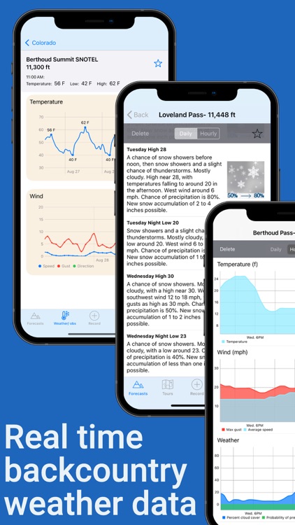
• Realtime snowfall, temperature and wind data from over 2000 mountain weather stations.
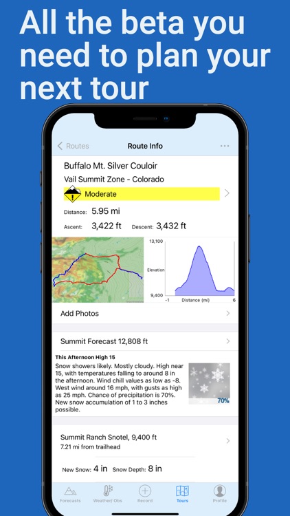
• Hourly NOAA summit weather forecasts including temperature, precipitation, wind and snow levels.
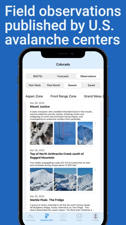
• Backcountry field observations published by the Colorado Avalanche Information Center, Utah Avalanche Center, Bridger-Teton Avalanche Center, Sierra Avalanche Center, Mount Washington Avalanche Center, Sawtooth Avalanche Center, Flathead Avalanche Center, Gallatin National Forest Avalanche Center, Bridgeport Avalanche Center and Wallowa Avalanche Center.
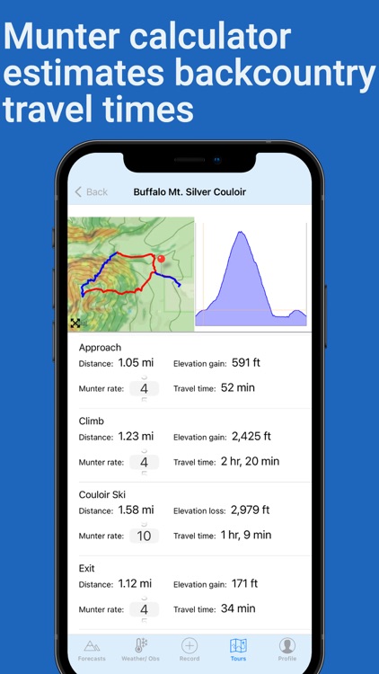
• Munter calculator estimates the backcountry travel times of your GPX tracks based on tour distance and elevation gain. Adjust the rate of travel for each segment of your tour depending on conditions and fitness level.
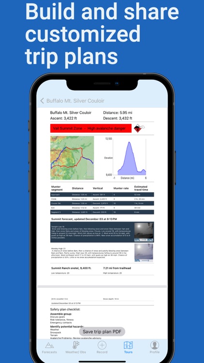
• Build and share customized trip plans highlighting terrain and weather data, travel times and avalanche safety checklists.
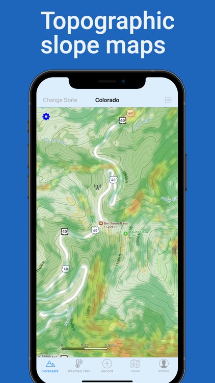
• Topographic slope maps help identify high risk avalanche terrain.
• Record your tracks and share snowpack observations with fellow backcountry users.
• Display backcountry weather and avalanche forecast widgets directly on your Home Screen
===============
Offline topo maps, point forecasts, snotel data, munter calculations, and customized trip plans require $5.99/year subscription. Subscriptions may be managed and auto-renewal may be turned off through the app's profile tab or from your iTunes account.
Disclaimer:
AppAdvice does not own this application and only provides images and links contained in the iTunes Search API, to help our users find the best apps to download. If you are the developer of this app and would like your information removed, please send a request to takedown@appadvice.com and your information will be removed.
AppAdvice does not own this application and only provides images and links contained in the iTunes Search API, to help our users find the best apps to download. If you are the developer of this app and would like your information removed, please send a request to takedown@appadvice.com and your information will be removed.