You are using an outdated browser. Please
upgrade your browser to improve your experience.

in top
50
of its
category
50
of its
category
***Now the Official Hunting App of the Bone Collector Brotherhood***

BaseMap: Hunting GPS Maps
by BaseMap Inc
What is it about?
***Now the Official Hunting App of the Bone Collector Brotherhood***
App Screenshots
App Store Description
***Now the Official Hunting App of the Bone Collector Brotherhood***
BaseMap is the only outdoor app you will ever need. Turn your phone into a GPS and compass to map your outdoor adventures and interact with the BaseMap community.
MOBILE GPS
• Know your exact location even without cellular or WiFi service
• See where you are in relation to property boundaries, roads, trails, peaks, or boundaries
• Navigate to trail heads, favorite places, markers, or anything you need to locate with our powerful Search and GoTo features.
XDR (Exact Direction & Range) NAVIGATION TOOL
• Immediately know the exact distance between you and your desired destination.
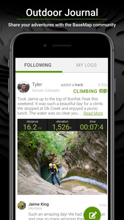
OUTDOOR JOURNAL
• Capture, log and share all your outdoor adventures with the BaseMap community
• Real-time location sharing so friends can see where you are in case of emergency (connection reqd.)
• SmartMarkers - Automatically capture the weather conditions at the time you add a marker.
HARVEST LOG
• Log your hunts as detailed as you'd like. Record your hunt type, species/size, weapon, unit/GMU & much more.
HUNTWIND™ & WEATHER CENTER
• Wind forecast to better plan your hunt.
• Know the exact day and time to hunt a particular stand and visualize wind direction and scent drift in relation to your location.
• Forecasts, temperature, moon phase, sunrise/sunset, wind, and more.
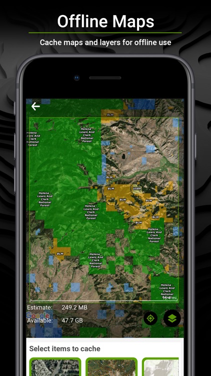
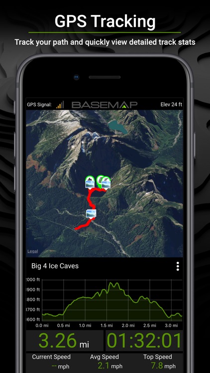
OFFLINE GPS and Tracking
• Cache maps for offline use and use anywhere…even without service.
• Save as many offline maps as you want with unlimited caching (Pro).
• Know exactly where you are in real time even without cellular coverage.
GEARDROP
• Drop your marker closest to the GearDrop marker & win free gear.
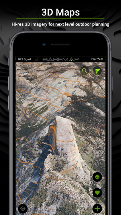
IN-APP 3D SATELLITE IMAGERY
• As close to boots-on-the-ground as you can get
• Tilt & rotate the map to see the terrain from every angle
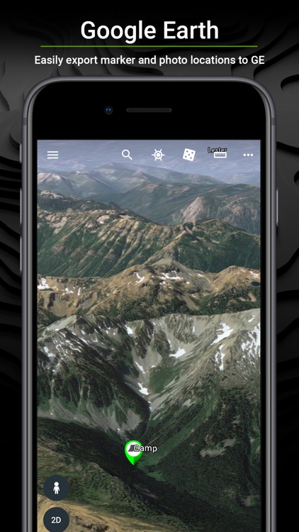
GOOGLE EARTH INTEGRATION
• Export markers and view them right in Google Earth
• View the terrain in true 3D
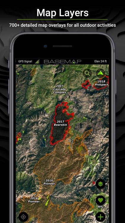
MAP LAYERS
• Over 700 layers and growing
• Nationwide Color Coded Govt Lands
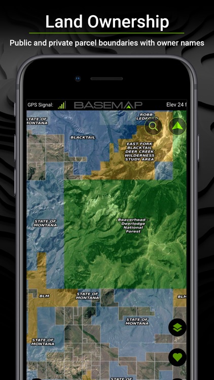
• Nationwide Private Parcel Boundaries & Owner Names
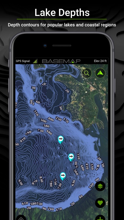
• Water depths for East coast, West, Coast, Gulf coast, & over 4,000 U.S. lakes
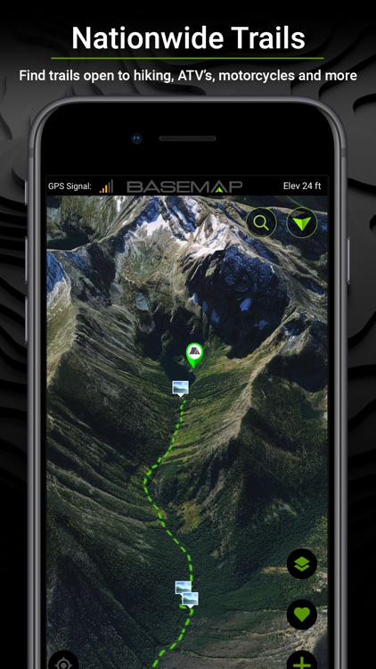
• Nationwide Hiking Trails
• Nationwide Wildfires & Timbercuts
• Nationwide Wilderness & Roadless Areas
• State specific hunting layers including hunting unit boundaries, private hunting opportunities, WMA’s & more
• Multiple Topography & Satellite Imagery basemap options
• Much more
BETTER EXPERIENCE
• Nationwide plans so you never have to be restricted to just one state.
• Fastest layer rendering speed
• Sync all your map data between your phone and the BaseMap web application.
SUBSCRIPTIONS
Basic (Free)
• No Ads
• Connect with friends
• Nationwide parcel boundaries
• Hybrid 3D Imagery (map tilt).
• GoTo Navigation
• Nationwide Roads, Trails & Points Of Interest
• Nationwide Lakes, Rivers & Streams
• Hunting Units
• GPS Location & Tracking
• Multiple Topo & Imagery basemap options
Pro ($9.99/mo or $34.99/yr)
• Everything in Basic plan
• Access to over 700 Layers
• Unlimited Data & Offline Use
• Nationwide parcel owner names
• Nationwide color-coded government lands
• 3D Earth view
• Google Earth Integration
• Import/Export KML and GPX with BaseMap online application
• Real-Time location sharing
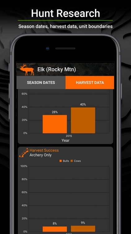
Hunting Research ($9.99/yr)
• In-depth hunting research tools
• Filter hunting units by species
• Hunting season dates for every unit and species
• Detailed harvest success graphs for Western big game species
• Subscriptions automatically renew unless auto-renew is turned off at least 24-hours before the end of the current period.
• Subscriptions and auto-renewal may be turned off any time in your Apple account
• Your Apple account will be charged for renewal within 24-hours prior to the end of the current period, and identify the cost of the renewal.
For questions or more information, contact us at: support@basemap.com
Privacy policy: https://www.basemap.com/privacy-policy/
Terms of use: https://www.basemap.com/terms-of-use/
Disclaimer:
AppAdvice does not own this application and only provides images and links contained in the iTunes Search API, to help our users find the best apps to download. If you are the developer of this app and would like your information removed, please send a request to takedown@appadvice.com and your information will be removed.
AppAdvice does not own this application and only provides images and links contained in the iTunes Search API, to help our users find the best apps to download. If you are the developer of this app and would like your information removed, please send a request to takedown@appadvice.com and your information will be removed.