You are using an outdated browser. Please
upgrade your browser to improve your experience.

Plan your trip along the Turkish coast

Bayexpress Türkei 2020
by roger riedmatten
What is it about?
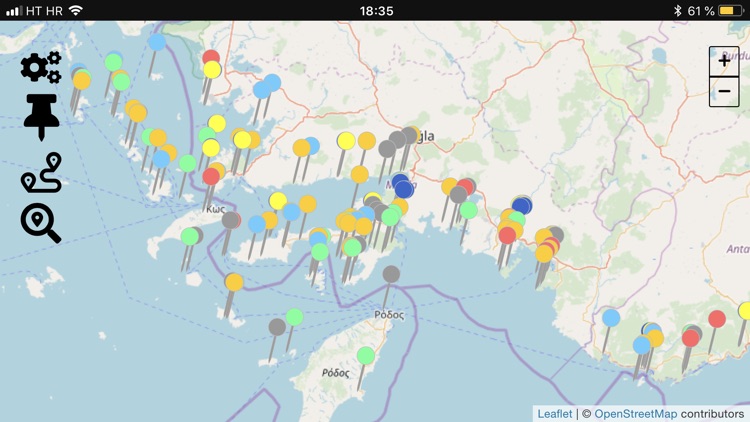
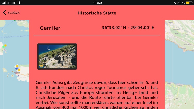
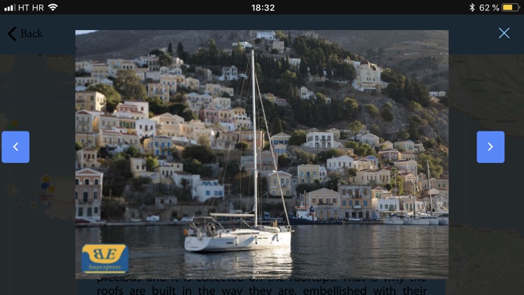
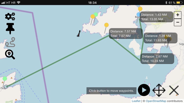
Plan your trip along the Turkish coast. Not only sailors find valuable information about bays and restaurants. The intuitive distance tool makes the Bayexpress app the ideal route planner that can also be used offline. More than 300 photos with many aerial photographs, together with the short descriptions, offer an interesting overview with a high information content, so that the skipper can show his crew in advance where he is going and how long it will take.
App Screenshots
App Store Description
Plan your trip along the Turkish coast. Not only sailors find valuable information about bays and restaurants. The intuitive distance tool makes the Bayexpress app the ideal route planner that can also be used offline. More than 300 photos with many aerial photographs, together with the short descriptions, offer an interesting overview with a high information content, so that the skipper can show his crew in advance where he is going and how long it will take.
For more than 10 years the Bayexpress has been a reliable guide for sailors in Turkey and the eastern Greek islands of the Dodecanese or in Croatia. In the new version of the app for the Turkish coast and the Greek islands of the Dodecanese, in addition to the most interesting restaurants along the coast, there are bays, marinas, petrol stations and ancient sites. The information about these places are also available offline, the app switches to offline mode if the connection is bad, but can also be limited to these settings. The map view is limited to a lower resolution in this state. The intuitive distance tool also works in offline mode. This tool can be used to draw routes in sections whose distances are individually calculated and summed up. The waypoints within this route can be edited later. The built-in full-text search function is limited to the offline content of the app.
Disclaimer:
AppAdvice does not own this application and only provides images and links contained in the iTunes Search API, to help our users find the best apps to download. If you are the developer of this app and would like your information removed, please send a request to takedown@appadvice.com and your information will be removed.
AppAdvice does not own this application and only provides images and links contained in the iTunes Search API, to help our users find the best apps to download. If you are the developer of this app and would like your information removed, please send a request to takedown@appadvice.com and your information will be removed.