You are using an outdated browser. Please
upgrade your browser to improve your experience.
Significant archaeological sites along England’s sinuous coast and on the foreshores of our tidal estuaries are continually eroded by winds, waves and the increasing frequency of major storms

CITiZAN Coastal Archaeology
by WildKnowledge
What is it about?
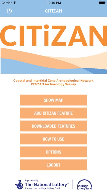
Significant archaeological sites along England’s sinuous coast and on the foreshores of our tidal estuaries are continually eroded by winds, waves and the increasing frequency of major storms. Much of our island’s fragile history is simply being washed away. Coastal erosion can rarely be halted, but at least archaeological sites can be recorded before they are destroyed. CITiZAN, the Coastal and Intertidal Zone Archaeological Network, encourages data collection through our app by volunteers like you!
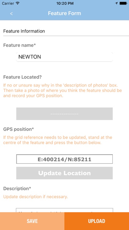
App Screenshots
App Store Description
Significant archaeological sites along England’s sinuous coast and on the foreshores of our tidal estuaries are continually eroded by winds, waves and the increasing frequency of major storms. Much of our island’s fragile history is simply being washed away. Coastal erosion can rarely be halted, but at least archaeological sites can be recorded before they are destroyed. CITiZAN, the Coastal and Intertidal Zone Archaeological Network, encourages data collection through our app by volunteers like you!
Smart phones and tablets are powerful archaeological recording tools: with a camera and GPS facilities they are perfect for locating and recording new archaeological features. As we already carry this tool around wherever we go, it is ideal for long-term monitoring of archaeological features at risk on England’s coastlines and estuaries.
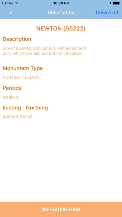
The remains of prehistoric forests and settlements, Roman forts and villas, ancient salt-working sites, medieval ports, fishing settlements, harbour works and countless abandoned boats, barges and ships are all under threat. But all of these vulnerable sites have a unique story to tell: about England’s first settlers, its maritime industries, the defence of the realm against waves of would-be invaders. There is also information to be collected about sea-level change, about the speed of coastal erosion, about the changing landscape and land use along the ever-changing coast.
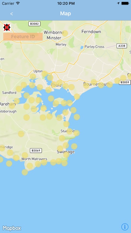
CITiZAN feature map:
The 80,000+ points on our interactive feature map provide information on England’s coastal and intertidal heritage from low tide to 100m inland from mean high water. They offer a snapshot of integrated data from Historic England, National Trust, several local Historic Environment Record offices and local archaeology groups. As a user you can:
1. View our interactive map of England’s coastal and intertidal heritage.
2. Add to the national record by creating new CITiZAN feature points.
3. Keep this national record accurate by updating existing points with your survey and monitoring information.
About us:
CITiZAN, the Coastal and Intertidal Zone Archaeological Network, is generously funded by a grant from the Heritage Lottery Fund, with match funding from National Trust and the Crown Estate and additional support from Historic England. In order to provide support to our volunteers, we are based in three offices across England, hosted in London by MOLA (Museum of London Archaeology) together with our partners the Council for British Archaeology in York and the Nautical Archaeology Society in Portsmouth.
The app uses background location tracking to provide a better experience, however, just to warn you that continued use of GPS running in the background can dramatically decrease battery life.
CITiZAN wants you to be safe while out on the foreshore, so please follow the guidelines at http://www.citizan.org.uk/health-and-safety/. Never put yourself or others at risk when recording and monitoring using this app. If you are unsure or feel that the situation is unsafe for any reason, do not continue.
Disclaimer:
AppAdvice does not own this application and only provides images and links contained in the iTunes Search API, to help our users find the best apps to download. If you are the developer of this app and would like your information removed, please send a request to takedown@appadvice.com and your information will be removed.
AppAdvice does not own this application and only provides images and links contained in the iTunes Search API, to help our users find the best apps to download. If you are the developer of this app and would like your information removed, please send a request to takedown@appadvice.com and your information will be removed.