You are using an outdated browser. Please
upgrade your browser to improve your experience.

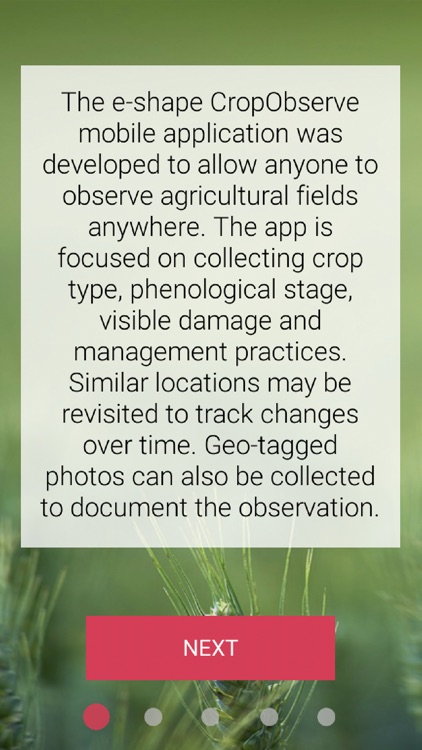
The e-shape CropObserve mobile application was developed to allow anyone to observe agricultural fields anywhere

CropObserve
by IIASA
What is it about?
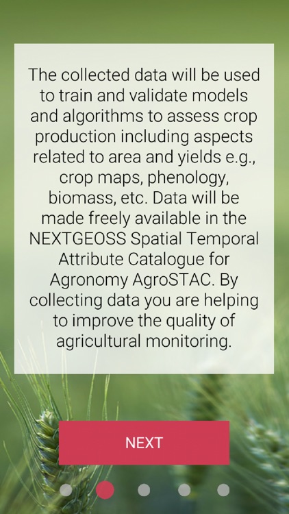
The e-shape CropObserve mobile application was developed to allow anyone to observe agricultural fields anywhere. The app is focused on collecting crop type, phenological stage, visible damage and management practices. Similar locations may be revisited to track changes over time. Geo-tagged photos can also be collected to document the observation. The collected data will be used to train and validate models and algorithms to assess crop production including aspects related to area and yields e.g., crop maps, phenology, biomass, etc. Data will be made freely available in the NEXTGEOSS Spatial Temporal Attribute Catalogue for Agronomy AgroSTAC. By collecting data you are helping to improve the quality of agricultural monitoring.
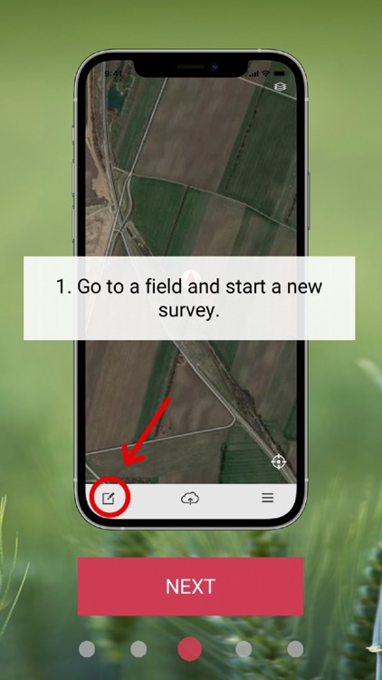
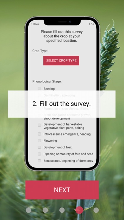
App Screenshots


App Store Description
The e-shape CropObserve mobile application was developed to allow anyone to observe agricultural fields anywhere. The app is focused on collecting crop type, phenological stage, visible damage and management practices. Similar locations may be revisited to track changes over time. Geo-tagged photos can also be collected to document the observation. The collected data will be used to train and validate models and algorithms to assess crop production including aspects related to area and yields e.g., crop maps, phenology, biomass, etc. Data will be made freely available in the NEXTGEOSS Spatial Temporal Attribute Catalogue for Agronomy AgroSTAC. By collecting data you are helping to improve the quality of agricultural monitoring.
The e-shape project has received funding from the European Union’s Horizon 2020 research and innovation programme under grant agreement 820852.
Disclaimer:
AppAdvice does not own this application and only provides images and links contained in the iTunes Search API, to help our users find the best apps to download. If you are the developer of this app and would like your information removed, please send a request to takedown@appadvice.com and your information will be removed.
AppAdvice does not own this application and only provides images and links contained in the iTunes Search API, to help our users find the best apps to download. If you are the developer of this app and would like your information removed, please send a request to takedown@appadvice.com and your information will be removed.