You are using an outdated browser. Please
upgrade your browser to improve your experience.

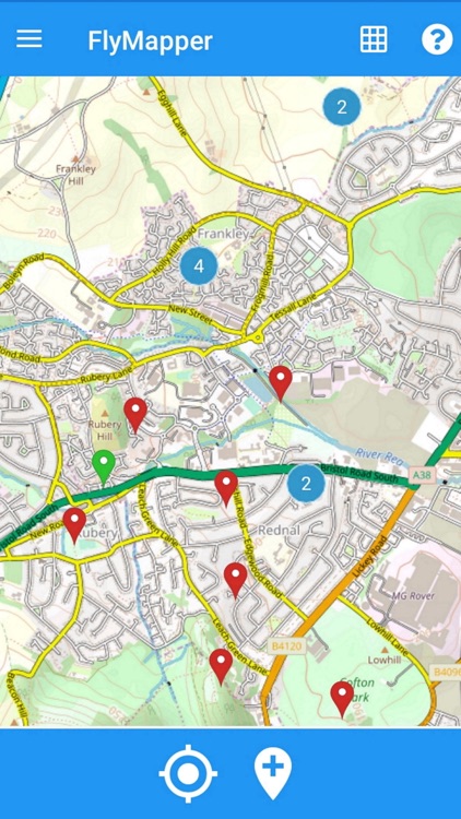
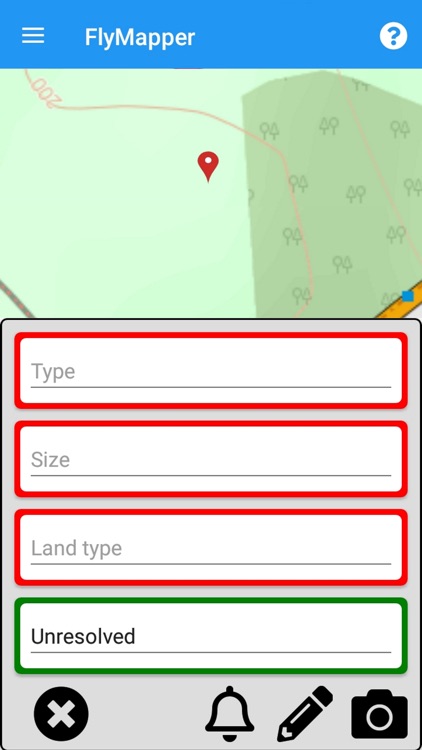
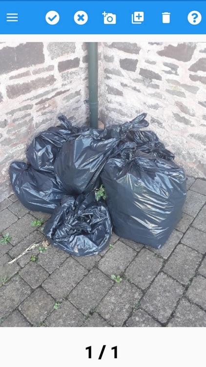
FlyMapper is a web and mobile based system to gather intelligence and to manage fly tipping

Defra FlyMapper
by EXEGESIS SPATIAL DATA MANAGEMENT LTD
What is it about?
FlyMapper is a web and mobile based system to gather intelligence and to manage fly tipping. The system is already in use in Scotland and Wales and this app is designed for the recording of incidents in England.
App Store Description
FlyMapper is a web and mobile based system to gather intelligence and to manage fly tipping. The system is already in use in Scotland and Wales and this app is designed for the recording of incidents in England.
By joining in you are helping Defra to understand the scale of the problems caused by fly tipping and providing information to inform policy and interventions.
• Simple to use smartphone app utilising GPS position fixing
• Records incident details, location, land type and status
• Works on and off line (using local mapping)
• Automatically synchronises data
• Integrates with smartphone camera to allow photos of incidents to be taken
Disclaimer:
AppAdvice does not own this application and only provides images and links contained in the iTunes Search API, to help our users find the best apps to download. If you are the developer of this app and would like your information removed, please send a request to takedown@appadvice.com and your information will be removed.
AppAdvice does not own this application and only provides images and links contained in the iTunes Search API, to help our users find the best apps to download. If you are the developer of this app and would like your information removed, please send a request to takedown@appadvice.com and your information will be removed.