You are using an outdated browser. Please
upgrade your browser to improve your experience.

Dowsing Mapper Lite is a flexible, easy-to-use tool for mapping your dowsing reactions

Dowsing Mapper Lite
by Tim Bowles
What is it about?
Dowsing Mapper Lite is a flexible, easy-to-use tool for mapping your dowsing reactions. Map your dowsing while you dowse!
App Screenshots
App Store Description
Dowsing Mapper Lite is a flexible, easy-to-use tool for mapping your dowsing reactions. Map your dowsing while you dowse!
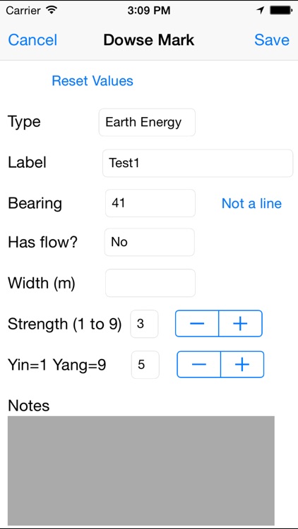
When you get a dowsing reaction simply add a marker to show what you have dowsed. For earth energy features, markers indicate the bearing, strength, width and the yin/yang (male/female) quality. For physical features, markers indicate the the bearing and direction of flow, if any.
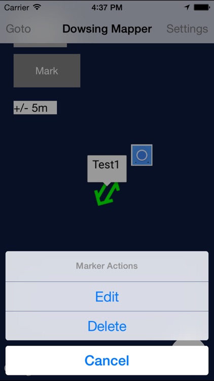
The distraction of fiddling with your phone is minimised. Each marker's details form the defaults for the next marker. Adding markers as you follow a line or feature then becomes simply a matter of touching the screen a couple of times at each point you dowse.
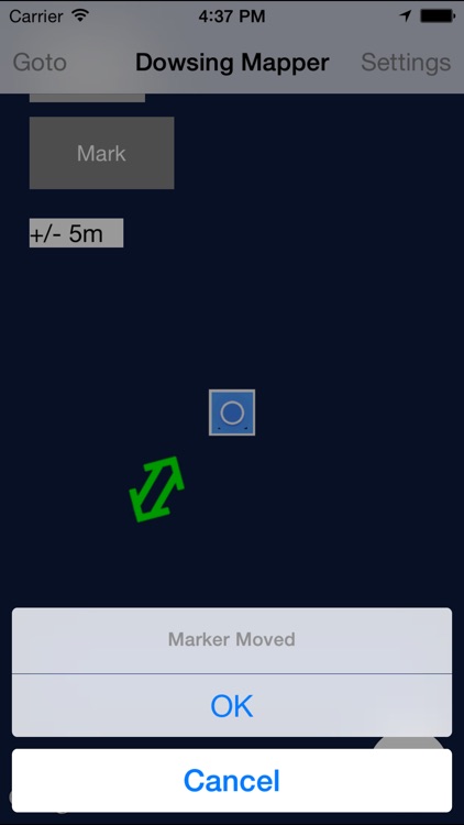
To allow greater accuracy then GPS alone provides, markers can be moved to the correct position on the map. The screen shots show a small partially wooded site. In such locations GPS can struggle. The ability to adjust the marker positions allows the mapping to reflect the patterns dowsed in a way that raw GPS locations would fail to show.
NOTE ON SCREEN-SHOTS: Dowsing Mapper Lite displays a background map behind the markers you add. Only the 3.5 inch screen shots currently show a map. Screen shots for other screen sizes are taken with a simulator which displays the maps as a blue background. It'll look much better than that on your device! If the screen shot for your own device is blue, after your next day out dowsing perhaps you'd like to send in your own screen shots! Thanks.
Dowsing Mapper Lite is designed to operate even when no phone signal is available (though maps won't display until a signal is found).
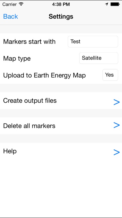
Files can be output in CSV (for spreadsheets) and KML (for Google Earth) formats.
Earth energy markers are automatically uploaded to www.earthenergymap.com if a phone signal is available. (This feature can be turned off for practicing or if secrecy is preferred.)
Dowsing Mapper Lite has been developed for the dowsing community to provide and easy-to-use tool for recording the raw data of dowsing and to provide a means of sharing that data. Please offer ANY feedback by emailing contact@dowsingmapper.com. Thanks.
Disclaimer:
AppAdvice does not own this application and only provides images and links contained in the iTunes Search API, to help our users find the best apps to download. If you are the developer of this app and would like your information removed, please send a request to takedown@appadvice.com and your information will be removed.
AppAdvice does not own this application and only provides images and links contained in the iTunes Search API, to help our users find the best apps to download. If you are the developer of this app and would like your information removed, please send a request to takedown@appadvice.com and your information will be removed.