You are using an outdated browser. Please
upgrade your browser to improve your experience.
Note: Continued use of GPS running in the background can dramatically decrease battery life

East of England
by River Canal Rescue
What is it about?
Note: Continued use of GPS running in the background can dramatically decrease battery life.
App Screenshots
App Store Description
Note: Continued use of GPS running in the background can dramatically decrease battery life.
WaterNav East (one of a set of 10 regional apps covering Great Britain) is the definitive waterway guide and map for the East of England for boaters, ramblers, cyclists, etc. - but don't worry, it does NOT tell you to "Turn around where possible"!
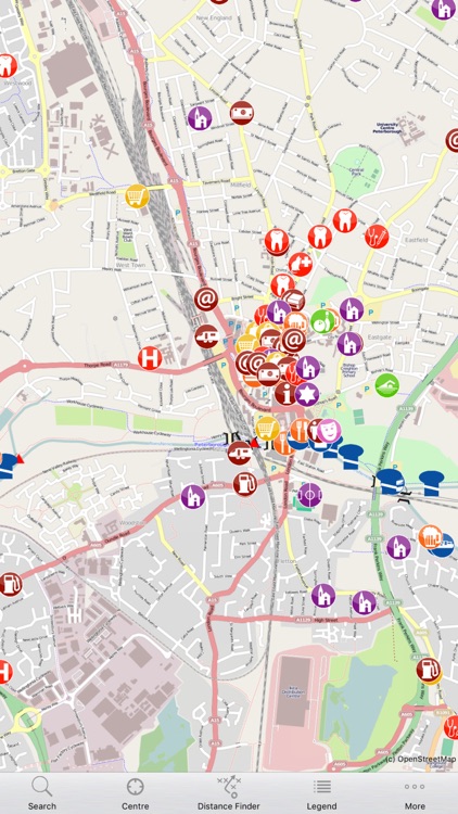
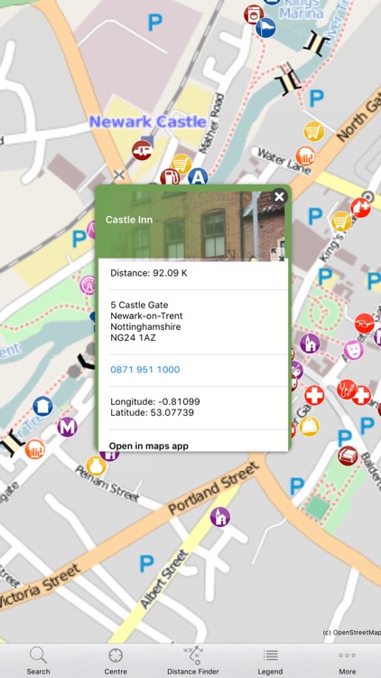
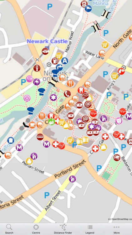
Suitable for iPhone (version 4 or later), iPad (2 or later) and iPad Mini, WaterNav apps provide an enormous amount of really useful, easy to access, information and make use of Smartphone GPS (see notes below) to show everything relative to where you are. The canal maps display thousands of continually updated points of interest (such as pubs, shops, vets, diesel, moorings, etc), as well as all the waterway information such as locks, bridges, turning points, etc. These are the essential towpath companions for boaters, ramblers, cyclists or anyone else enjoying the waterways.
Please note: wifi only iPads will NOT display your location if no wifi connected.
An essential feature of the Apps is that they are off-line, so there’s no interruption due to the poor Internet connection on the canals!
* Location-based, they can display your current GPS coordinates, heading and speed
* Comprehensive road and footpath network provided by OpenStreetMaps™
* Move around the map easily, zooming in/out to see more/less detail
* Handy distance measurer
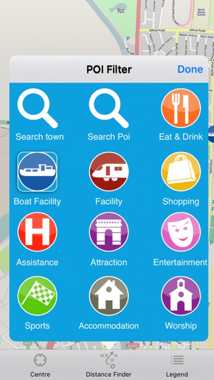
* Filter on thousands of regularly updated points of interest to display:
- places to eat and drink
- shops, laundrettes and libraries
- doctors, vets and dentists
- towpaths, footpaths and moorings
- diesel, gas and pump-outs
- internet access points, bus stops, train stations
- museums, cinemas and attractions
.... and much, much more
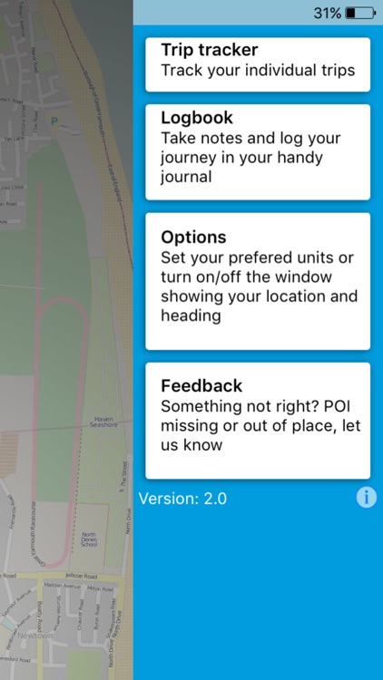
* Track and record your journey with the Trip Tracker function.
* Create Log Book entries
WE VALUE YOUR FEEDBACK
Please let us have your feedback and suggestions - use the in-app Feedback functionality to provide POI detail or location changes, map issues or report problems/suggestions for the app itself!
NOTES
* Data updates are free
* Having GPS continuously running in the background can seriously decrease battery life - we recommend having your device charging while travelling.
* We recommend use of waterproof cases for use when boating, walking or cycling.
* Dedicate iPad version available BUT wifi only iPads will NOT display your location if no wifi connected.
OTHER E-CANALMAPP REGIONS:
The English Midlands
The South of England
The Grand Union-Oxford Canal Ring
The West of England
The North West of England
The North East of England
The Welsh Canals
The Norfolk Broads
Scotland
Disclaimer:
AppAdvice does not own this application and only provides images and links contained in the iTunes Search API, to help our users find the best apps to download. If you are the developer of this app and would like your information removed, please send a request to takedown@appadvice.com and your information will be removed.
AppAdvice does not own this application and only provides images and links contained in the iTunes Search API, to help our users find the best apps to download. If you are the developer of this app and would like your information removed, please send a request to takedown@appadvice.com and your information will be removed.