You are using an outdated browser. Please
upgrade your browser to improve your experience.

The ultimate collection of electronic maps of Washington DC including

eMap Washington DC
by Earman Consulting
What is it about?
The ultimate collection of electronic maps of Washington DC including
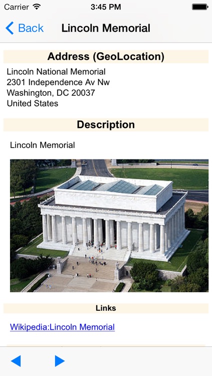
App Screenshots
App Store Description
The ultimate collection of electronic maps of Washington DC including
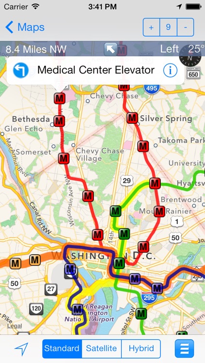
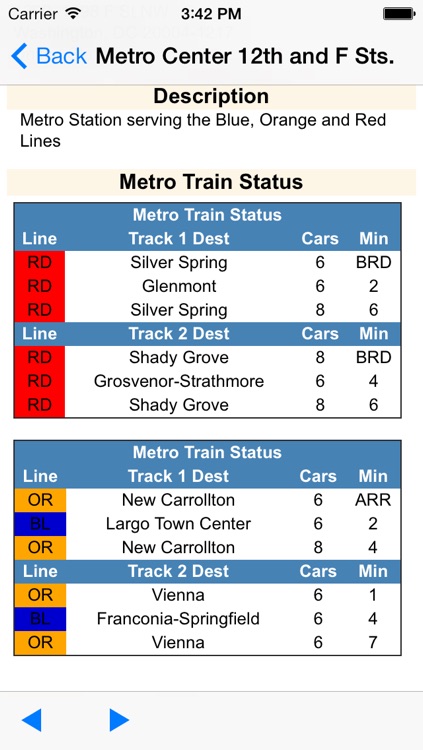
1) DC Metrorail Map: A map showing the Washington DC Metrorail lines, location of station entrances including elevators and the real time arrival times of the trains
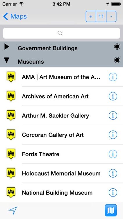
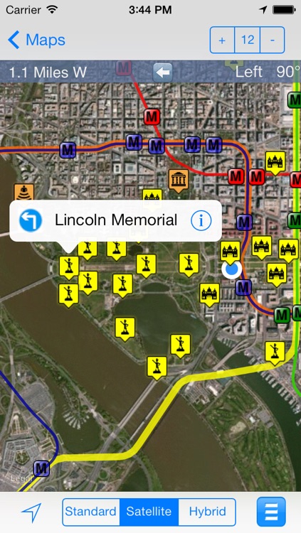
2) DC Attraction Map: A map showing Washington DC attractions including Museums, Monuments, Government Agencies and Sport Venues
3) DC Embassies: A map showing the location of all the Embassies located in Washington DC.
4) DC Bike Trails: A map showing the location of the major bike trails in the DC area.
5) National Zoo: A map showing the key trails inside the National Zoo including key exhibits, food, rest rooms and medical locations.
6) DC Capitol 4th: A map showing the planned events, security checkpoints and closed roads associated with Washington DC's 4th of July celebration.
This application includes capabilities to:
- Show turn by turn driving or walking directions to the selected annotation.
- Select any annotation to get the direction and distance from your current location.
- Select an annotation to get detailed information including the address, a description including related pictures, historical information, links to additional information on associated Websites, a Streetview Image (if available), and links to reviews of nearby restaurants and businesses.
- Show maps in standard, satellite and hybrid format.
- Search and filter annotations by name
- Customize maps with your own annotations. These custom annotations will automatically display the geolocation address, a Streetview image (if available), links to reviews of nearby restaurants and businesses, and property information from Zillow (if available).
- Create new maps with your own custom annotations.
This eMap application is a perfect companion for students or visitors to the University.
Notes:
1) The application is currently and will always remain Ad free!!!!
2) The application is a universal application that is customized to take advantage of both the iPhone and iPad devices
Thanks for all the positive feedback I have received!!!! Please send any additional questions, issues or suggestions to eMap@earman.net. I am anxious to improve and enhance the application based on your needs and feedback.
Disclaimer:
AppAdvice does not own this application and only provides images and links contained in the iTunes Search API, to help our users find the best apps to download. If you are the developer of this app and would like your information removed, please send a request to takedown@appadvice.com and your information will be removed.
AppAdvice does not own this application and only provides images and links contained in the iTunes Search API, to help our users find the best apps to download. If you are the developer of this app and would like your information removed, please send a request to takedown@appadvice.com and your information will be removed.