You are using an outdated browser. Please
upgrade your browser to improve your experience.
FlyToMap™ is a valid and interesting alternative, Benetti Yachts

FlyToMap All in One GPS maps marine lakes parks
by Flytomap

What is it about?
FlyToMap™ is a valid and interesting alternative, Benetti Yachts
App Screenshots
App Store Description
FlyToMap™ is a valid and interesting alternative, Benetti Yachts
Top Ten since 2008
Featured in : On the Deck
► The charts downloaded are resident in the app. It works WITHOUT mobile coverage!
Flytomap All In One HD works on all Apple devices
FlyToMap™ offers a revolutionary app; you can download any chart worldwide (500+) free of charge
- All USA Marine charts (US All, East, West, Great Lakes, Major Rivers,Florida, Texas, California, etc.)
- more than 150 US Parks and Forests
- New Zealand Nautical charts
- All Europe marine charts
- 200+ major EU parks
- most famous world holiday ie: Caribbean, Seychelles, Mauritius, Maldives, Canary Islands, Azores, Bora Bora, Bali, Oslo Fjord .. and many more.
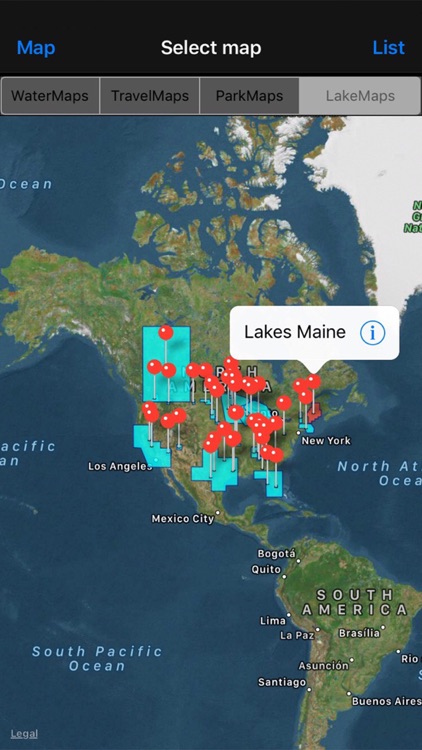
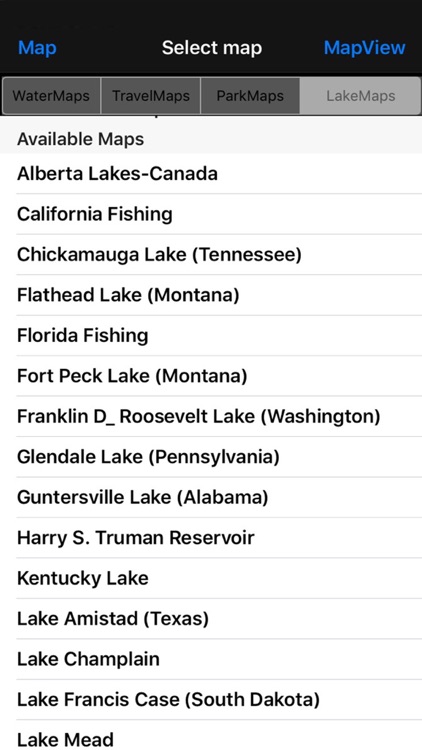
- USA Lake Maps 15000+ : Minnesota, Maine, Michigan, Massachusetts, Wisconsin, Texas,California, Florida,Iowa,North and South Dakota...and many more.
-Canada Lake Maps: Alberta, Lake of the Wood.. and many more.
► Worldwide Marine and Outdoor Maps available, thanks to viewer.flytomap.com
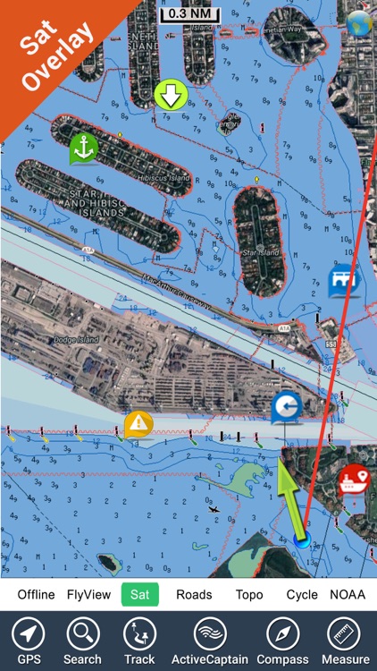
► Worldwide Satellite images overlay on charts
► Worldwide Terrain features overlay on charts, thanks to Open Street Map, Open Cycle Map, Bing,Earth,GMap
►Interactive Weather forecast
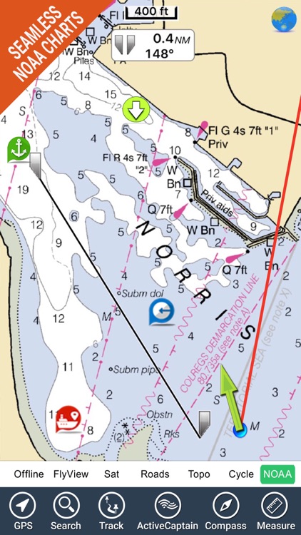
►NOAA raster charts seamless with continuous updates from the official Government server
Now with ActiveCaptain - Worldwide boaters community, with * 200.000 + Captains
Use to Explore:
√ Latitudes and Longitudes to go to your favorite places
√ Search your Favorite points directly
√ Zoom, Rotate and Pan fast just by a finger touch
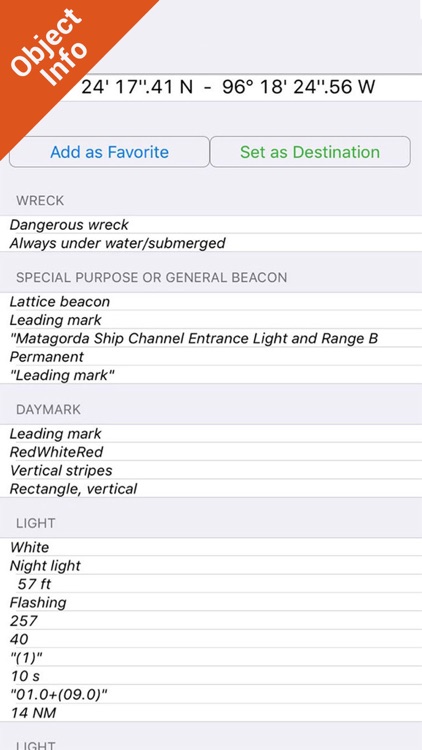
√ Quick Object information just tapping, thanks to vector technology
√ GPS Heading Vector Towards the direction movement
√ Distance Measurement Tool to easily calculate the distance from one location to another
√ Route planning, Waypoints - Insert the target/destination and see in real time your speed, distance and bearing
√ Magnified Lens for all info
√ Unlimited Tracks, Markers, Geo-tagged photos, records and share via email, visible on Google, Flytomap Viewer, KMZ format - Store your track without the need of cellular data or mobile signal
√ Select Depth Contours
√ a la carte menu
√ iOS background mode - Flytomap works in background as well, you can swap with another app and receive/make calls send sms while track recording.
√ Optimized battery usage
√ And so much more to come - It’s the only app you will ever need! Our charts are installed on: GARMIN NAVICO LOWRANCE B&G NORTHSTAR EAGLE SIMRAD
Follow us:
▶ Twitter @flytomap
▶ Web Site flytomap.com
▶ Facebook facebook.com/flytomap
FlytoMap™ has a wide range of Applications and Maps for you to use - Free of charge on Flytomap All In One !
- WATER MAPS
Electronic Nautical Charts (ENC) from NOAA and Corps of Engineers compressed to store the largest coverage. You can transform your device in a chart plotter with best NOAA-USACE, ENC S57 cartography; which includes Coastline, Anchoring areas, Fishing areas, Restriction areas, Obstructions, Rocks, Buoys, Beacons, Lights, Depth contours, Spot Soundings and more.
- LAKE MAPS
High quality lake maps with detailed information and important features compressed to assure the larger coverage. Lake maps contain the most important lakes with detailed Depth Contours, Boat Ramps, Fishing spots etc. Maps also include Trails, Roads and Railways information.
- PARK MAPS:
Extremely advanced embedded electronic charts with all information collected from the National/State Park and Forest Services and many other local sources. The maps contain all trails (Hiking, Biking, Equestrian trails etc.,) and Points of interests (POI) like Campgrounds, Visitor Centers, Lookout points, Eating places, Ranger Stations, Picnic areas, Boat/Canoe ramps, Parking areas etc..
- TRAVEL MAPS
These Maps cover most interesting touristic areas combining Sea and Land information to allow you a complete travel experience.
Continued use of GPS running in background can decrease battery life.
Disclaimer:
AppAdvice does not own this application and only provides images and links contained in the iTunes Search API, to help our users find the best apps to download. If you are the developer of this app and would like your information removed, please send a request to takedown@appadvice.com and your information will be removed.
AppAdvice does not own this application and only provides images and links contained in the iTunes Search API, to help our users find the best apps to download. If you are the developer of this app and would like your information removed, please send a request to takedown@appadvice.com and your information will be removed.