You are using an outdated browser. Please
upgrade your browser to improve your experience.

GeoFlyer US Canada 3D Maps Lite

GeoFlyer US Canada 3D Maps LT
by GeoMind

What is it about?
GeoFlyer US Canada 3D Maps Lite
App Screenshots
App Store Description
GeoFlyer US Canada 3D Maps Lite
How would you like a mapping app with routing and GPS tracking that offers you the BEST 3D VISUALIZATION for the outdoors?
How would you like a mapping app that shows points of interest in 3D with info or links to embedded Wikipedia pages?
How would you like a mapping app that works OFFLINE (*), too?
GeoFlyer 3D Map offers you all this and more!
If you love hiking, biking, horseback riding, or any other outdoor activity, GeoFlyer 3D Map is the app you need.
MAIN FEATURES
- Online and Offline (*) modes (with preloading of selected areas)
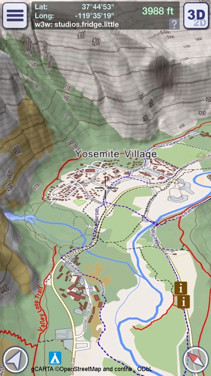
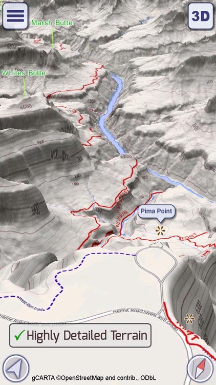
- Highly-detailed 3D terrain
- 3D labels/icons of Points of Interest (POIs)
- Integrated Wikipedia descriptions
- Place searching by name (Online and Offline)
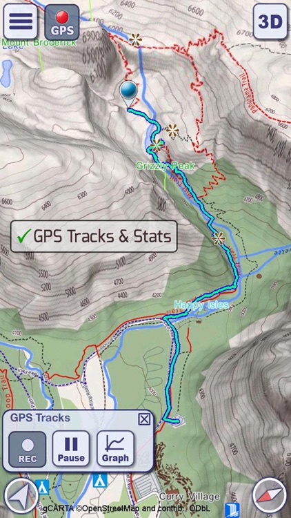
- GPS tracking
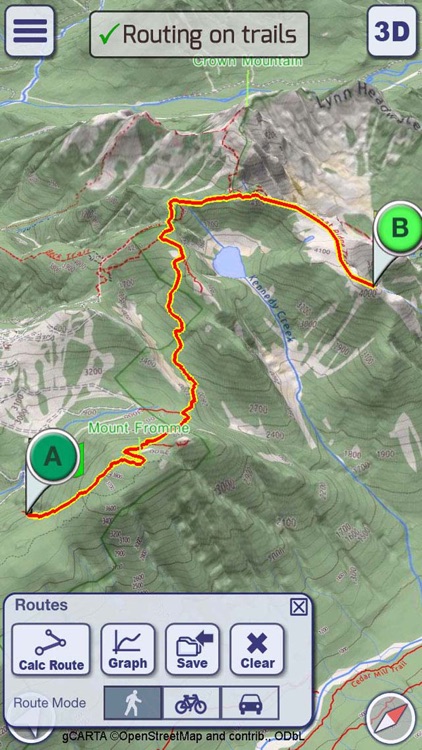
- Routing
- Sync of tracks and routes on all your devices (iCloud)
- Altimetry graph and statistics
- Custom-made gCARTA topographic chart
- Gyroscope features: GyroPilot and First Person View
GeoFlyer 3D Map reproduces the terrain in 3D with stunning details, using the best available digital elevation models from the US Geological Survey and NASA.
The terrain is overlaid with a custom-made topographic chart (gCARTA) that shows trails and accurate elevation contour lines, or aerial images if you prefer.
Find out more about a POI using the labels and icons. Wikipedia geo-tagged entries and other associated content are integrated right into the 3D map.
Plan your trip using multiple routing options, and save your routes for later use.
Record your GPS tracks and share (*) them with your friends through Facebook or other social media.
Get the best from your outdoor experience with the “First Person View” mode, a sort of augmented reality feature that enables you to see a virtual 3D view of what is in front of you, allowing you to identify peaks and other landmarks.
And it’s fun! Try the GyroPilot mode: dive into the valleys with a low level flyby, handling your device like a virtual plane, and explore the maps like a top-gun pilot!
GeoFlyer 3D Map… your outdoor companion!
Map coverage: continental US, Canada and northern Mexico (min latitude: 23°, max latitude: 59°).
UPGRADE FROM LITE TO FULL VERSION:
If iCloud is enabled, in the Full version you will keep your existing tracks and routes.
(*) REDUCED FUNCTIONALITIES IN THE LITE VERSION:
- Offline mode not available
- Limited number of recorded tracks and routes
- Sharing of tracks and routes not available
WARNING
Continued use of GPS running in the background can dramatically decrease battery life.
Disclaimer:
AppAdvice does not own this application and only provides images and links contained in the iTunes Search API, to help our users find the best apps to download. If you are the developer of this app and would like your information removed, please send a request to takedown@appadvice.com and your information will be removed.
AppAdvice does not own this application and only provides images and links contained in the iTunes Search API, to help our users find the best apps to download. If you are the developer of this app and would like your information removed, please send a request to takedown@appadvice.com and your information will be removed.