You are using an outdated browser. Please
upgrade your browser to improve your experience.
Geoheritage explores the geology, coal and iron mining heritage of the Forest of Dean, Gloucestershire, England

Geoheritage
by BrooksDesigns
What is it about?
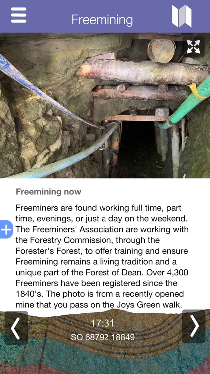
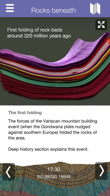
Geoheritage explores the geology, coal and iron mining heritage of the Forest of Dean, Gloucestershire, England. The app includes introductions to the rocks beneath the Forest, how the rocks of the Forest formed over 500 million years of Earth history and the unique ancient tradition of Freemining for minerals.
App Screenshots

App Store Description
Geoheritage explores the geology, coal and iron mining heritage of the Forest of Dean, Gloucestershire, England. The app includes introductions to the rocks beneath the Forest, how the rocks of the Forest formed over 500 million years of Earth history and the unique ancient tradition of Freemining for minerals.
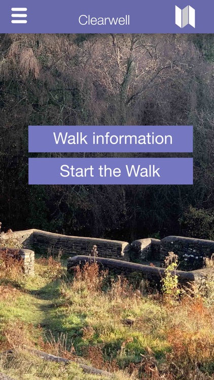
These themes are developed in a number of walks which explore further the rocks and geoheritage of this unique and fascinating area located between the rivers Severn and Wye. The content for the walks you select can be downloaded into the app allowing the walks to used offline. You may also delete walks when no longer required and receive updates as new ones are added.
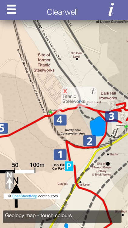
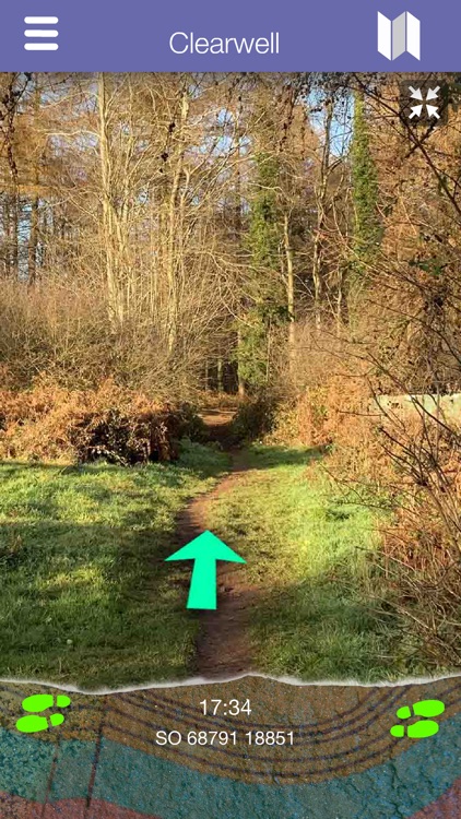
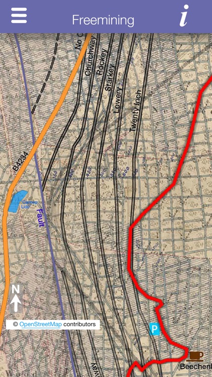
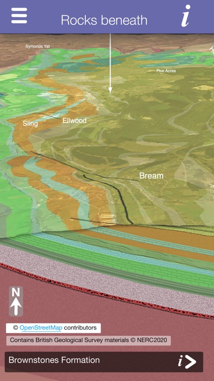
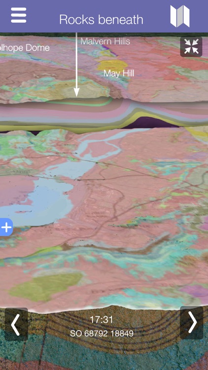
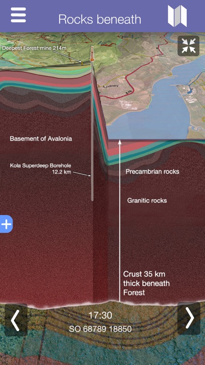
Each walk includes a large scale detailed map, with the route and points of interest marked. GPS continually shows your current location along the route and triggers information as you enter areas of interest. The maps include a geology map of the area, with information about the origins and age of the rock beneath your feet. The map shows the location of former mines, tramways, railways and past industrial activity. 3D sectional diagrams of the landscape, show your current position and how the rocks beneath you have been folded and faulted by past tectonic events.
The app has been developed as part of the Heritage Lottery funded project Foresters’ Forest Landscape Partnership scheme. The principle content contributor to the app has been the Gloucestershire Geology Trust.
Disclaimer:
AppAdvice does not own this application and only provides images and links contained in the iTunes Search API, to help our users find the best apps to download. If you are the developer of this app and would like your information removed, please send a request to takedown@appadvice.com and your information will be removed.
AppAdvice does not own this application and only provides images and links contained in the iTunes Search API, to help our users find the best apps to download. If you are the developer of this app and would like your information removed, please send a request to takedown@appadvice.com and your information will be removed.