You are using an outdated browser. Please
upgrade your browser to improve your experience.

Altimeter is a smart tracking devices, used to altitude measure

GPS Altimeter - Altitude & Map
by ExaMobile S.A.

What is it about?
Altimeter is a smart tracking devices, used to altitude measure. It is perfect app for people who love hiking, skiing, mountain biking and other outdoor activities. Any time and with high precision you can check altitude, elevation or localization coordinates. It works online and offline.
GPS Altimeter is FREE but there are more add-ons
-
$0.99
Remove ads
App Screenshots

App Store Description
Altimeter is a smart tracking devices, used to altitude measure. It is perfect app for people who love hiking, skiing, mountain biking and other outdoor activities. Any time and with high precision you can check altitude, elevation or localization coordinates. It works online and offline.
This altimeter app, to measure altitude uses:
- GPS satellites triangulation - works without internet connection,
- barometer pressure sensor (if available in your device) - high accurate data; if internet connection is available it calibrates itself to improve accuracy,
- online networks location services (wifi and other) - need internet connection.
You can use each sensor separate or all together.
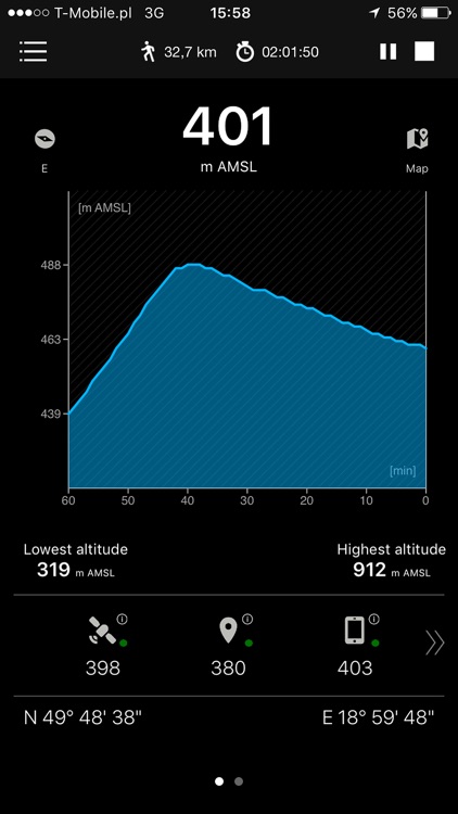
App altitude meter includes the following features:
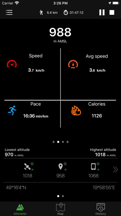
- accurate measurement of altitude - indication in meters or feet
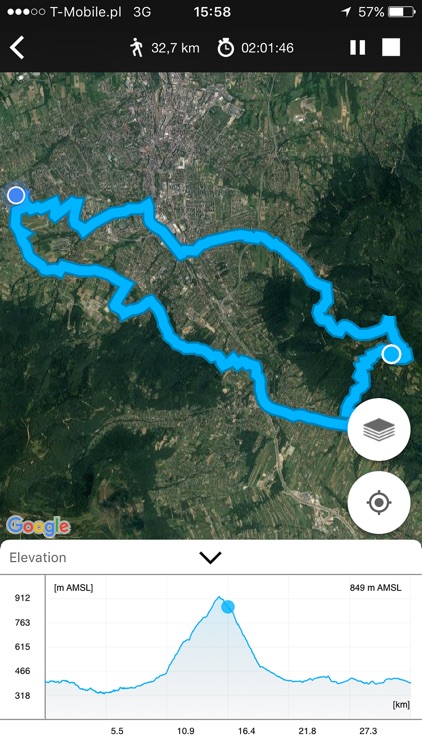
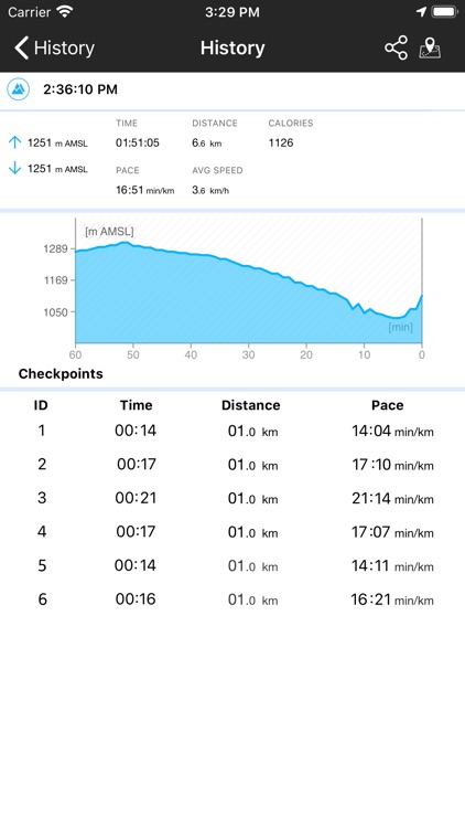
- recording sports activities with a map of the route traveled
- record of: lowest (low), highest (max) altitude
- smart mini compass
- full GPS coordinates - latitude and longitude
- current localization name and state
- results of measurements are shown in the chart
- ability to stop and record the results of measurements at any time
- invert background color (black and white)
- sharing with others your achievements (photo taking function with the current altitude above sea level)
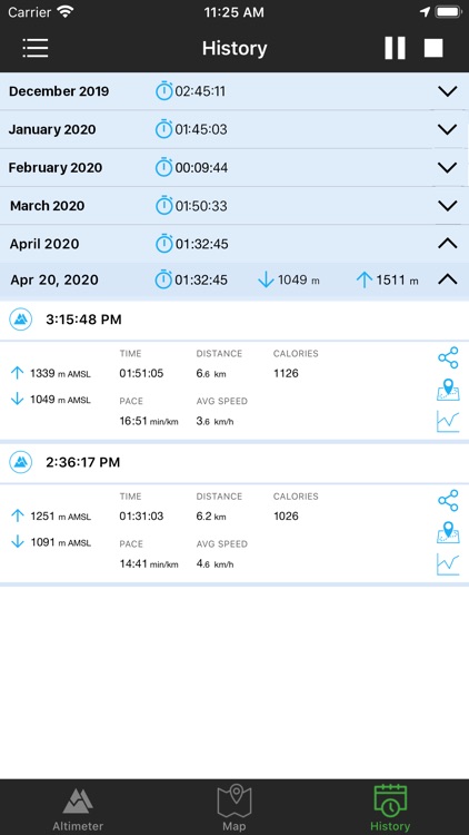
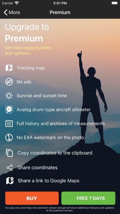
You can activate in app the Premium version which includes:
- No ads in the entire application
- Activity stats (speed, calories, etc.)
- Checkpoints
- Analog drum-type aircraft altimeter
- Full history and archives of measurements
- Tracking map with altitude chart
- Sunrise and sunset times
- No watermark on the picture
Check altitude wherever you are!
Information:
This apps works in the background to proper operation uses GPS. Continued use of GPS running in the background can dramatically decrease battery life.
Enjoy with this altimeter app !
Disclaimer:
AppAdvice does not own this application and only provides images and links contained in the iTunes Search API, to help our users find the best apps to download. If you are the developer of this app and would like your information removed, please send a request to takedown@appadvice.com and your information will be removed.
AppAdvice does not own this application and only provides images and links contained in the iTunes Search API, to help our users find the best apps to download. If you are the developer of this app and would like your information removed, please send a request to takedown@appadvice.com and your information will be removed.