You are using an outdated browser. Please
upgrade your browser to improve your experience.
The application MapsTools supplies tools working with MAPS

Maps Tools,GPS tracking,Speed
by Laurent Simond
What is it about?
The application MapsTools supplies tools working with MAPS
App Screenshots
App Store Description
The application MapsTools supplies tools working with MAPS
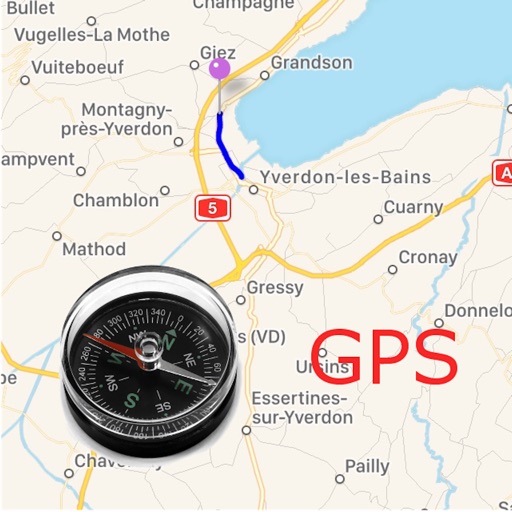
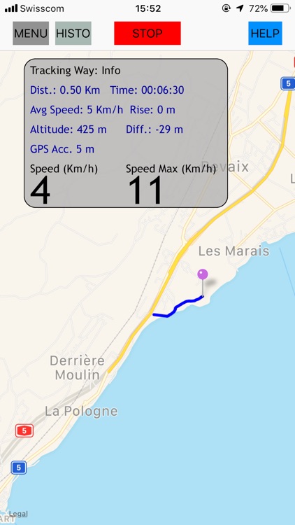
1) GPS Tracking
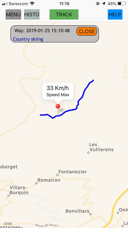
Draws your way on MAPS
Records your way
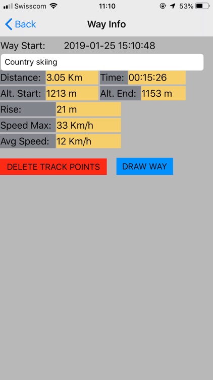
Shows information about your way
- Max Speed
- Average Speed, Current Speed
- Distance
- Elapsed time
- Altitude, Altitude Difference, Rising
Displays recorded tracking
Switchs between metric and imperial units system
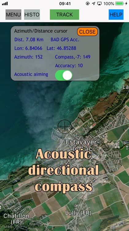
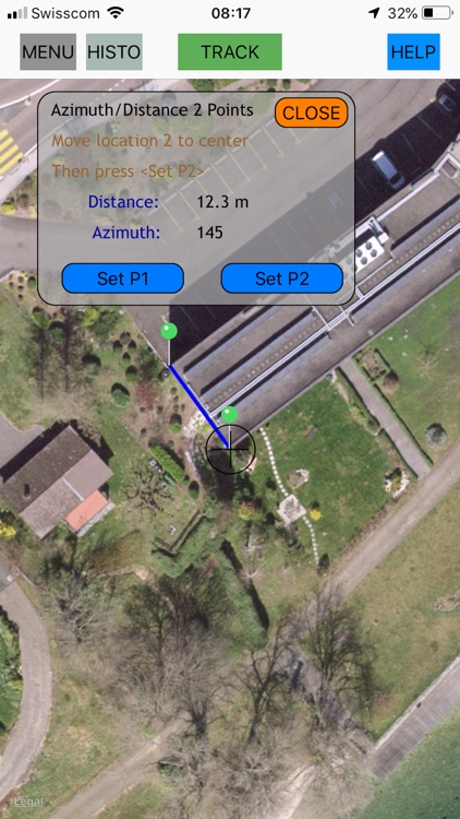
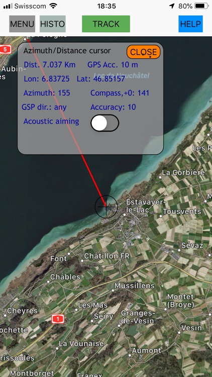
2) Azimuth and Distance to central cursor
- Distance from your location to an other location
- Azimuth from your location to an other location
- GPS coordinates other location
- Acoustic aiming (a voice helps you to orient the device in the direction of the second location)
- GPS Direction
When your location changes, the distance and the azimuth (the cap) are updated
It is possible to keep a cap (GPS direction, Left/Right arrows)
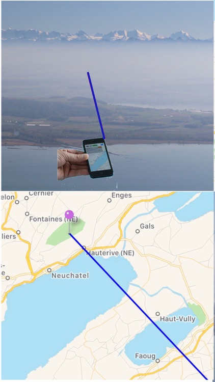
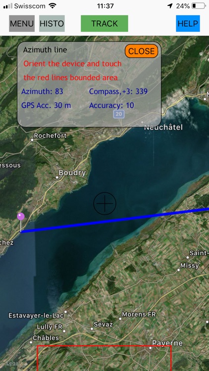
3) Azimuth line
Sometimes, you'd like to know what you see far away
- orient your device and touch the screen
- a line is drawn on MAPS in the direction
measured by the compass
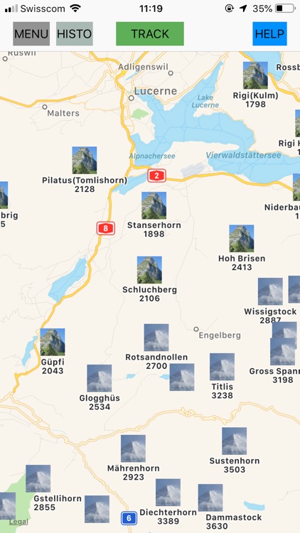
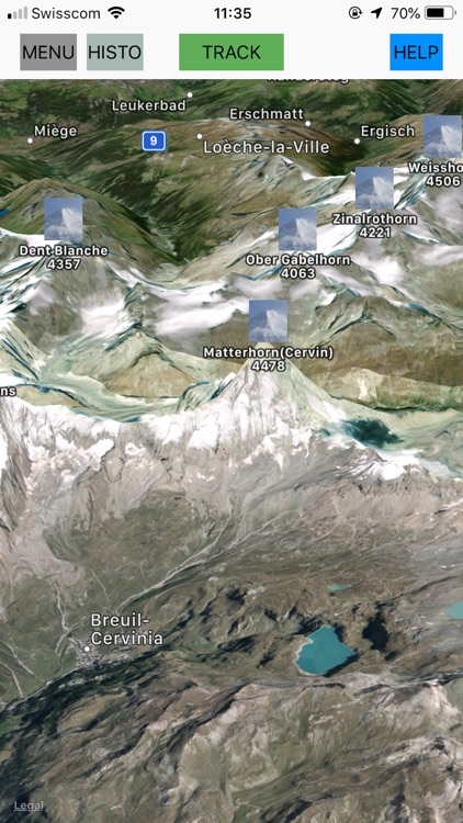
4) Possibility to show the swiss Mountains.To reduce the number of mountains, a filter on the altitude may be applied.
5) Display GPS information and Compass
- GPS coordinates
- Speed
- Altitude
- Horizontal and Vertical accuracy
- GPS direction
- Compass, Compass accuracy
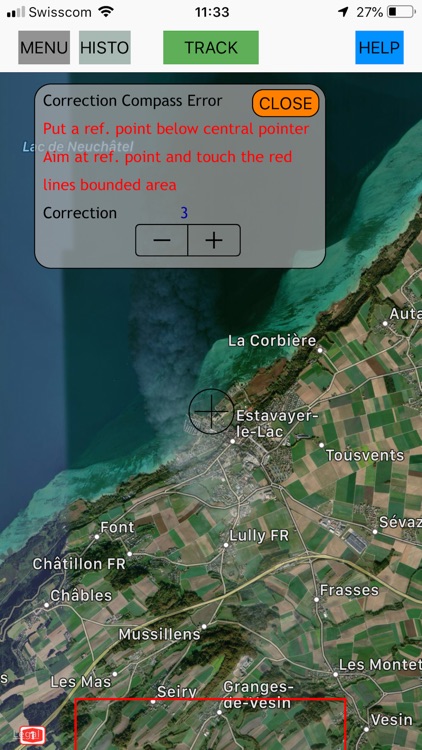
6) Possibility to correct the compass
If you see a geographic point you know and you can find it on the map, you have the possibility to set a compass correction
When the APP is not active (in background), the GPS is working only in the case the user has started the function GPS tracking
WARNING:
- Don't use the application to get your way in dangerous environment. This application don't replace a topographic map and a good compass.
- Without GPS, some features are not fully functional
- The reliability of the functions azimuth line and azimuth/distance depends of
- The reliability of the compass
- The GPS reliability
- The right device orientation
- The GPS increases the energy consumption
- The Maps refreshing consumes internet data and energy
Disclaimer:
AppAdvice does not own this application and only provides images and links contained in the iTunes Search API, to help our users find the best apps to download. If you are the developer of this app and would like your information removed, please send a request to takedown@appadvice.com and your information will be removed.
AppAdvice does not own this application and only provides images and links contained in the iTunes Search API, to help our users find the best apps to download. If you are the developer of this app and would like your information removed, please send a request to takedown@appadvice.com and your information will be removed.