You are using an outdated browser. Please
upgrade your browser to improve your experience.

KEY FEATURES

Greater London A-Z Street Map
by Visual IT Ltd
What is it about?
KEY FEATURES
App Screenshots

App Store Description
KEY FEATURES
● Offline street level map for the whole of the Greater London area.
● Colourful clear custom drawn geographically accurate mapping.
● No internet connection required, no data roaming charges.
● GPS location and tracking.
● Ability to add multiple custom locations, routes and areas directly on the map.
● Streets, Post codes, Places of interest, Museums and Galleries etc built into the application.
● Search now also uses internet services when available.
OVERVIEW
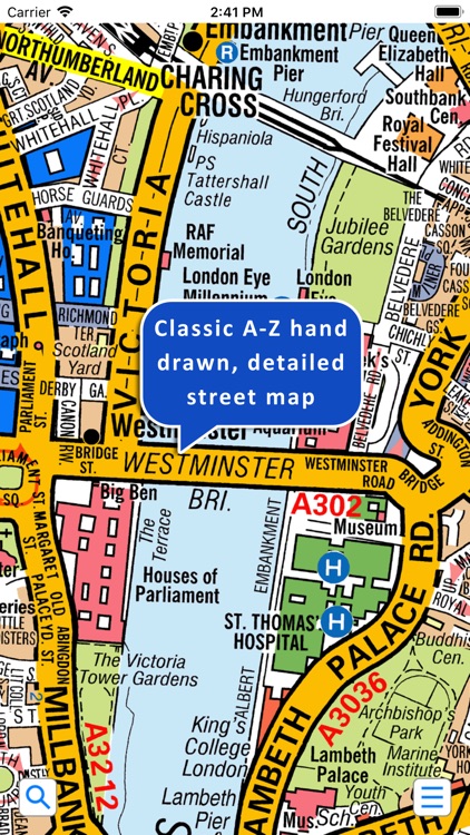
This clear colourful and high quality map covers the whole of the Greater London area down to street level. The familiar look of this map makes it by far the easiest London map to use. The map is drawn by real cartographers with the detailed care and human touch of emphasis that A-Z are famous for.
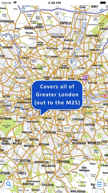
The map covers 3743 sq km (1445 sq miles) of London down to street level, the same area as the printed version of the Master Atlas of Greater London and extends beyond the Greater London and M25 area to Hemel Hempstead, St Albans, Potters Bar, Waltham Cross, Epping, Brentwood, Thurrock, Stanford-le-Hope, Gravesend, Wrotham, Sevenoaks, Westerham, Oxted, Redhill, Reigate, Leatherhead, Great Bookham, Woking, Egham, Windsor, Slough, Chalfont Street Peter, Chorleywood and Bovingdon.
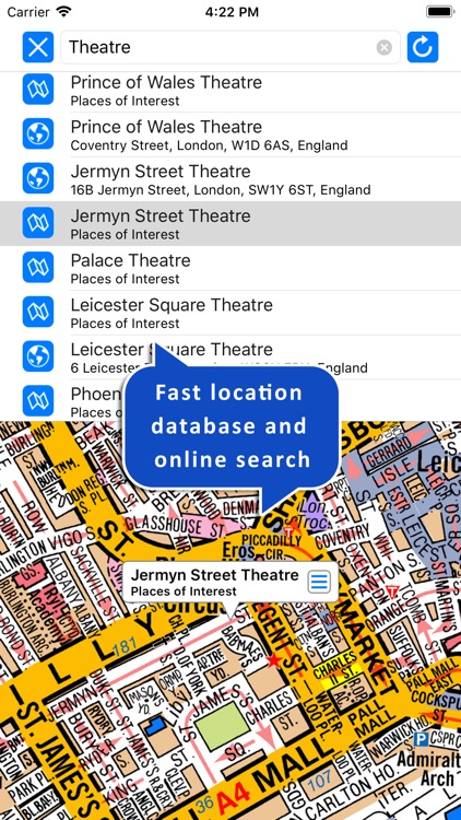
The map index contains over 300,000 entries with nearly 100,000 streets, over 200,000 postcodes, plus thousands of places of interest, hospitals and rail stations. All can be located on this high quality map within a few seconds using the search feature or by browsing the index. The search now reaches out to the internet for additional selections when an internet connection is available.
The map installs completely on the device so that it is available instantly anywhere and with no internet connection..
ANNOTATING THE MAP
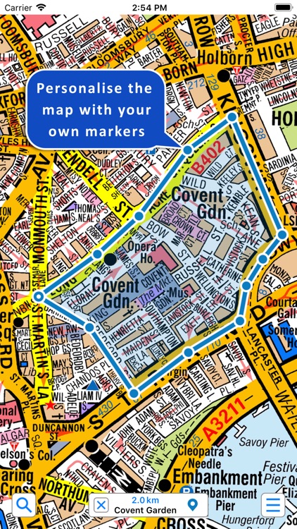
You can now add places of interest, routes and areas to the map. This is a very simple yet powerful feature that allows the user to quickly and easily customise their map. This is also a great benefit to anyone planning routes as it instantly displays the distance for the complete route. These annotations can be stored and retrieved instantly on the device.
GPS
You can use your device’s inbuilt location services to show your current location on the map or follow your movements as you travel.
Add this map to one of our “Zuti” route planner maps and you are well equipped to travel anywhere in the Greater London area.
Disclaimer:
AppAdvice does not own this application and only provides images and links contained in the iTunes Search API, to help our users find the best apps to download. If you are the developer of this app and would like your information removed, please send a request to takedown@appadvice.com and your information will be removed.
AppAdvice does not own this application and only provides images and links contained in the iTunes Search API, to help our users find the best apps to download. If you are the developer of this app and would like your information removed, please send a request to takedown@appadvice.com and your information will be removed.