You are using an outdated browser. Please
upgrade your browser to improve your experience.

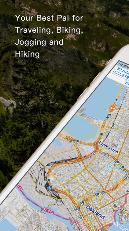
Let Hiking Logger enrich your outdoor activities

Hiking Logger
by CCMedia Technology Company
What is it about?
Let Hiking Logger enrich your outdoor activities! You can record and share your adventures as well as keep every memorable moment. Also, with the offline map and GPS features, you can track your exact location and navigate along the route without connecting to cellular network.
App Screenshots
App Store Description
Let Hiking Logger enrich your outdoor activities! You can record and share your adventures as well as keep every memorable moment. Also, with the offline map and GPS features, you can track your exact location and navigate along the route without connecting to cellular network.
► Record & Share Your Adventures
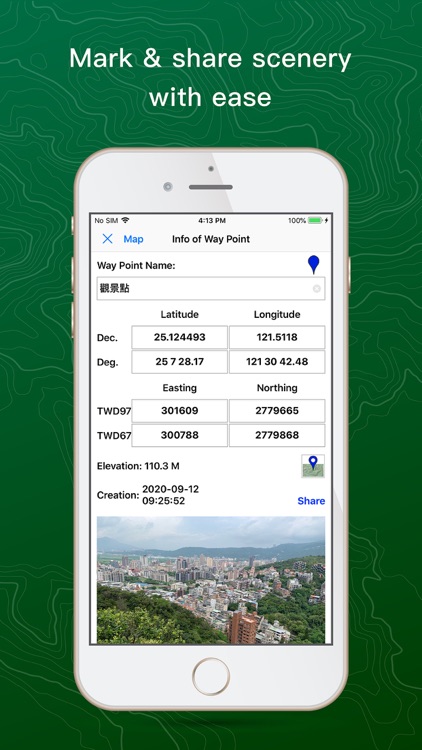
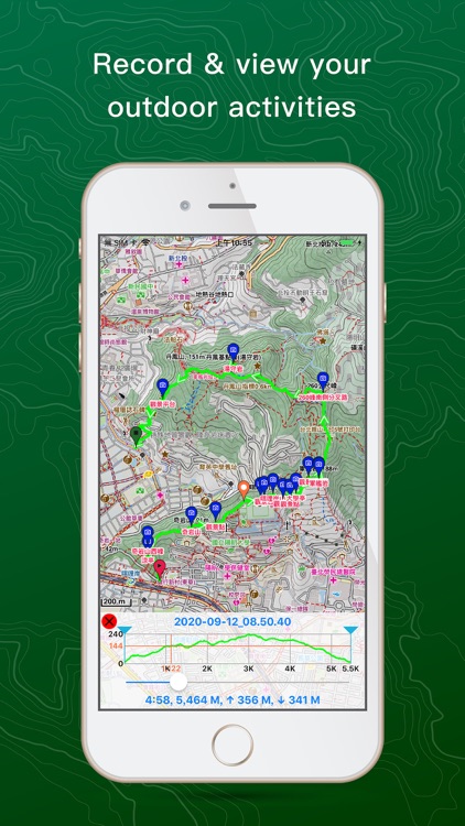
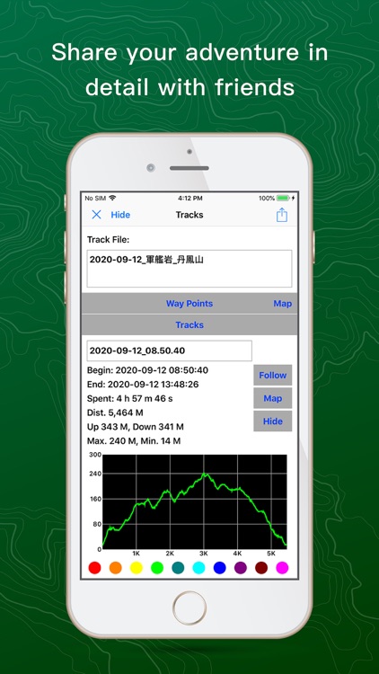
· Keep track of time, distance, altitude and elevation in details for your outdoor activities
· Take photos and display them on the map for your review in the future
· Share your outdoor adventures containing photos, videos or recordings with friends
► Stay Safe with Detailed Cartographic Info & Supportive Features
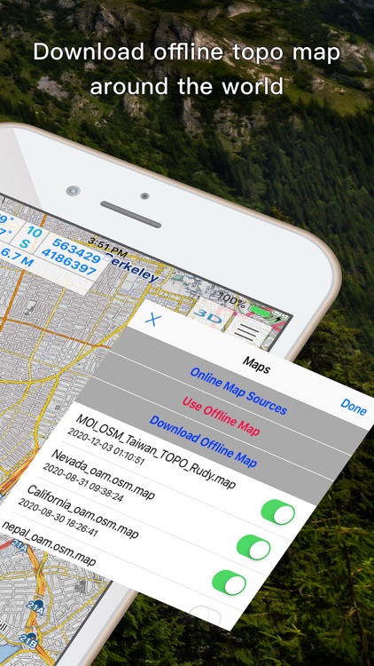
· Offline map helps you know exactly where you are without connecting to cellular network
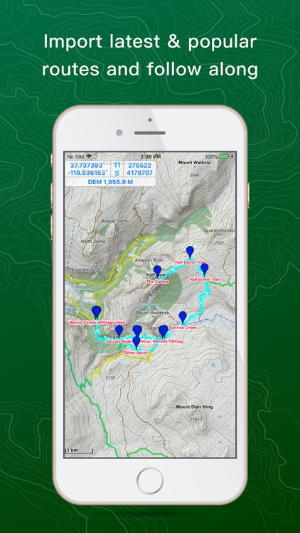
· Import latest and popular routes and follow along for keeping you safe at all time
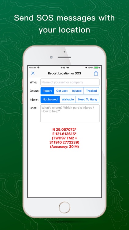
· Quick options for sending out SOS messages with location, type of accident and injury condition
► No Subscription or In-App Purchase Needed! One-time Purchase to Enjoy ALL Features:
- Mapsforge format offline map, ex. OpenAndroMaps
- JPG/PNG format MBTiles
- Map overlays
- DEM for creating relief map
- Text size adjustment of offline map
- WMTS online maps, ex. USGS Topo WMTS
- Preload online map tiles and purging cached online map tiles
- MGRS, USNG, TWD67, TWD97, UTM, and other coordinate systems
- Displaying information and drawing navigation line of target way point
- Adding photo, video, and/or audio to your track
- Record logging track
- Color selection for each track
- Importing/exporting GPX/KML/KMZ
- Offline POI
- Distance measurement
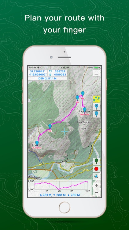
- Navigation by route or track
- Location reporting
- SOS messages
- Output A3/A4 1/12500, 1/25000, 1/50000 map
Disclaimer:
AppAdvice does not own this application and only provides images and links contained in the iTunes Search API, to help our users find the best apps to download. If you are the developer of this app and would like your information removed, please send a request to takedown@appadvice.com and your information will be removed.
AppAdvice does not own this application and only provides images and links contained in the iTunes Search API, to help our users find the best apps to download. If you are the developer of this app and would like your information removed, please send a request to takedown@appadvice.com and your information will be removed.