You are using an outdated browser. Please
upgrade your browser to improve your experience.

Shopping for furniture with augmented reality is one thing, but placing an entire building on a vacant lot is another

HL AR Maps
by Houseal Lavigne Associates, LLC
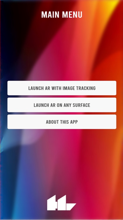

What is it about?
Shopping for furniture with augmented reality is one thing, but placing an entire building on a vacant lot is another. Houseal Lavigne's AR Map Gallery App explores the potential for augmented reality in the field of city planning, allowing you to spawn and explore a proposed development right in front of you.
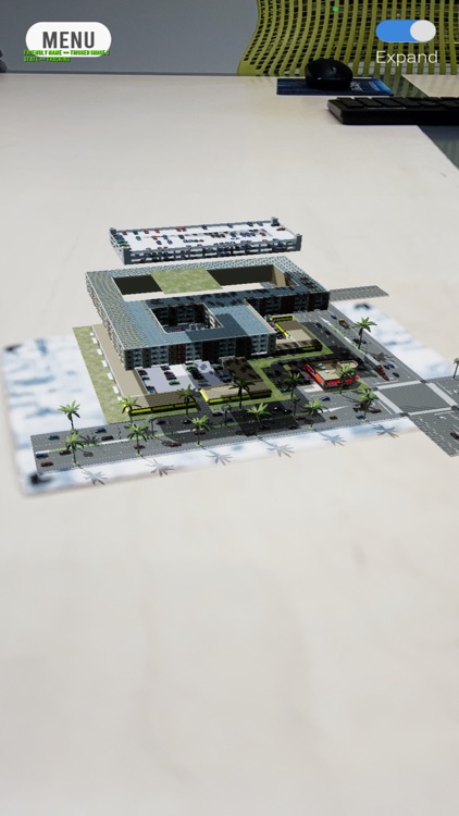
App Screenshots

App Store Description
Shopping for furniture with augmented reality is one thing, but placing an entire building on a vacant lot is another. Houseal Lavigne's AR Map Gallery App explores the potential for augmented reality in the field of city planning, allowing you to spawn and explore a proposed development right in front of you.
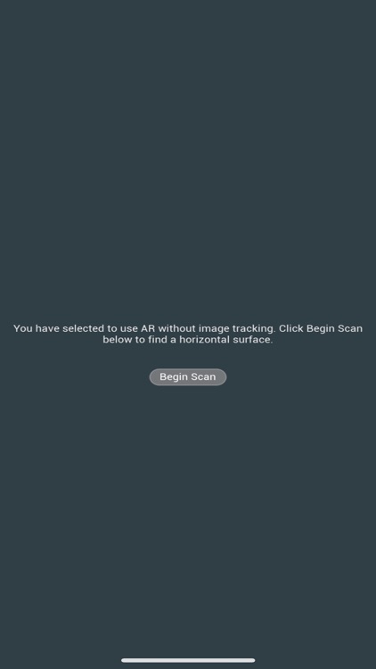
The app supports two ways to launch the augmented reality experience:
LAUNCH AR WITH IMAGE TRACKING. This setting has been configured to place a 3D model on top of a 2D image it has been configured to recognize. When launched, the app first requests permission to use your device’s camera. Once the app detects the image it will spawn, scale, and rotate the 3D model. If the position of the image changes, such as rotation, the 3D model will also rotate.
LAUNCH AR ON ANY SURFACE. After the user selects “Begin Scan” the app uses your device’s camera to search for horizontal planes. After a horizontal plane is detected, it overlays a pulsing graphic. Once the user selects the plane, a 3D model of the development is spawned. The app is capable of tracking which plane the 3D model was placed on, allowing the user to move the camera away or move closer in.
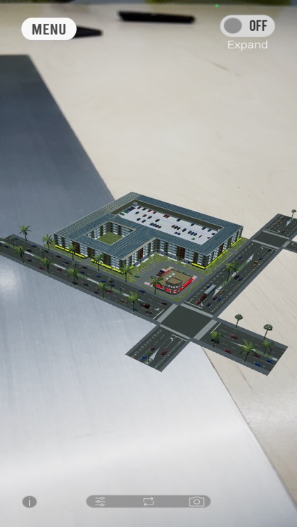
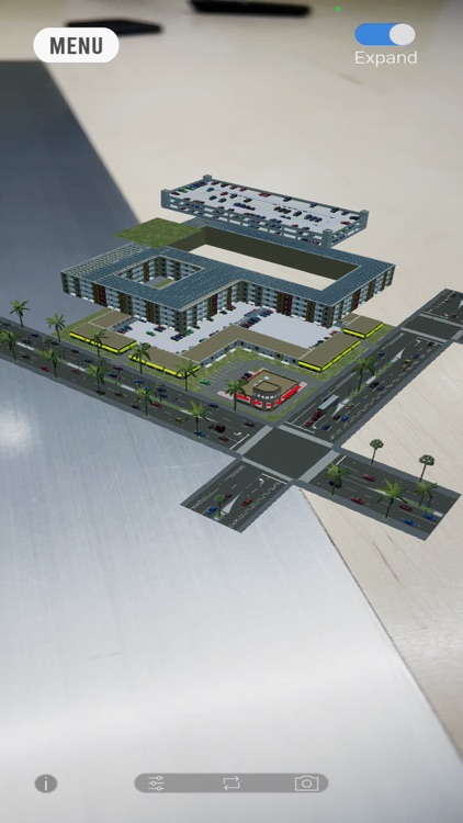
About the Model
The City of Cypress, California, like most cities in the greater Los Angeles metropolitan area, is almost completely built-out. Finding parcels that can accommodate new development to meet the City’s housing need is a challenge. As part of the City’s Housing Element Update, the site at Lincoln and Moody was under consideration for a rezoning from Commercial to Mixed-Use. The City wanted to see how many units could be developed on this site at various densities. Houseal Lavigne created a development concept for this housing opportunity using CityEngine. Within the HL AR Map Gallery application, users can toggle between Plan and Exploded views and click on building components to understand certain attributes, such as the number of dwelling units, cost, and parking availability. These attributes are all calculated within CityEngine.
Disclaimer:
AppAdvice does not own this application and only provides images and links contained in the iTunes Search API, to help our users find the best apps to download. If you are the developer of this app and would like your information removed, please send a request to takedown@appadvice.com and your information will be removed.
AppAdvice does not own this application and only provides images and links contained in the iTunes Search API, to help our users find the best apps to download. If you are the developer of this app and would like your information removed, please send a request to takedown@appadvice.com and your information will be removed.