You are using an outdated browser. Please
upgrade your browser to improve your experience.
THE ALL NEW ADVANCED MARINE RASTER NAUTICAL CHARTS APP FOR BOATERS, SAILORS, KAYAKERS & CANOERS

Hudson River, New York Boating
by Vishwam B
What is it about?
THE ALL NEW ADVANCED MARINE RASTER NAUTICAL CHARTS APP FOR BOATERS, SAILORS, KAYAKERS & CANOERS!
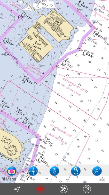
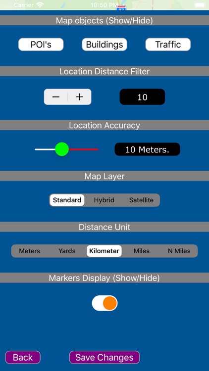
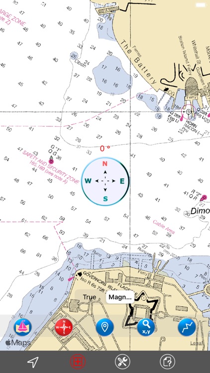
App Screenshots
App Store Description
THE ALL NEW ADVANCED MARINE RASTER NAUTICAL CHARTS APP FOR BOATERS, SAILORS, KAYAKERS & CANOERS!
COMBINATION OF SMALL CRAFT AND HARBOR CHARTS FOR EASY NAVIGATION.
ALL CHARTS OVERLAY IS ARRANGED IN A SEAMLESS ORDER, BASED ON CHART SCALE AND PRIORITY.
NO WAITING TIME FOR NAUTICAL CHART DOWNLOADS. NO NEED TO CHANGE CHARTS MANUALLY, THEY ARE READY FOR CONTINUOUS NAVIGATION.
- ALL HUDSON RIVER (New York) NAUTICAL CHARTS ARE FROM NOAA SOURCES.
- ALL CHARTS ALIGNED WITH ORIGINAL CHART CO-ORDINATES, ARE ACCURATE FOR USE.
- TRACK YOUR LOCATION WITH GPS ON MAP.
- OFFLINE CHART OVERLAY DISPLAY, USE THEM AS LONG AS YOU SAIL.
- HIDE AND SHOW CHART OVERLAY TO SEE DIFFERENCE IN SATELLITE OR OTHER MAPS.
- USER-INTERACTIVE COMPASS FOR DIRECTIONS (TRUE/MAGNETIC).
- INSERT UNLIMITED FAVORITE MARKERS ON MAP. PHOTO TAGGED FACILITY FOR MARKERS WITH EMAIL OPTION.
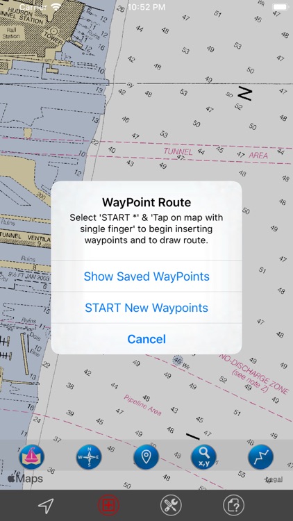
- FIND DISTANCES WITH ROUTE TOOL, DRAW ON MAP AND NAVIGATE ALONG THE ROUTE. SAVE, LOAD & EMAIL AS KMZ.
- USER FRIENDLY SETTINGS TO CONTROL MAP FEATURES.
THIS APP IS MOST ADVANCED WITH ALL THE NECESSARY TOOLS FOR EASY NAVIGATION ON WATER. CONTINUOUS CHARTS DISPLAY MAKES IT MORE EASIER FOR SAILING AND AS THERE WILL BE NO INTERNET ON SEA, THE OFFLINE CHART DISPLAY WILL BE HELPFUL FOR EASY NAVIGATION.
NOTE: All charts are Geo-positioned to match the exact location of features displayed on charts but there may be some difference between the positions of actual objects that are in the water or sea and nautical charts shown on map because of the different chart scales.
We strive to provide the best quality products to the boaters/sailors. We welcome suggestions from the users of this product to improve and make the map more useful.
HAPPY BOATING AND SAILING ALL THE TIME!
Disclaimer:
AppAdvice does not own this application and only provides images and links contained in the iTunes Search API, to help our users find the best apps to download. If you are the developer of this app and would like your information removed, please send a request to takedown@appadvice.com and your information will be removed.
AppAdvice does not own this application and only provides images and links contained in the iTunes Search API, to help our users find the best apps to download. If you are the developer of this app and would like your information removed, please send a request to takedown@appadvice.com and your information will be removed.