You are using an outdated browser. Please
upgrade your browser to improve your experience.
This App offers access to Finland offline nautical charts, lake & river navigation maps for fishing, kayaking, boating, yachting & sailing

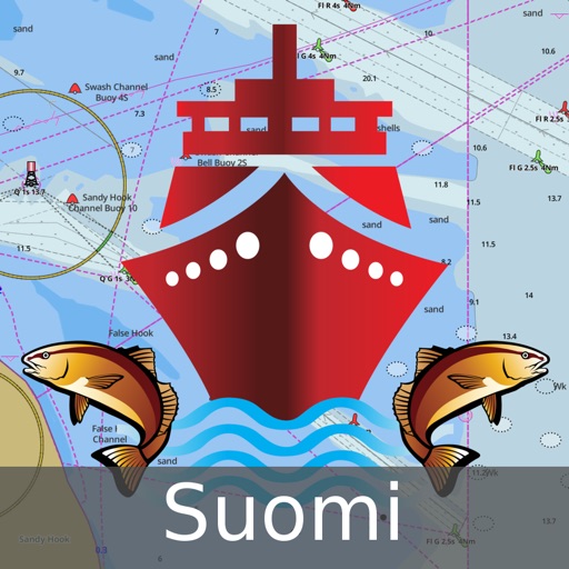
i-Boating:Finland Marine Chart
by Bist LLC
What is it about?
This App offers access to Finland offline nautical charts, lake & river navigation maps for fishing, kayaking, boating, yachting & sailing. Coverage includes marine vector charts, freshwater lake maps, and inland river maps (HD/1ft/3ft bathymetry included where available). First marine GPS app to have route assistance with Voice Prompts for marine navigation. You can create new boating routes or import existing GPX/KML routes. It supports Nautical Charts course up orientation. Includes Tide & Currents prediction.
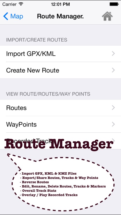
App Screenshots
App Store Description
This App offers access to Finland offline nautical charts, lake & river navigation maps for fishing, kayaking, boating, yachting & sailing. Coverage includes marine vector charts, freshwater lake maps, and inland river maps (HD/1ft/3ft bathymetry included where available). First marine GPS app to have route assistance with Voice Prompts for marine navigation. You can create new boating routes or import existing GPX/KML routes. It supports Nautical Charts course up orientation. Includes Tide & Currents prediction.
►FEATURES
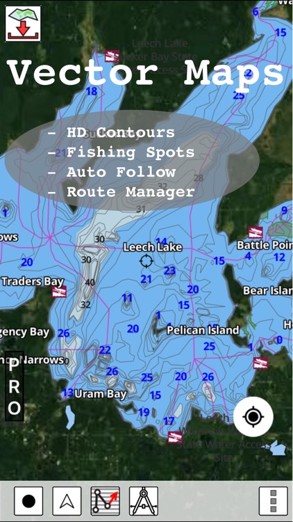
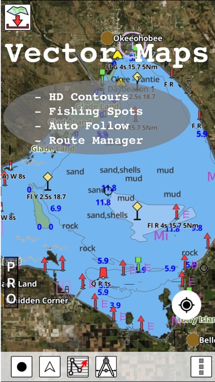
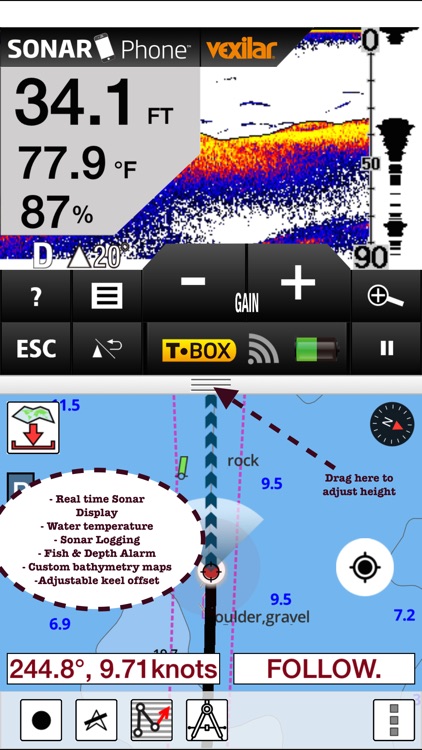
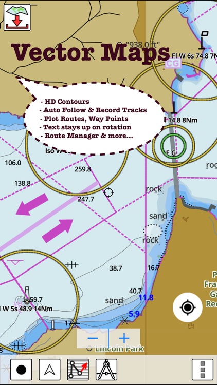
√ Download Beautiful & detailed Hardware/GPU accelerated vector charts (text stays upright on rotation)
√ Query details of Maritime object (Buoy, Lights, Obstruction etc).
√ Custom depth(Ft/Fathom/Meter) & distance units (km/mi/NM)
√ Custom Shallow Depth.
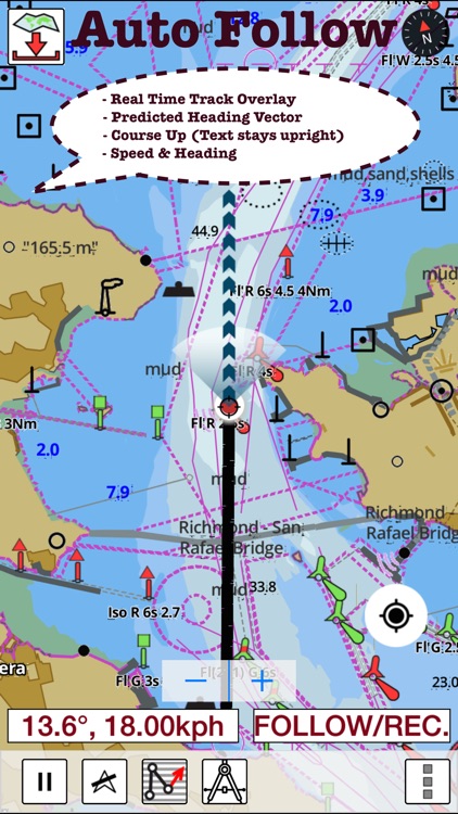
√ Record tracks, Autofollow with real-time track overlay & predicted path vector.
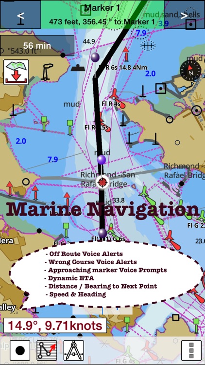
√ Voice Prompts for marine navigation (requires GPS )
√ 1ft / 3ft depth contour maps for anglers for selected lake maps. Useful for fishing/trolling(freshwater/saltwater).
√ Supports GPX/KML for boating route editing/import.
√ Tide & Currents.
√ Seamless chart quilting. Map details from Coastal, Approaches,Harbour, Inland Encs(rivers), and general ENC (Electronic Marine Charts) are automatically mapped to correct zoomlevel
√ Enter / import Waypoints.
► MAPS
Coverage includes Finland lakes & marine maps.
►ROUTE MANAGEMENT / TRIP PLANNING
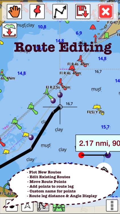
√ Create New /Edit Routes
√ Reverse Routes
√ Enter,Move, Add, Delete, Rename Waypoints
√ Import GPX, KML & KMZ files
√ Plot/Edit Routes
√ Share/Export Routes, Tracks & Markers
►GPS FEATURES
√ Auto Follow
* Real Time Track Overlay
* Predicted Path Vector
* Course Up (Text stays upright)
* Speed & Heading
√ Route Assistance With Voice Prompts
* Prompts when approaching a boating route marker
* Continous distance & ETA updates
* Alerts when sailing/boating off route
* Alerts when boating in wrong direction
√ Record Tracks
►TIDE & CURRENTS
* For US, Canada, UK,Germany&New Zealand
* High/Low Tides
* Tidal Current Prediction
* Active Current Stations
► SHARING
* Share tracks/routes/markers on Facebook & Twitter
* Export tracks/routes/markers as compressed GPX files.
Sample Maps (See http://goo.gl/IoQsog for full list)
Partakoski, Taistensaari and Vekarantaipale
Helsinki, Vuosaari
Pellinki
Kotka
Rauma
Kemi and Tornio
Kaskinen and Kristiinankaupunki
Raahe
Northern Baltic
Gulf of Finland eastern part
Sulkava
Loviisa, Orrengrund, Kaunissaari
Port of Raahe
Joensuu
Paasivesi
Pirttisaari
Vallgrund, Norrskär, Veckargrund
Varkaus
Archipelago Sea,
Mikkeli, Porrassalmi and Juurisalmi
Houtskär
Lappeenranta
Äijänantaja
Äimäjärvi
Aittojärvi
Please Note: "Continued use of GPS running in the background
can dramatically decrease battery life."
Disclaimer:
AppAdvice does not own this application and only provides images and links contained in the iTunes Search API, to help our users find the best apps to download. If you are the developer of this app and would like your information removed, please send a request to takedown@appadvice.com and your information will be removed.
AppAdvice does not own this application and only provides images and links contained in the iTunes Search API, to help our users find the best apps to download. If you are the developer of this app and would like your information removed, please send a request to takedown@appadvice.com and your information will be removed.