You are using an outdated browser. Please
upgrade your browser to improve your experience.
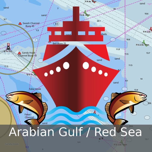
GPS Marine Charts App offers access to charts covering Arabian/Persian Gulf & Red Sea (incl

i-Boating:Persian/Arabian Gulf
by Bist LLC
What is it about?
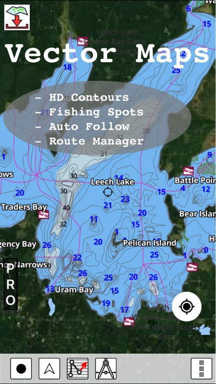
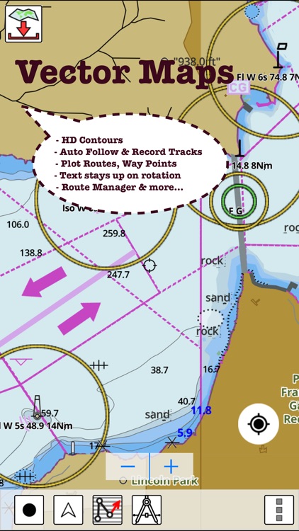
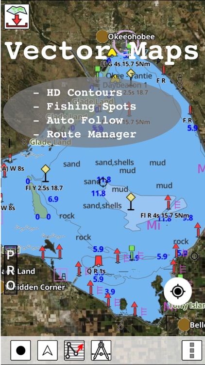
GPS Marine Charts App offers access to charts covering Arabian/Persian Gulf & Red Sea (incl. Oman, United Arab Emirates, Iran and Qatar). Only marine GPS app to have route assistance with Voice Prompts for marine navigation. It has route manager to create new boating routes or import existing GPX/KML routes. It supports Nautical Charts course up orientation.
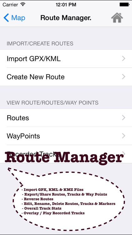
App Screenshots
App Store Description
GPS Marine Charts App offers access to charts covering Arabian/Persian Gulf & Red Sea (incl. Oman, United Arab Emirates, Iran and Qatar). Only marine GPS app to have route assistance with Voice Prompts for marine navigation. It has route manager to create new boating routes or import existing GPX/KML routes. It supports Nautical Charts course up orientation.
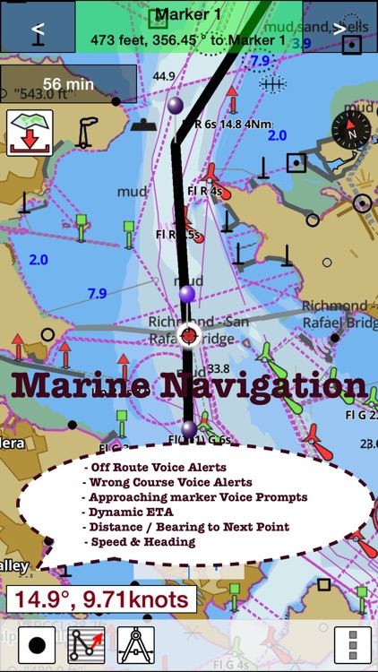
► Voice Prompts for marine navigation (requires GPS )
-prompts when approaching a boating route marker
-Continous distance and ETA updates
-Alerts when sailing/boating off route
-Alerts when boating in wrong direction
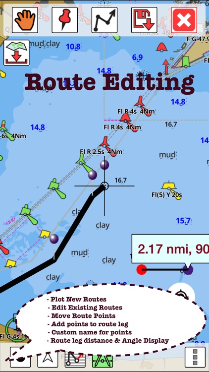
►Route Editing/Creation
-Create routes from scratch
-Edit existing GPX/KML routes.
-Add custom description to any route point.
-Drop markers along route.
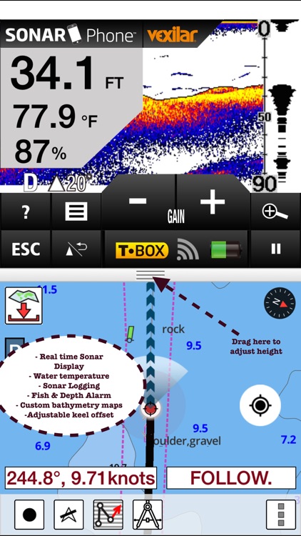
► Advanced NMEA Instrumentation
√AIS over TCP/UDP
√Wind speed, direction, temperature, depth, GPS over NMEA
► Offline charts for Persian/Arabian Gulf, Red Sea and Gulf of Aden.
►Seamless chart quilting of marine charts
► Persian/Arabian Gulf
-Iran & Qatar: Chiru, Khafji & more.
►Distance Bearing tool
►Oman
-Mirbat, Muscat, Sohar, Hormuz & more.
►Create custom way points
- Using GPS
-Select point on map
-Manually enter latitude & longitude coordinates
► Red Sea and Gulf of Aden
-Melita Bay, Strait of Tiran, Yemen, Zeit & more
► United Arab Emirates
- Al Jeer Port, Khalifa Port & more
*Pan/Zoom/My Location
* Record Marine GPS tracks
* View tracks overlay
* Live track animation
* Track analytics/stats
► Export GPX tracks.
-Export to SDCard
-Share GPX trakcs with friends/View on Google earth.
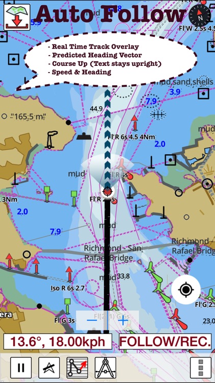
►Auto Follow Mode (Course up)
-Continuously updates boat's location on chart
- Adjustable update frequency
Battery Disclaimer:
"Continued use of GPS running in the background can dramatically decrease battery life."
Disclaimer:
AppAdvice does not own this application and only provides images and links contained in the iTunes Search API, to help our users find the best apps to download. If you are the developer of this app and would like your information removed, please send a request to takedown@appadvice.com and your information will be removed.
AppAdvice does not own this application and only provides images and links contained in the iTunes Search API, to help our users find the best apps to download. If you are the developer of this app and would like your information removed, please send a request to takedown@appadvice.com and your information will be removed.