You are using an outdated browser. Please
upgrade your browser to improve your experience.

iGeoTrak – More than Mobile GIS, it is SMART GIS Platform with a built-in Logic Engine and User Customizable collection and reporting technologies

iGeoTrak
by Cogent3D
What is it about?
iGeoTrak – More than Mobile GIS, it is SMART GIS Platform with a built-in Logic Engine and User Customizable collection and reporting technologies. Need to do more than drop a pin and take a photo? iGeoTrak is the tool for you! The award-winning, map-centric app can collect and edit vectors, display drone imagery, capture survey data, perform complex math like excel, alert to problems like no other GIS tool, and create custom reports based on Microsoft Word. All native on the iPad/iPhone, using the cloud for multiple user collaboration, consolidation, remote reporting, and administration.
App Store Description
iGeoTrak – More than Mobile GIS, it is SMART GIS Platform with a built-in Logic Engine and User Customizable collection and reporting technologies. Need to do more than drop a pin and take a photo? iGeoTrak is the tool for you! The award-winning, map-centric app can collect and edit vectors, display drone imagery, capture survey data, perform complex math like excel, alert to problems like no other GIS tool, and create custom reports based on Microsoft Word. All native on the iPad/iPhone, using the cloud for multiple user collaboration, consolidation, remote reporting, and administration.
SMART GIS Engine:
Taking GIS to the next level, GISEngine evaluates your manual and automated loaded data against rules you design (without programming) to feed our GIS Ai Engine (artificial intelligence).
Rules can with automatic emails, text messages, apple notifications, work orders, and map icons:
a) REMIND you of work efforts,
b) ALERT you to problems,
c) ADVISE you on what to do,
d) DISPLAY current status of external feeds, and
e) REMEMBER what was done and why.
Find out why our beta testers, say they wished they had this technology their whole life.
VECTORS:
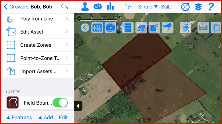
Create, edit, and survey any Vector type: Points, Lines, and Polygons (including multiple part features).
SURVEY FORMS:
Create, Edit, and Customize the Survey Forms. Including icons, content, in-form math, external table look-up, pick-lists, photo tools, drawing tools, barcodes, data input validators, and even the help all without programming one line of code.
IN-APP ANALYSIS:
Create, view, and export custom in-app analysis of the data you just collected and historical data like never before. Even do unit conversions, colorization, quantization, and more. Export can be shapefiles, excel, and Microsoft Word.
REPORT:
Use our unique Microsoft Office plug-in to make custom pixel perfect reports that can format your data for even the most demanding customer or requirement.
Disclaimer:
AppAdvice does not own this application and only provides images and links contained in the iTunes Search API, to help our users find the best apps to download. If you are the developer of this app and would like your information removed, please send a request to takedown@appadvice.com and your information will be removed.
AppAdvice does not own this application and only provides images and links contained in the iTunes Search API, to help our users find the best apps to download. If you are the developer of this app and would like your information removed, please send a request to takedown@appadvice.com and your information will be removed.