You are using an outdated browser. Please
upgrade your browser to improve your experience.

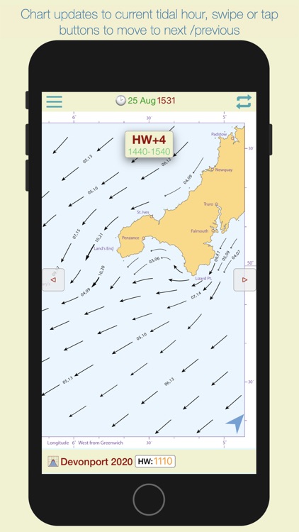
iStreams displays the valid hourly Lands End tidal stream atlas for the current real time, in reference to the time of high water at Devonport

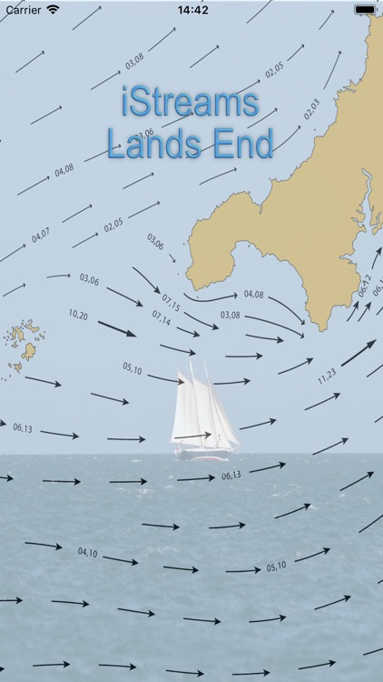
iStreams Lands End
by Navtech Software

What is it about?
iStreams displays the valid hourly Lands End tidal stream atlas for the current real time, in reference to the time of high water at Devonport... a smart app, fully functional offline. With tools to measure tide set and interpolated rate.
App Screenshots
App Store Description
iStreams displays the valid hourly Lands End tidal stream atlas for the current real time, in reference to the time of high water at Devonport... a smart app, fully functional offline. With tools to measure tide set and interpolated rate.
The nearest Devonport HW time to the actual time is selected from the database and the relevant streams chart is displayed, together with the time period for which the chart is valid.
As the time moves to the next valid period, the relevant hourly chart is auto displayed.
* Swiping on the chart (or using navigation buttons), displays the next or previous tidal hour chart.
* Whenever the chart displayed is valid at the current time, the validity period is displayed in green.
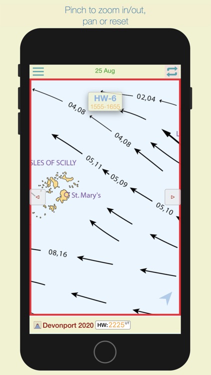
* Pinching the screen zooms the chart
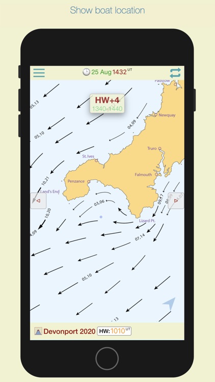
* Tapping the location button shows your actual boat position on the chart.
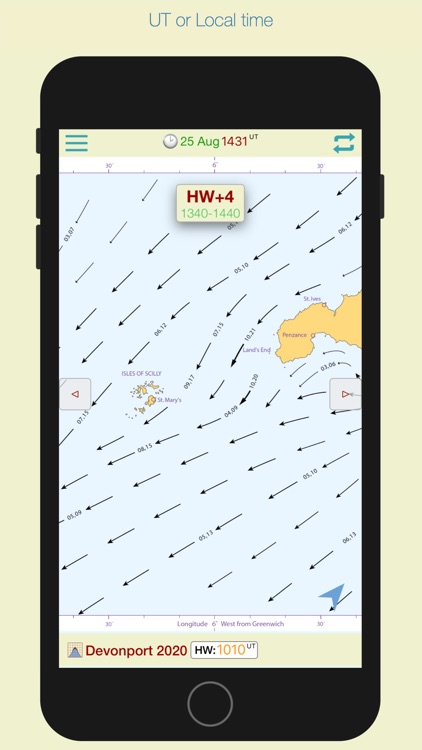
* Select Local or UTC time.
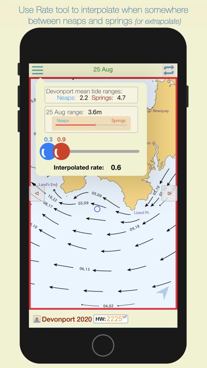
Select the rate tool to auto calculate the interpolated tidal rate when in between neaps and springs.
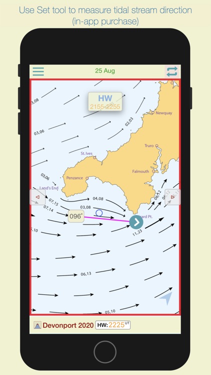
Select the 'Set' tool to measure the precise true course of any tidal stream arrow. (in-app purchase)
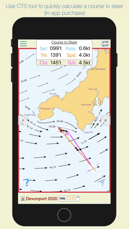
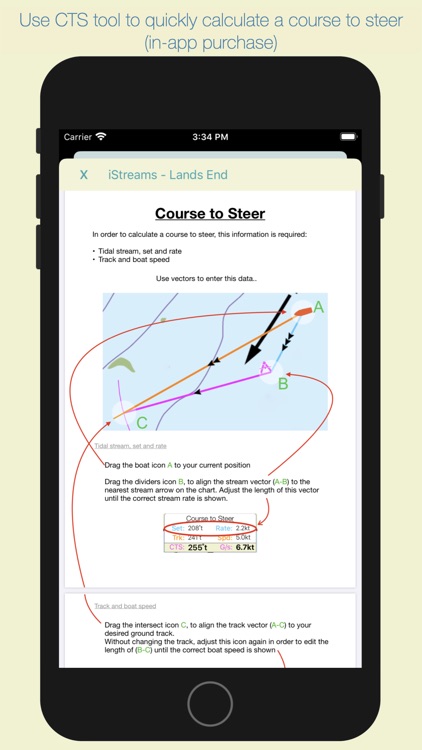
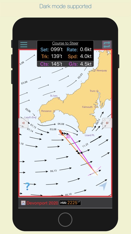
Select the 'CTS' tool to calculate a course to steer. (in-app purchase)
The app automatically selects the nearest Devonport HW time of the day, but if you want to see data for the next or previous HW of the day, swipe forward or back to advance the tidal hour.
For forward planning, tap on the date to select a different date, whereupon data relevant to that date will be displayed.
Disclaimer:
AppAdvice does not own this application and only provides images and links contained in the iTunes Search API, to help our users find the best apps to download. If you are the developer of this app and would like your information removed, please send a request to takedown@appadvice.com and your information will be removed.
AppAdvice does not own this application and only provides images and links contained in the iTunes Search API, to help our users find the best apps to download. If you are the developer of this app and would like your information removed, please send a request to takedown@appadvice.com and your information will be removed.