You are using an outdated browser. Please
upgrade your browser to improve your experience.
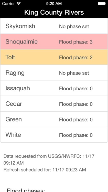
The King County Flood Warning app helps safeguard people and property by providing real-time flooding info for the Skykomish, Snoqualmie, Tolt, Raging, Cedar, Green and White rivers, and Issaquah Creek

King County Flood Warning
by King County
What is it about?
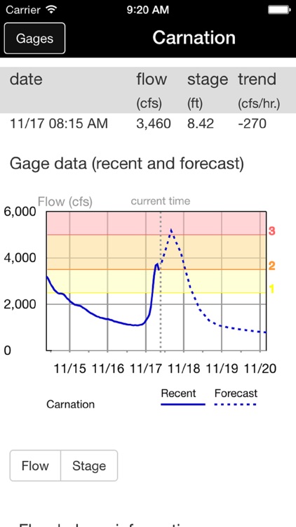
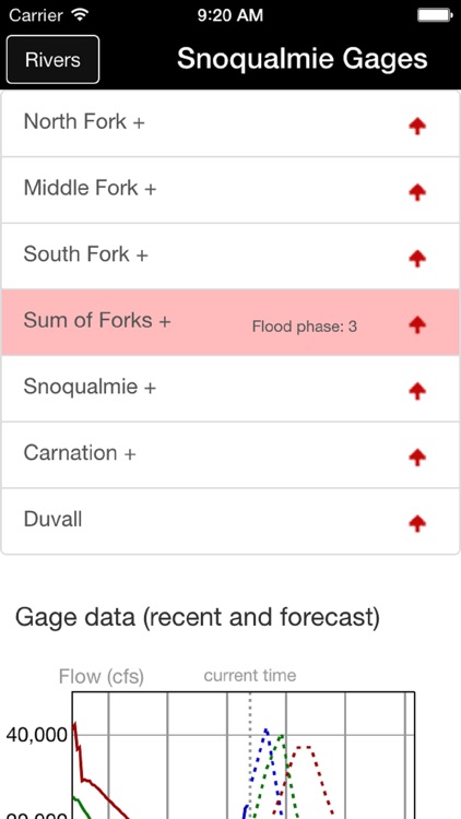
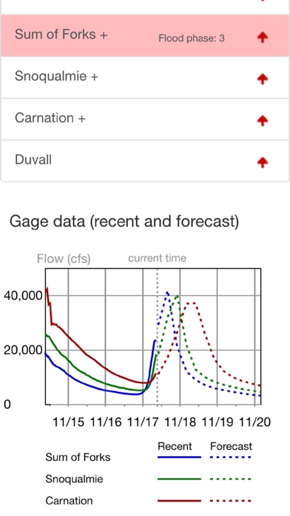
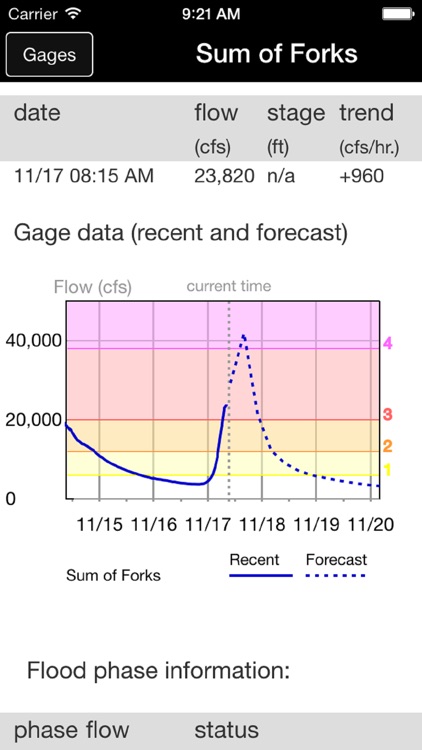
The King County Flood Warning app helps safeguard people and property by providing real-time flooding info for the Skykomish, Snoqualmie, Tolt, Raging, Cedar, Green and White rivers, and Issaquah Creek. If you live, work, go to school or regularly travel in or through these areas of King County download this app to track flood conditions. The app shows current river flows, flood stage data and forecasts plus real-time flood phases. Hydrographs make it easy to see several days of river data and forecasts. This app uses data from U.S. Geological Survey and National Weather Service and Northwest River Forecast Center downloaded every 10 minutes (source data update timing varies). Developed by King County and funded by the King County Flood Control District.
App Details
Version
1.3.3
Rating
(2)
Size
5Mb
Genre
Weather
Last updated
June 27, 2017
Release date
September 18, 2013
More info
App Screenshots
App Store Description
The King County Flood Warning app helps safeguard people and property by providing real-time flooding info for the Skykomish, Snoqualmie, Tolt, Raging, Cedar, Green and White rivers, and Issaquah Creek. If you live, work, go to school or regularly travel in or through these areas of King County download this app to track flood conditions. The app shows current river flows, flood stage data and forecasts plus real-time flood phases. Hydrographs make it easy to see several days of river data and forecasts. This app uses data from U.S. Geological Survey and National Weather Service and Northwest River Forecast Center downloaded every 10 minutes (source data update timing varies). Developed by King County and funded by the King County Flood Control District.
Disclaimer:
AppAdvice does not own this application and only provides images and links contained in the iTunes Search API, to help our users find the best apps to download. If you are the developer of this app and would like your information removed, please send a request to takedown@appadvice.com and your information will be removed.
AppAdvice does not own this application and only provides images and links contained in the iTunes Search API, to help our users find the best apps to download. If you are the developer of this app and would like your information removed, please send a request to takedown@appadvice.com and your information will be removed.