You are using an outdated browser. Please
upgrade your browser to improve your experience.

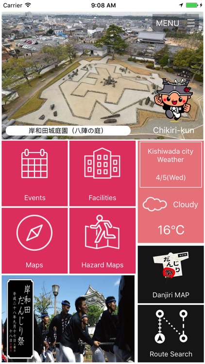
“Kishiwada navi” is the app which can easily search the event information, facility information and secondary traffic such as bus

Kishiwada Navi
by KISHIWADA CITY
What is it about?
“Kishiwada navi” is the app which can easily search the event information, facility information and secondary traffic such as bus. Use photos and maps, you can handle intuitively. It deals with Japanese and English. (a part, Chinese (Simplified Chinese Character / Traditional Chinese Character)
App Store Description
“Kishiwada navi” is the app which can easily search the event information, facility information and secondary traffic such as bus. Use photos and maps, you can handle intuitively. It deals with Japanese and English. (a part, Chinese (Simplified Chinese Character / Traditional Chinese Character)
■Facility Information
Search the history spot such as Kishiwada castle, sightseeing spots as cultural heritage in the city, accommodations and public facilities.
You can check the place at a glance to display the list of near facilities from the present location or mapping on the map. The details of each facility, search transfer route, and possible to call just one touch.
Please enjoy the tourist attractions in Kishiwada which has great nature and tradition as a castle town.
■Hazard map
Hazard map which check tsunami, earthquake, inundation inside a levee, floods and landslide, it can use even in case of your phone cannot be connected like data communication offline. Show your location and refuge information around you on the map by GPS. (*Please note that GPS accuracy is depending on environment, positional deviation will happen in actual use, and can’t get the location data depending on the weather and geography.)
Because it recognizes the dangerous place and the way to refuge, it can be used for tourists and visitors, not only for the local people.
It’s possible to change the map and hazard map in order to utilize in the daily life.
■Event Information
Pick up the event and festival information on the day from calendar, and navigate you. Please have nice experiences in Kishiwada.
■Route Search
It’s possible to navigate to the destination using the local public transportation such as bus.
Display the route on the map, and catch the geographic information. Display transportation, fare, time required and distance.
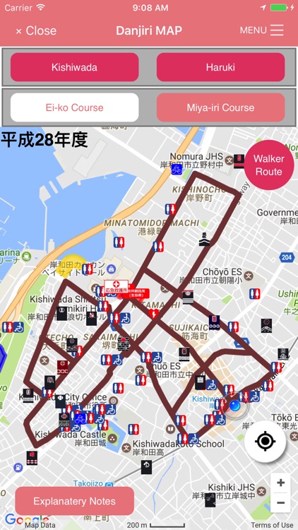
■Danjiri MAP
Heroic Danjiri festival which is held at two areas of Kishiwada and Haruki. Display the guidance of festival area of Danjiri pulling route, Danjiri hut and toilet place on the map.
■Special
Others, distribute contents of the tips and highlight related to Danjiri festival.
■Instructions
About the data which provided in this app, we ensure the display contents, but it’s not guaranteed completeness. Please judge yourself about accuracy, reliability, safety and utility of the data.
And we assume no responsibility whatever for any damages based on the use of this app. Other instructions mention the terms of use, please use this app after make sure of it.
Disclaimer:
AppAdvice does not own this application and only provides images and links contained in the iTunes Search API, to help our users find the best apps to download. If you are the developer of this app and would like your information removed, please send a request to takedown@appadvice.com and your information will be removed.
AppAdvice does not own this application and only provides images and links contained in the iTunes Search API, to help our users find the best apps to download. If you are the developer of this app and would like your information removed, please send a request to takedown@appadvice.com and your information will be removed.