You are using an outdated browser. Please
upgrade your browser to improve your experience.

With the KORE mobile app for iOS, you can access the SoilEssentials KORE platform, a precision agriculture application for companies, agronomists and farmers - anywhere, anytime

KORE Mobile
by SoilEssentials
What is it about?
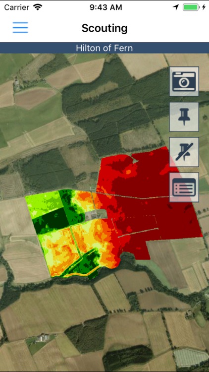
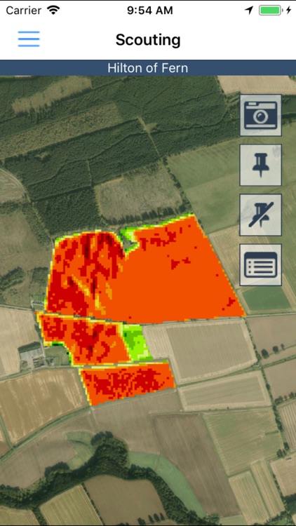
With the KORE mobile app for iOS, you can access the SoilEssentials KORE platform, a precision agriculture application for companies, agronomists and farmers - anywhere, anytime. The mobile app lets farmers, agronomists, advisors and field staff, view and explore high resolution drone imagery, different satellite images, soil texture maps and soil sampling results.
App Screenshots
App Store Description
With the KORE mobile app for iOS, you can access the SoilEssentials KORE platform, a precision agriculture application for companies, agronomists and farmers - anywhere, anytime. The mobile app lets farmers, agronomists, advisors and field staff, view and explore high resolution drone imagery, different satellite images, soil texture maps and soil sampling results.
Key features of SoilEssentials KORE for iOS
• View drone and satellite images on your iOS device
• Zoom into images to examine crop problems, weed patches and soil texture
• View and share crop problem zones with the cloud app
• Take geo-referenced images and notes on crop problems and share them with colleagues on the KORE web application
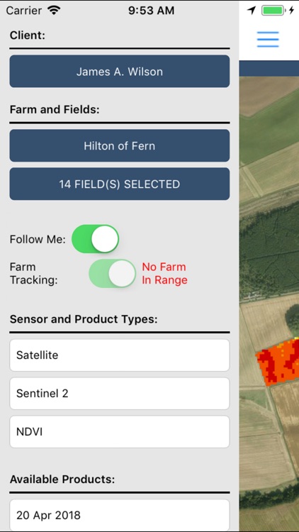
• View your field boundaries and automatically detect which field images and notes should be associated with
Features include:
• Mobile app for in-field use
• GPS tagged images to record crop and field problems
• View crop images on the web app
• Display of all your field data, satellite and drone images from the KORE system
• Same login as the KORE web app
Benefits:
• Easily share all your field information with your colleagues
• Record and share geo-referenced crop problems
• Automatic field detection
• Use your device GPS to locate crop problems
Disclaimer:
AppAdvice does not own this application and only provides images and links contained in the iTunes Search API, to help our users find the best apps to download. If you are the developer of this app and would like your information removed, please send a request to takedown@appadvice.com and your information will be removed.
AppAdvice does not own this application and only provides images and links contained in the iTunes Search API, to help our users find the best apps to download. If you are the developer of this app and would like your information removed, please send a request to takedown@appadvice.com and your information will be removed.