You are using an outdated browser. Please
upgrade your browser to improve your experience.

Collect land cover data around you to help researchers to validate the GlobeLand30 (GLC30) dataset

Land Cover Collector
by Politecnico di Milano
What is it about?
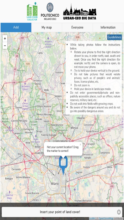
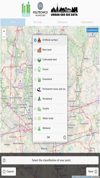
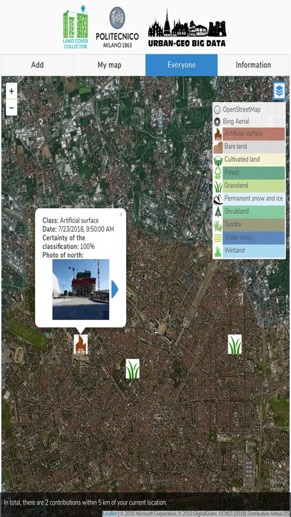
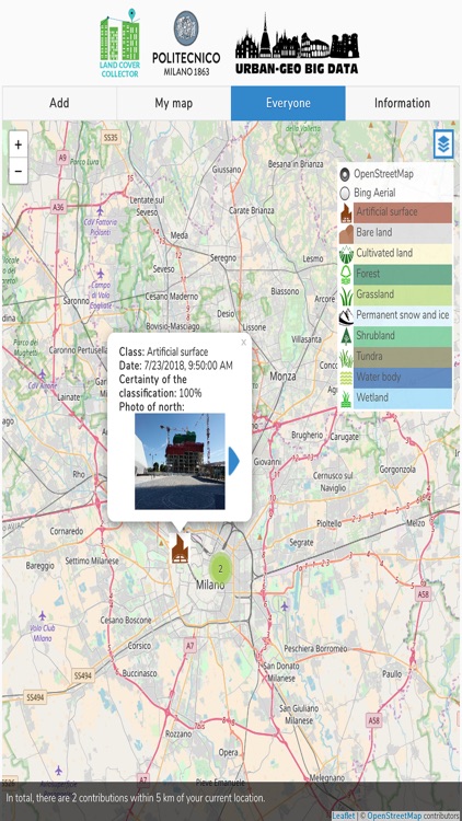
Collect land cover data around you to help researchers to validate the GlobeLand30 (GLC30) dataset! GLC30 is a global land cover raster map produced by the National Geomatics Center of China (NGCC) for years 2000 and 2010 with 30 meter resolution. When collecting a land cover observation, in addition to enabling their GPS, users are required to indicate the land cover class according to the GLC30 nomenclature and their degree of certainty; to take four photos in the north, east, south and west directions; and optionally to add a comment. Guidelines are given in the application. The collected data can be visualized as clusters, aggregated based on their land cover class. The details of each single point can be queried. The application is available in English, Italian, Arabic, Chinese, Spanish, Russian, Portuguese and French. Data can be collected online and offline.
App Screenshots
App Store Description
Collect land cover data around you to help researchers to validate the GlobeLand30 (GLC30) dataset! GLC30 is a global land cover raster map produced by the National Geomatics Center of China (NGCC) for years 2000 and 2010 with 30 meter resolution. When collecting a land cover observation, in addition to enabling their GPS, users are required to indicate the land cover class according to the GLC30 nomenclature and their degree of certainty; to take four photos in the north, east, south and west directions; and optionally to add a comment. Guidelines are given in the application. The collected data can be visualized as clusters, aggregated based on their land cover class. The details of each single point can be queried. The application is available in English, Italian, Arabic, Chinese, Spanish, Russian, Portuguese and French. Data can be collected online and offline.
Land Cover Collector application has been developed at GEOlab - Department of Civil and Environmental Engineering of Politecnico di Milano. It is an open source project, available on GitHub at https://github.com/kilsedar/land-cover-collector. The project is protected under GNU General Public License v3.0 license (https://github.com/kilsedar/land-cover-collector/blob/master/LICENSE). The application is partially based on and extends the project EmoMap, developed by the Research Group Cartography in the Department of Geodesy and Geoinformation in TU Wien University. This work is supported by URBAN GEOmatics for Bulk Information Generation, Data Assessment and Technology Awareness (URBAN GEO BIG DATA), a Project of National Interest (PRIN) funded by the Italian Ministry of Education, University and Research (MIUR) - id. 20159CNLW8.
Disclaimer:
AppAdvice does not own this application and only provides images and links contained in the iTunes Search API, to help our users find the best apps to download. If you are the developer of this app and would like your information removed, please send a request to takedown@appadvice.com and your information will be removed.
AppAdvice does not own this application and only provides images and links contained in the iTunes Search API, to help our users find the best apps to download. If you are the developer of this app and would like your information removed, please send a request to takedown@appadvice.com and your information will be removed.