You are using an outdated browser. Please
upgrade your browser to improve your experience.

The new App for getting around Rome and the Latium region

Lazio Mobility
by Studio Hangloose

What is it about?
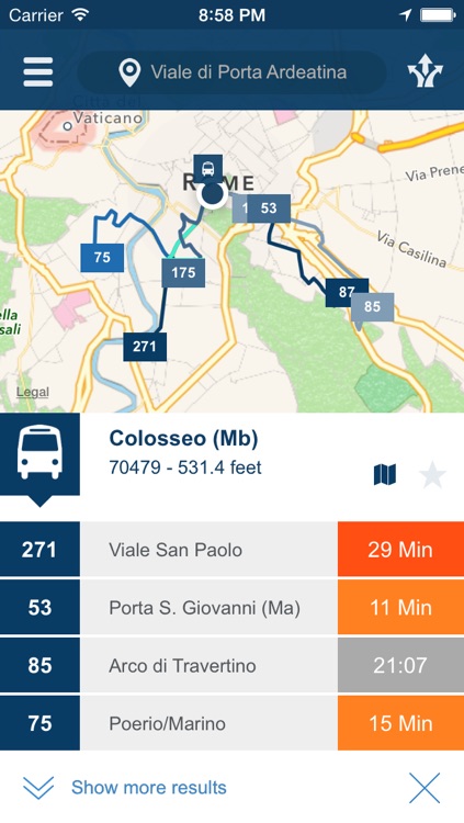
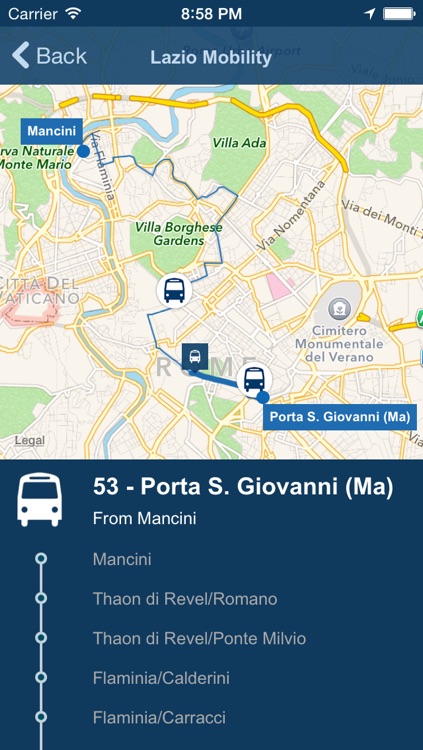
The new App for getting around Rome and the Latium region. All the information you need on private and public transport in one place: traffic situation and bus/metro/rail timetables, all updated in real time and presented in an intuitive graphic user interface.
App Screenshots
App Store Description
The new App for getting around Rome and the Latium region. All the information you need on private and public transport in one place: traffic situation and bus/metro/rail timetables, all updated in real time and presented in an intuitive graphic user interface.
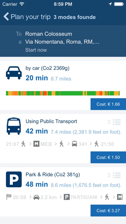
The first App of its kind to provide the user with integrated, multi-modal transport itineraries (Park & Ride), including travel times, costs, carbon footprint and distance travelled, with various alternatives.
Lazio Mobility combines several data sources to provide a unique service: public transport routes and car travel times with real-time information measured through the integration of multiple technology systems and satellite tracking systems for vehicle fleets (floating Car Data and AVM), fuel prices updated daily, warnings and tweets from Rome council, location and costs relating to council parking lots, limited traffic zone (ZTL) boundaries, street parking rates and much more.
Features
- Push notifications on public transport positioning based on the itinerary chosen by the user.
- Information and timetables for public transport for the city of Rome and the Latium Region.
- Real time traffic reports.
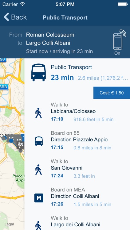
- Itinerary planner with the following modes of transportation: Private car, Public Transportation, Park and Ride (Private Car + Parking + Public Transport).
- Ability to view and compare multiple travel arrangements with an indication of the cost, duration and CO2 emissions produced.
- Search by street address or bus stop code.
- Ability to save favorite routes.
Disclaimer:
AppAdvice does not own this application and only provides images and links contained in the iTunes Search API, to help our users find the best apps to download. If you are the developer of this app and would like your information removed, please send a request to takedown@appadvice.com and your information will be removed.
AppAdvice does not own this application and only provides images and links contained in the iTunes Search API, to help our users find the best apps to download. If you are the developer of this app and would like your information removed, please send a request to takedown@appadvice.com and your information will be removed.