You are using an outdated browser. Please
upgrade your browser to improve your experience.

Mobile access to the Lebanon County and other public WebCad information

Lebanon PA Incidents and Radio
by Lancaster Decisions, LLC
What is it about?
Mobile access to the Lebanon County and other public WebCad information.
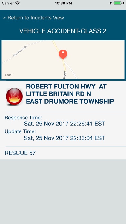
App Screenshots
App Store Description
Mobile access to the Lebanon County and other public WebCad information.
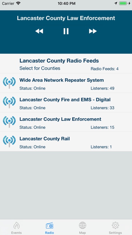
Multiple radio feeds let you listen to all emergency responders in Lebanon as well as nationwide dispatchers. Feeds include Police, Fire, and EMS through county dispatch.
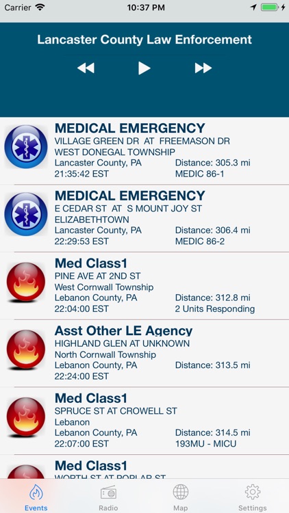
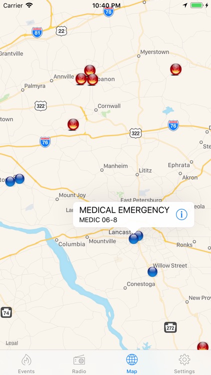
Lebanon County Emergency Radio geolocates live emergency incident responses for Lebanon County, Pennsylvania. Find the location and description of current fire, EMS, and traffic incidents. Live radio stream lets you listen to the events as they unfold. While listening, Lebanon Co Radio shows you where the incident is, describes what is happening, and provides the details of who is involved.
Lebanon Co Radio also provides invaluable information while travelling. By knowing the location of potential traffic problems, you can plan your route to avoid the possible delays.
Features include:
- Access to multiple live radio streams for Police, Fire, and EMS in Lebanon, PA and the surrounding counties.
- Map showing current location of all fire, traffic, and other emergency incidents
- Popup window showing type of incident and responding units
- List view of all current emergency incidents with a list of first responders, their location and the response time
- Information is automatically refreshed every two minutes so that you can follow the information as it changes and know when the emergency has cleared.
- Map Icons clearly indicate the type of incident.
- Detail window describing the nature of the incident, time that it occurred in the local time for the device, location, and easily viewed list of responding units.
- Zoom from detail screen to individual incident location on map.
Disclaimer:
AppAdvice does not own this application and only provides images and links contained in the iTunes Search API, to help our users find the best apps to download. If you are the developer of this app and would like your information removed, please send a request to takedown@appadvice.com and your information will be removed.
AppAdvice does not own this application and only provides images and links contained in the iTunes Search API, to help our users find the best apps to download. If you are the developer of this app and would like your information removed, please send a request to takedown@appadvice.com and your information will be removed.