You are using an outdated browser. Please
upgrade your browser to improve your experience.

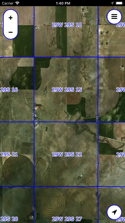
The PLSS (Public Land Survey System) is a system in which land is divided into rectangular townships and sections

Legal Land Map
by David Holdeman


What is it about?
The PLSS (Public Land Survey System) is a system in which land is divided into rectangular townships and sections.
App Store Description
The PLSS (Public Land Survey System) is a system in which land is divided into rectangular townships and sections.
This app displays legal section names (e.g. "21W 13S 6") and borders, overlaid on a satellite map.
You can search for sections by their legal name.
NOTE: Not all locations are supported. Please check the list below for your state or provnce.
Supported states and provinces:
USA:
AL
AZ
AR
CA
CO
FL
ID
IL
IN
IA
KS
LA
MI
MN
MS
MO
MT
NE
NV
NM
ND
OH - Partial support
OK
OR
SD
UT
WA
WI
WY
Canada:
AB
BC (No Searching)
MB
ON (No Searching)
SK
Disclaimer:
AppAdvice does not own this application and only provides images and links contained in the iTunes Search API, to help our users find the best apps to download. If you are the developer of this app and would like your information removed, please send a request to takedown@appadvice.com and your information will be removed.
AppAdvice does not own this application and only provides images and links contained in the iTunes Search API, to help our users find the best apps to download. If you are the developer of this app and would like your information removed, please send a request to takedown@appadvice.com and your information will be removed.