You are using an outdated browser. Please
upgrade your browser to improve your experience.

Think GPS Device Data, Combined with Maps

LocationPRO
by Jonathan Field
What is it about?
Think GPS Device Data, Combined with Maps.
App Screenshots

App Store Description
Think GPS Device Data, Combined with Maps.
LocationPRO is a Multifunctional Advanced Location Data and Navigation Application for iOS. Works with both iPhone and iPad.
What can I use it for?
- Cyclist wanting to see how fast they can go
- Driving a known route but want to be able to see the road without an annoying sat nav
- Saving locations as pins to make a personal map
- Finding latitude and longitude coordinates for the emergency services
- Lost and need to know which town or city you are in
- Need to draw a route on a map for a friend
The list of possible uses is endless, LocationPRO is there when you need it, try it today!
LocationPRO is simple to use and has a wide array of features that everyone can find useful.
See a video demo at http://locationpro.jonathanfield.me/locationpro.html
For Guides, How-To's and Support http://locationpro.jonathanfield.me
Feel free to request new features or help at
http://locationpro.jonathanfield.me/support.html
Data Displays:
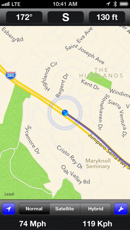
Course display
Direction display
Altitude Display
Speed Display
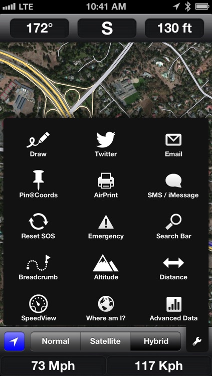
Export photo to Twitter with your current location
- Take a photo and post it to twitter along with a prepared tweet containing your current geocoded location
Export map to twitter with current location
-Tweet a prepared tweet of your current location and a picture of your current map
Export map via email - attached link to Google Map location and advanced Location Data
Export advanced location via SMS/ iMessage - Send people details of your location e.g. latitude, longitude, altitude, speed, course, date and time.
Set a pre-prepared emergency message and set contacts for it to be sent to along with advanced location data in the event that you are lost and need help.
Distance travelled display
- Enable distance display to see how far away you are from your starting position
- Please note this setting assumes you are moving away from your starting location
Rotate map with compass heading
- See the map at the same angle that you see whats ahead of you
Dedicated speedview
-Fullscreen speed display in MPH and KPH
On the fly map style change
-Standard
-Satellite
-Hybrid
Geolocation data, find out exactly where you are in the world
-Street
-Town
-Area
-State/County
-Administrative Area
-Postal/Zip Code
-ISO Country Code
-Country
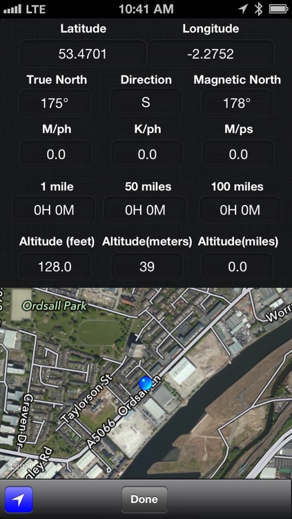
Advanced location data, when you need more precise location information
-Latitude
-Longitude
-True North
-Direction North, East, South, West
-Magnetic North
-Current Speed in MPH, KPH and MPS
-Calculated time to travel 1,50 and 100 miles
-Altitude in feet, meters and miles
-Small map of your current location
Pin drop data
-Display the address information for any location on the map with a simple pin drop
-Display advanced location information for any location (as much as is available)
-Display the distance of the pin from your current position
-Save and name pins
-Street
-Town
-City/County
-Administrative Area/State
-Postal/Zip Code
-Latitude
-Longitude
-Distance from current location
iCloud or device stored custom map
-Name and save pin locations for future reference, for instance where you are parked or location of an item in a store
-Enable iCloud data and document storage to save pins between iOS devices
-If iCloud is not enable your pins will be saved to your iPhone or iPad
-Reset your pins from the menu
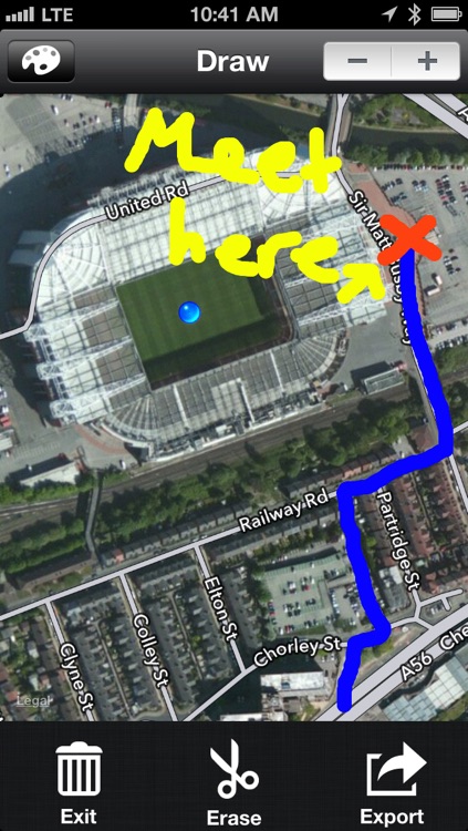
Drawing view
-Draw on the map with your finger
-Draw directions on the map and then export to Twitter, Email, Photo Album or Print via AirPrint
Breadcrumb trail
- Enable breadcrumb to draw a line as you travel.
- Export the map with your trail and show your friends exactly how to get to you
Export to saved photo album
Print map via AirPrint
Please note
- iPad 3G required to take advantage of dynamic location updates such as speed.
- 3G data connection required for maxmium performance but still accurate with 2G
- LocationPRO does use cellular data for advanced location data.
Disclaimer:
AppAdvice does not own this application and only provides images and links contained in the iTunes Search API, to help our users find the best apps to download. If you are the developer of this app and would like your information removed, please send a request to takedown@appadvice.com and your information will be removed.
AppAdvice does not own this application and only provides images and links contained in the iTunes Search API, to help our users find the best apps to download. If you are the developer of this app and would like your information removed, please send a request to takedown@appadvice.com and your information will be removed.