You are using an outdated browser. Please
upgrade your browser to improve your experience.

Find the best route to your destination even without an internet connection

Magic Earth Navigation & Maps
by General Magic GmbH


Magic Earth Navigation & Maps Offers Apple Watch App
Check the details on WatchAware
Check the details on WatchAware
What is it about?
Find the best route to your destination even without an internet connection. Magic Earth uses OpenStreetMap data and a powerful search engine to offer you the optimal routes for driving, biking, hiking, and public transportation.

Magic Earth Navigation & Maps supports Siri commands
Dash
Cam
Day
Color
End
Navigation
Map
Mode
Navigate
To
Night
Color
Open
Roadblock
Search
Social
Report
Traffic
Dash
Cam
Day
Color
End
Navigation
Map
Mode
Navigate
To
Night
Color
Open
Roadblock
Search
Social
Report
Traffic
Dash Cam
Day Color
End Navigation
Map Mode
Navigate To
Night Color
Open
Roadblock
Search
Social Report
Traffic
Dash Cam
Day Color
End Navigation
Map Mode
Navigate To
Night Color
Open
Roadblock
Search
Social Report
Traffic
Magic Earth Navigation & Maps is FREE but there are more add-ons
-
$9.99
HD Traffic - United States and Canada - 1 year
-
$8.99
HD Traffic - Saudi Arabia - 1 year
-
$10.99
HD Traffic - Mexico - 1 year
-
$9.99
HD Traffic - Chile - 1 year
-
$9.99
HD Traffic - Brazil - 1 year
-
$6.99
HD Traffic - Russia - 1 year
-
$8.99
HD Traffic - United Arab Emirates - 1 year
-
$9.99
HD Traffic - Taiwan - 1 year
-
$9.99
HD Traffic - New Zealand - 1 year
-
$9.99
HD Traffic - Australia - 1 year
App Screenshots
App Store Description
Find the best route to your destination even without an internet connection. Magic Earth uses OpenStreetMap data and a powerful search engine to offer you the optimal routes for driving, biking, hiking, and public transportation.
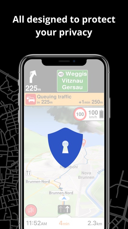
PRIVACY FIRST!
• We do not track you. We do not profile you. We do not trade in your personal data; moreover, we do not have it.
MAPS
• Save big on mobile internet costs and navigate reliably with offline maps powered by OpenStreetMap. 233 countries and regions are ready to be downloaded.
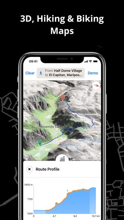
• Choose between 2D, 3D, and Satellite map views.
• Get ready for travel and know every detail of your route like surface, difficulty, distance and elevation profile.
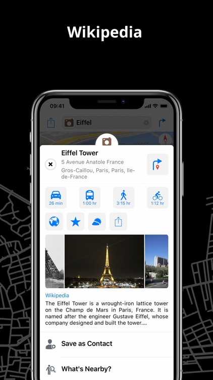
• Learn more about the points of interest near you from Wikipedia articles.
• Spot nearby parking places to easily park your car.
• Stay up-to-date and enjoy regular free map updates.
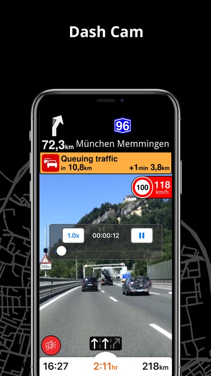
AI DASHCAM
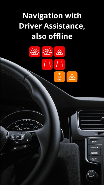
• Improve safe driving and avoid accidents. Receive alerts to potential problems on the road and record your trip.
• AI DashCam features Driver Assistance warnings and Dash Cam functionality.
• Avoid collisions and accidents with Driver Assistance warnings: Headway Warning, Forward Collision Warning, Pedestrian Collision Warning, Lane Departure Warning, Leaving Lane Warning, Stop & Go Assist.
• Record the road ahead during navigation to have an aid in the event of a collision or incident.
• Driver Assistance warnings and Recordings are available when the device is on a car mount in landscape mode, with a clear view of the road ahead.
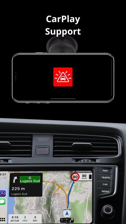
CARPLAY compatibility
• Connect to Apple CarPlay and enjoy the ultimate navigation experience.
NAVIGATION
• Find the fastest or the shortest route to your destination when you travel by car, bike, on foot or with public transport.
• Plan your route with multiple waypoints.
• Stay safe with the free Head-up Display (HUD) feature which projects the most important navigation info onto the windshield of your car.
• Know in advance which lane to take with precise turn-by-turn navigation and lane assistance.
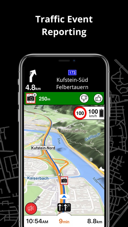
• Get notified about speed cameras and stay up to date with current speed limits.
TRAFFIC INFO
• Get real-time traffic info, updated every minute.
• Discover alternative routes that avoid traffic jams and save you time on the road.
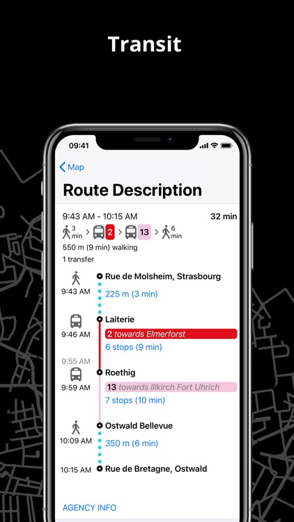
PUBLIC TRANSPORT
• Get around town quickly and easily. Choose from public transit routes that combine all transportation modes: bus / metro / subway / light rail / train / ferry
• Get walking directions, transfer times, departure times, number of stops. And when available, the cost.
• Find wheelchair or bike-friendly public transportation.
WEATHER
• View current temperature and local weather forecasts for your favorite locations.
• See what weather conditions to expect in the next hours and view the forecast for the next 14 days.
NOTES:
* Some features are not available in all countries.
* Some features require internet connection.
Disclaimer:
AppAdvice does not own this application and only provides images and links contained in the iTunes Search API, to help our users find the best apps to download. If you are the developer of this app and would like your information removed, please send a request to takedown@appadvice.com and your information will be removed.
AppAdvice does not own this application and only provides images and links contained in the iTunes Search API, to help our users find the best apps to download. If you are the developer of this app and would like your information removed, please send a request to takedown@appadvice.com and your information will be removed.