You are using an outdated browser. Please
upgrade your browser to improve your experience.

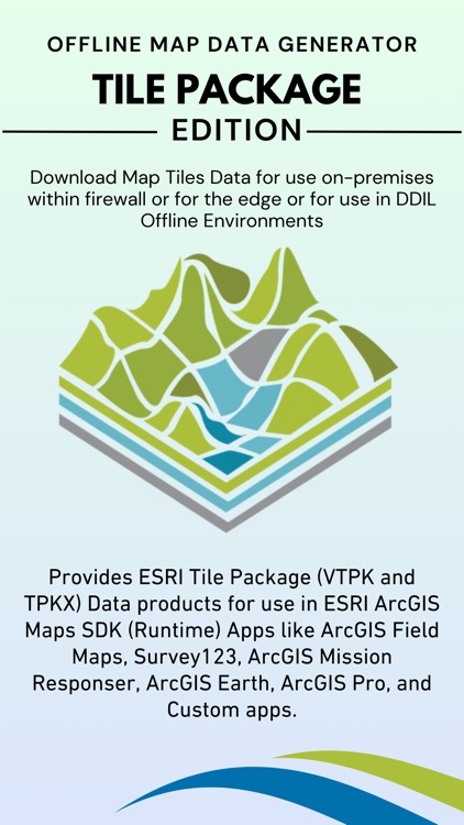
Provides ESRI Tile Package (VTPK and TPKX) Data products for use in ESRI ArcGIS Maps SDK (Runtime) Apps like ArcGIS Field Maps, Survey123, ArcGIS Mission Responser, ArcGIS Earth, ArcGIS Pro, and Custom apps

Map Data Generator TilePackage
by Tech Maven GeoSpatial LLC
What is it about?
Provides ESRI Tile Package (VTPK and TPKX) Data products for use in ESRI ArcGIS Maps SDK (Runtime) Apps like ArcGIS Field Maps, Survey123, ArcGIS Mission Responser, ArcGIS Earth, ArcGIS Pro, and Custom apps.
App Screenshots

App Store Description
Provides ESRI Tile Package (VTPK and TPKX) Data products for use in ESRI ArcGIS Maps SDK (Runtime) Apps like ArcGIS Field Maps, Survey123, ArcGIS Mission Responser, ArcGIS Earth, ArcGIS Pro, and Custom apps.
Core main features part of app subscription:
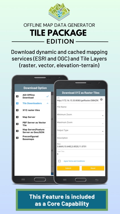
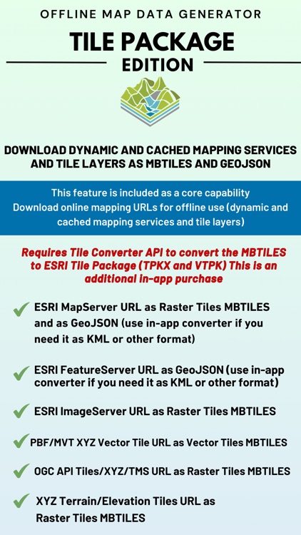
Download online mapping URL’s for offline use (dynamic and cached mapping services and tile layers)
ESRI MapServer URL as Raster Tiles MBTILES and as GeoJSON (use in-app converter if you need it as KML or other format)
ESRI FeatureServer URL as GeoJSON (use in-app converter if you need it as KML or other format)
ESRI ImageServer URL as Raster Tiles MBTILES
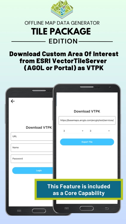
ESRI VectorTileServer URL as Vector Tiles MBTILES
PBF/MVT XYZ Vector Tile URL as Vector Tiles MBTILES
OGC API Tiles/XYZ/TMS URL as Raster Tiles MBTILES
XYZ Terrain/Elevation Tiles URL as Raster Tiles MBTILES
Future Versions will include downloading from other providers (OGC WFS/OGC API Features, OGC WMS/OGC API Maps, OGC WMTS)
Support for some pre-configured Tile Layers
Users are responsible for the terms of use/service and access to the data they are downloading from the URL’s they are adding.
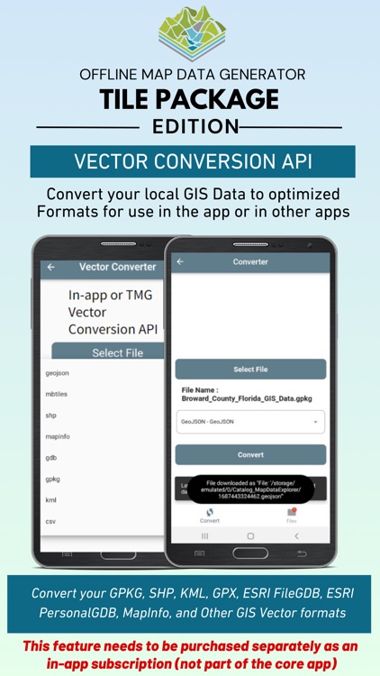
In-app Vector Data Converter
Converts GIS Vector Data to optimized formats (Build MBTILES Vector Tiles, Build GPKG Vector Features or build GeoJSON or Build KML) - Convert an ESRI FileGDB, ESRI PersonalGDB, ESRI Shapefile, MapInfo, GPX, CSV and others.
Live Event Driven Data Feeds Downloader
ESRI FeatureServer
Network Link KML Downloader Module
GeoRSS Feeds
downloads the data at a set frequency and converts to GeoJSON (can be converted in-app to KML for use in other apps like ATAK or iTAK).
Share Downloaded Data
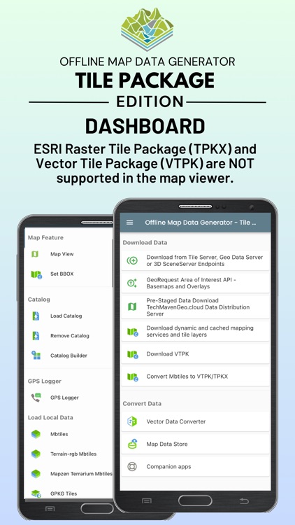
Visualize downloaded Data and user loaded data in the integrated Map Viewer
Supports the offline formats - GeoJSON,Raster tiles from MBTILES and GPKG and vector tiles from MBTILES.
(MAP Viewer DOES NOT View ESRI Tile Package formats TPKX and VTPK Plesae use an ESRI app like ArcGIS Earth to view them)
Premium API Access as additional in-app purchases
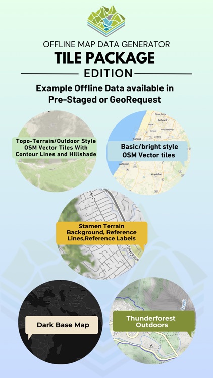
Pre-Staged (Ready to Go) Basemaps and Overlays in TPKX and VTPK
Tech Maven Geospatial has a prepared foundational basemaps and overlays that include: basemaps osm vector tiles, hillshade raster tiles, contour line vector tiles, low res satellite raster tiles, reference lines and reference labels raster tiles, for some regions and areas high res satellite raster tiles, MapZen Terrarium RGB encoded Elevation Terrain tiles PNG.
This Ready-to-go Data immediately available by Regions, Countries, US States, Canadian Provinces. We have a high performance data distribution server and the data is delivered in VTPK and TPKX ESRI Tile Package Format.
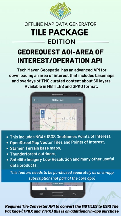
GeoRequest AOI-Area of Interest/Operation API
Tech Maven Geospatial has an advanced API for downloading an area of interest that includes basemaps and overlays of TMG curated content about 60 layers. Available in MBTILES and GPKG format. This includes NGA/USGS GeoNames Points of Interest, OpenStreetMap Vector Tiles and Points of Interest, Stamen Terrain basemaps, Thunderforest outdoors, Satellite Imagery Low Resolution and many other useful data products.(to use these products it requires purchase of tile converter API to have them converted to VTPK and TPKX ESRI Tile Packages)
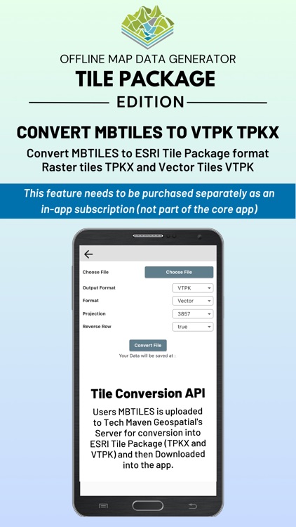
Tile Converter API
Convert MBTILES to ESRI Tile Package forma t Raster tiles TPKX and Vector Tiles VTPK
Elevate API - get MGRS, GARS, What3Words, PlusCode, PlaceKey and Elevation for a Point GeoJSON or SQLite or GPKG Points
$24.99/year for unlimited use
Vector Conversion API - convert GIS Vector Formats - (Convert Data to GPKG Vector Features, MBTILES Vector Tiles)
$24.99/year for unlimited use
EULA: https://offlinedatadownloader.techmaven.net/eula-tilepackage/
Disclaimer:
AppAdvice does not own this application and only provides images and links contained in the iTunes Search API, to help our users find the best apps to download. If you are the developer of this app and would like your information removed, please send a request to takedown@appadvice.com and your information will be removed.
AppAdvice does not own this application and only provides images and links contained in the iTunes Search API, to help our users find the best apps to download. If you are the developer of this app and would like your information removed, please send a request to takedown@appadvice.com and your information will be removed.