You are using an outdated browser. Please
upgrade your browser to improve your experience.
Our unique zoomable 'South-East-Asia' map atlas is now available in the languages of English [the Default], Spanish, French, German, Italian, and Netherlands [Dutch]
![Our unique zoomable 'South-East-Asia' map atlas is now available in the languages of English [the Default], Spanish, French, German, Italian, and Netherlands [Dutch]](https://is1-ssl.mzstatic.com/image/thumb/Purple127/v4/3f/2b/ad/3f2bad57-da1a-7a56-2518-63dc0067d0ed/source/60x60bb.jpg)
mapQWIK sea - South-East-Asia Zoomable Atlas
by Henry Vaughan
What is it about?
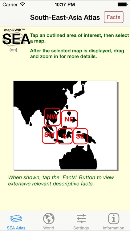
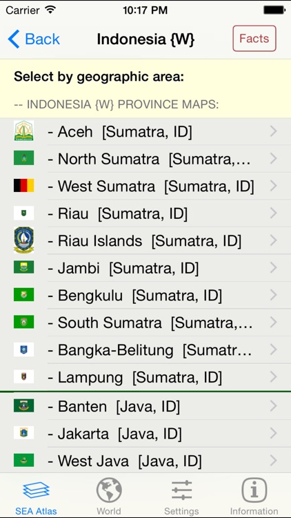
Our unique zoomable 'South-East-Asia' map atlas is now available in the languages of English [the Default], Spanish, French, German, Italian, and Netherlands [Dutch]. It generates custom real-time regional maps plus separate maps for each country, for the very large metropolitan areas, and for each of the provinces of Indonesia. The overall geographical area covered in this app ranges from Thailand in the north-west to Indonesia and the Philippines in the east.
App Screenshots
App Store Description
Our unique zoomable 'South-East-Asia' map atlas is now available in the languages of English [the Default], Spanish, French, German, Italian, and Netherlands [Dutch]. It generates custom real-time regional maps plus separate maps for each country, for the very large metropolitan areas, and for each of the provinces of Indonesia. The overall geographical area covered in this app ranges from Thailand in the north-west to Indonesia and the Philippines in the east.
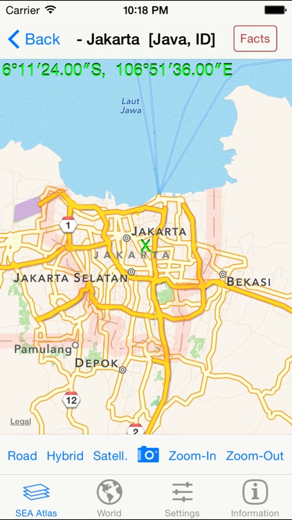
If you give permission in the Privacy Settings of your device, this version will also show your current location on the maps as a pulsating blue circular marker. If you adjust the map being displayed, your current location will be automatically updated using your device's GPS location.
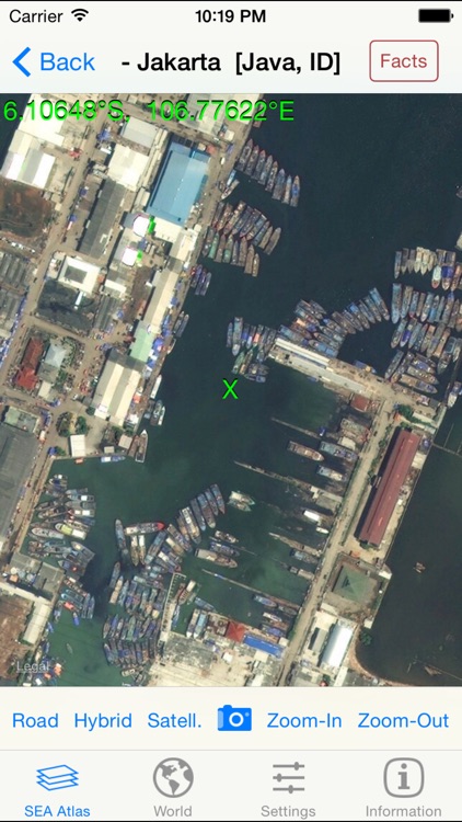
Easily switch between 'Road', 'Hybrid', or 'Satellite' maps, and zoom in (and out) to any detail level desired -- down to the house level! Change to a different area of focus with the drag of a finger and your display is instantly updated.
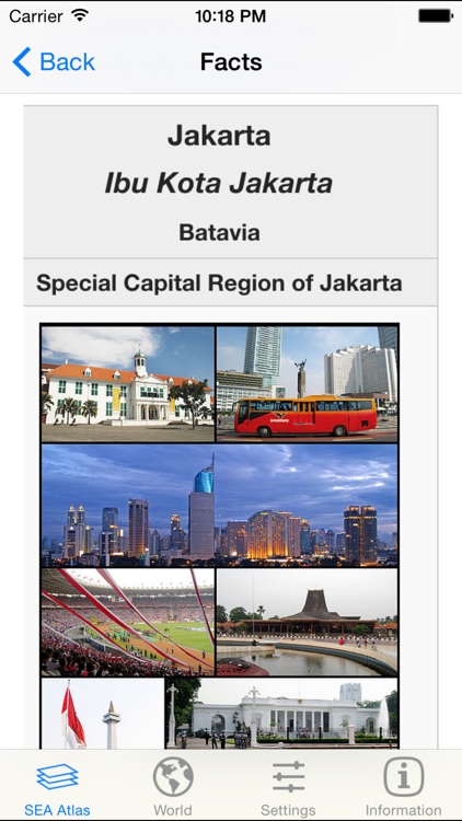
Tapping a 'Facts' Button, when shown, displays extensive relevant interactive descriptive information from Wikipedia. By following indicated links, more facts and photos are available in a specific areas of interest.
Using a new 'Settings' tab, you can select the GPS Coordinates format to be displayed on all maps, or omit it. Three different popular display formats are supported: Traditional [dddmmss.xx] , Modern [ddd.xxxxx], and Geocaching [dddmm.xxx]. As you drag or zoom on a map display, the GPS coordinates of the center of the display are automatically updated.
Tap the camera icon to quickly capture the created map image to your device's Photo Gallery. [Later you can print or share this image with others via Facebook, Twitter, Flickr, or email using the Apple-provided 'Photo' app.]
Using the 'World' tab, tap an appropriate button to launch any of the other component apps in our World Atlas series that are installed on the device.
Disclaimer:
AppAdvice does not own this application and only provides images and links contained in the iTunes Search API, to help our users find the best apps to download. If you are the developer of this app and would like your information removed, please send a request to takedown@appadvice.com and your information will be removed.
AppAdvice does not own this application and only provides images and links contained in the iTunes Search API, to help our users find the best apps to download. If you are the developer of this app and would like your information removed, please send a request to takedown@appadvice.com and your information will be removed.