You are using an outdated browser. Please
upgrade your browser to improve your experience.

Minneapolis Skyway Maps makes navigating the Skyway faster and easier

Minneapolis Skyway Maps
by Honeywell International Sarl
What is it about?
Minneapolis Skyway Maps makes navigating the Skyway faster and easier.
App Store Description
Minneapolis Skyway Maps makes navigating the Skyway faster and easier.
In this first release, coverage is provided for a core route covering sporting venues, hotels, parking ramps etc.
Coverage will continue to increase as more businesses opt in.
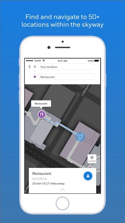
When you are inside the coverage area, you will see your location as a blue dot – think of it as an indoor GPS system
Search for major points of interest and get turn by turn directions to your destination
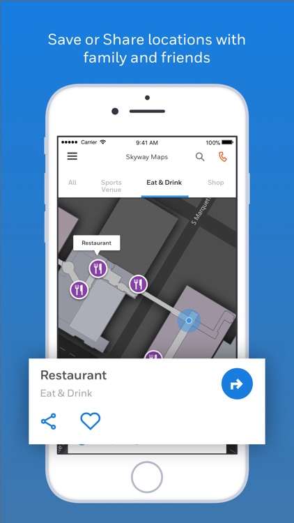
Save a location and send it to someone you know via text or email for them to navigate to you (they will need the app as well)
After the application and map has been downloaded, navigation on site in the Skyway doesn’t require a data / Wi-Fi connection
The app needs to be in the foreground to work. Bluetooth and Location services to be turned on
Continued use can reduce battery life
Please send feedback to DL-HBTSkyway@Honeywell.com
Disclaimer:
AppAdvice does not own this application and only provides images and links contained in the iTunes Search API, to help our users find the best apps to download. If you are the developer of this app and would like your information removed, please send a request to takedown@appadvice.com and your information will be removed.
AppAdvice does not own this application and only provides images and links contained in the iTunes Search API, to help our users find the best apps to download. If you are the developer of this app and would like your information removed, please send a request to takedown@appadvice.com and your information will be removed.