You are using an outdated browser. Please
upgrade your browser to improve your experience.

Be prepared

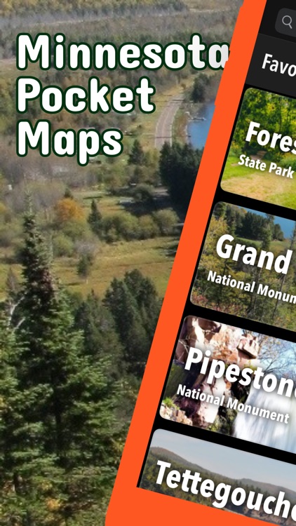
Minnesota Pocket Maps
by Alex Gugel
What is it about?
Be prepared! Plan your next trip to one of the great Minnesota parks. Download maps and guides before you venture into the Wi-Fi free wilderness.
App Screenshots
App Store Description
Be prepared! Plan your next trip to one of the great Minnesota parks. Download maps and guides before you venture into the Wi-Fi free wilderness.
Discover
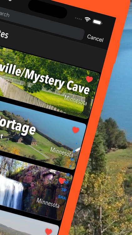
- 35+ national parks, state parks, monuments, forests
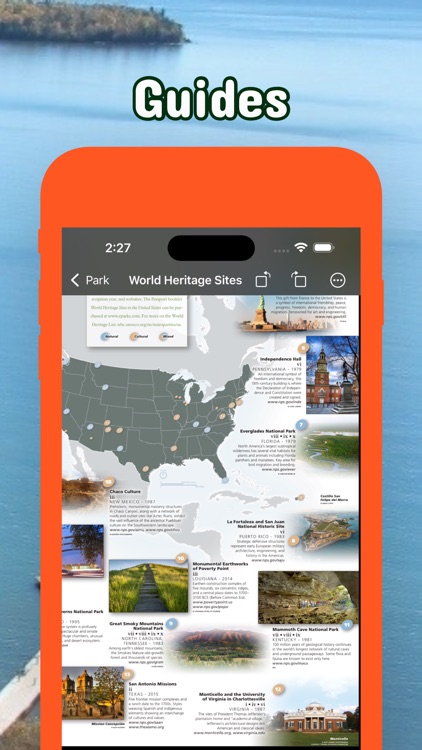
- 350+ neatly folded maps by the National Park Service, Bureau of Land Management, United States Forest Services, and other agencies.
- 500+ campgrounds and campsites
- 300+ trails and trailheads
- 50,000+ points of interests
Plan
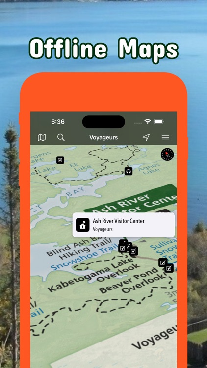
- Download maps, park brochures, and newspapers. These downloads are ready when you are offline and off the grid in the great outdoors.
- Download arbitrary map sections as offline packs.
- Photo galleries, panorama views.
- Share links to parks and maps with friends
Have fun
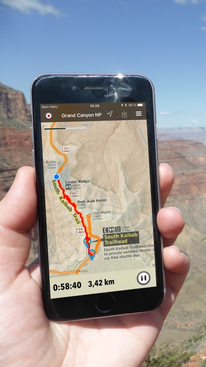
- GPS and GPX support: record your hikes, import GPX routes, tracks and waypoints for your hiking trails.
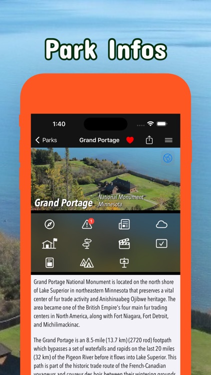
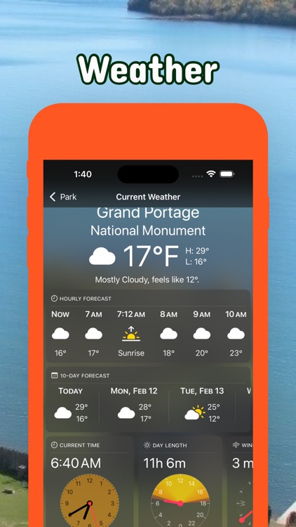
- Detailed national park information: alerts, news, visitor centers, campgrounds, driving directions, weather.
- Open your favorite maps app to get a route to the selected park.
- Current weather conditions, easy access to multi-day forecasts, sunrise and sunset times.
- Push notifications for park alerts, park news, weather warnings
So download maps and guides for:
- Grand Portage National Monument
- Mississippi National River & Recreation Area
- North Country National Scenic Trail
- Pipestone National Monument
- Saint Croix National Scenic Riverway
- Voyageurs National Park
- Afton
- Banning, Bear Head Lake, Big Bog, Blue Mounds
- Cuyuna Country
- Forestville/Mystery Cave
- George H. Crosby Manitou, Grand Portage, Great River Bluffs
- Itasca
- Jay Cooke
- Lake Vermilion-Soudan Underground Mine
- Mapplewood, Mille Lacs Kathio, Minneopa
- Savanna Portage, Split Rock Lighthouse, St. Croix
- Tettegouche
- Whitewater, Wild River
- Zippel Bay
- FULL ACCESS is available for a for $3.49/three month (after a free 3-days trial period) or $2.49/two months or $7.49/year. You can subscribe and pay through your iTunes account. The account will be charged for renewal within 24-hours prior to the end of the current period, and identify the cost of the renewal. Your subscription will automatically renew unless canceled at least 24 hours before the end of the current period. Auto-renew can be turned off anytime by going to your Account Settings in iTunes after purchase.
- Continued use of GPS running in the background can dramatically decrease battery life.
LEGAL
Terms of Use: https://www.icoat.de/pocketmaps/terms
Privacy Policy: https://www.icoat.de/pocketmaps/privacy
Disclaimer:
AppAdvice does not own this application and only provides images and links contained in the iTunes Search API, to help our users find the best apps to download. If you are the developer of this app and would like your information removed, please send a request to takedown@appadvice.com and your information will be removed.
AppAdvice does not own this application and only provides images and links contained in the iTunes Search API, to help our users find the best apps to download. If you are the developer of this app and would like your information removed, please send a request to takedown@appadvice.com and your information will be removed.