You are using an outdated browser. Please
upgrade your browser to improve your experience.

The most comprehensive app for safe and prepared boating navigation

Waterkaarten: Boat Navigation
by Biggerworks.com
What is it about?
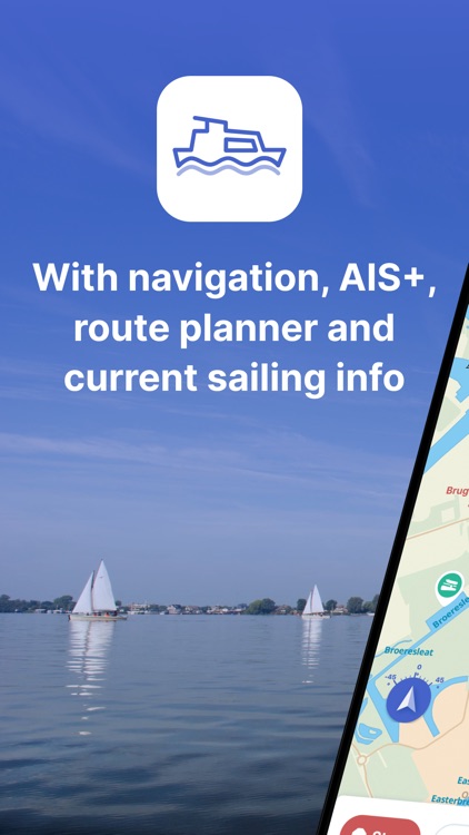
The most comprehensive app for safe and prepared boating navigation. With route planner, water maps, AIS pairing, marinas, bridges and locks, offline use and more. Try now and plan your next trip!
Waterkaarten is FREE but there are more add-ons
-
$9.99
maandabonnement ANWB Waterkaarten
-
$4.99
weekabonnement ANWB Waterkaarten
-
$38.99
jaarabonnement ANWB Waterkaarten
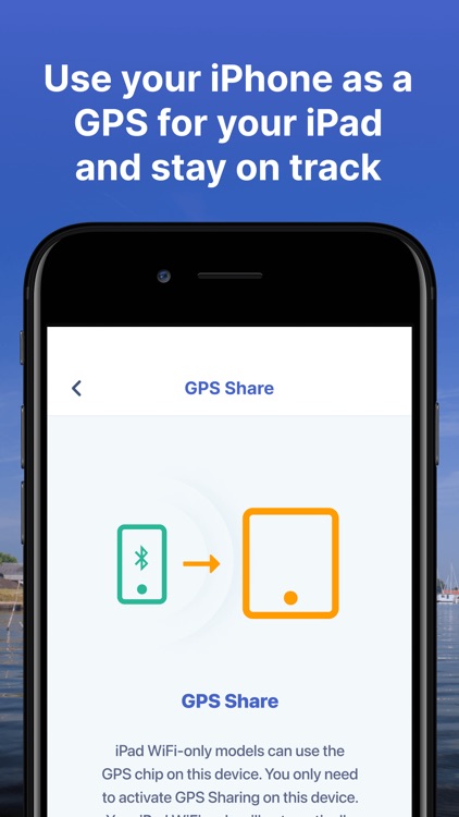
App Screenshots
App Store Description
The most comprehensive app for safe and prepared boating navigation. With route planner, water maps, AIS pairing, marinas, bridges and locks, offline use and more. Try now and plan your next trip!
With the Waterkaarten app (formerly ANWB Waterkaarten) you have everything you need at hand:
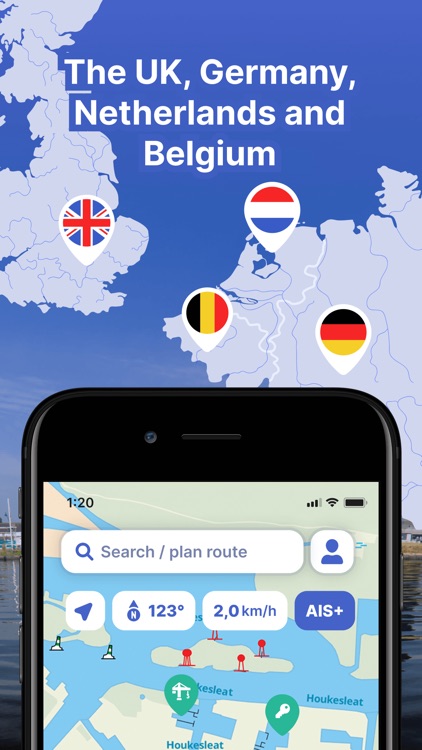
• 5 countries, 1 price: Complete nautical maps of the United Kingdom, Netherlands, Germany, France and Belgium
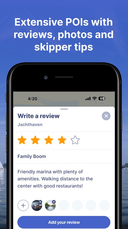
• All almanack info: Access all information you need on the water with just a few taps in the app
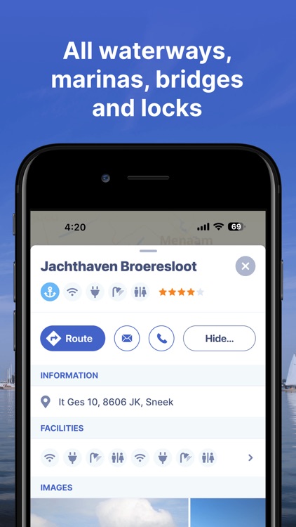
• All current information about marinas, bridges and locks including opening times
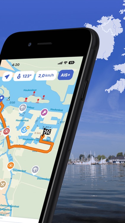
• Plan the optimal route between your starting point and destination, including the objects you encounter
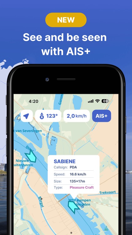
• New! AIS pairing: Connect your AIS device to the app and see at a glance where surrounding ships are located
• Show or hide information on the nautical maps to see exactly what you need
• Stay up-to-date with the current navigation reports and obstructions from the Rijkswaterstaat
• More than 200,000 nautical objects (bridges, locks, markings, mooring places and more)
• Locations of more than 4,000 marinas and all details of existing facilities
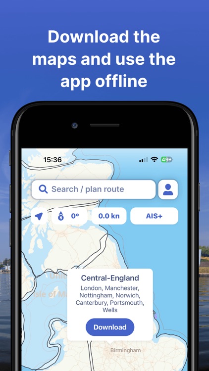
• Radio silence on the water? No problem! Download the corresponding charts for offline use
• Regular updates and free access to all new features
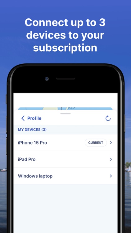
• Each user account can be used on up to 3 devices at no extra cost
• Free Windows version included
• Reliable service: We are at your service 7 days a week (support@waterkaarten.app)
How it works:
Waterkaarten is free for the first 7 days. After that, the app only works with a valid subscription. You can choose from the following options:
• Month (€ 13,99)
• Season (3 months for € 34,99)
• Year (€ 49,99)
The subscription ends automatically.
Please note: If you purchase a subscription during the free 7-day trial period, we will add your new credit to your remaining balance. Your purchased subscription is not automatically renewed.
Payment methods for subscription:
• The subscription will be charged to your iTunes account
• At Apple you can use different payment methods for a credit, such as PayPal or credit card
Even more boating pleasure with a Waterkaarten account
You can create an account in the app to activate your subscription on a total of 3 devices.
Note:
• The file size of the offline map material is very large and you are advised to download it on a stable Wi-Fi connection
• Prolonged use of GPS in the background can considerably shorten the battery life of your device
Do you have questions about the app? Please contact our helpdesk (support@waterkaarten.app) or read more on our website: www.waterkaarten.app/en.
Please note that this app is only intended as an aid when navigating on the water. Stay alert to your surroundings while boating.
Disclaimer:
AppAdvice does not own this application and only provides images and links contained in the iTunes Search API, to help our users find the best apps to download. If you are the developer of this app and would like your information removed, please send a request to takedown@appadvice.com and your information will be removed.
AppAdvice does not own this application and only provides images and links contained in the iTunes Search API, to help our users find the best apps to download. If you are the developer of this app and would like your information removed, please send a request to takedown@appadvice.com and your information will be removed.