You are using an outdated browser. Please
upgrade your browser to improve your experience.
NAV Photo 2 is a multi-functional App that combines camera, compass, GPS positioning, text editor and the timer

Nav Photo 2
by Altus Geomatics Limited Partnership
What is it about?
NAV Photo 2 is a multi-functional App that combines camera, compass, GPS positioning, text editor and the timer. NAV Photo 2 is created by the same company who created LSD NAV PRO 2 which won the Association of Canada Lands Surveyors 2012 David Thompson Award for Innovation in Geomatics.
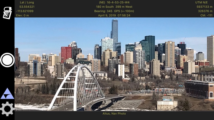
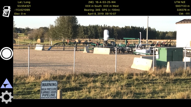
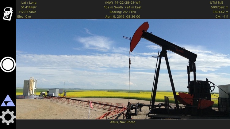
App Screenshots
App Store Description
NAV Photo 2 is a multi-functional App that combines camera, compass, GPS positioning, text editor and the timer. NAV Photo 2 is created by the same company who created LSD NAV PRO 2 which won the Association of Canada Lands Surveyors 2012 David Thompson Award for Innovation in Geomatics.
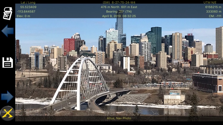
It stamps real time position, altitude, direction of camera, and Legal Township information on to the iPad/iPhone's camera image. The geo-tagged image can then be viewed on the Apple Photos app or emailed using the system tools. With 2 comment fields it lets you append detailed descriptions you need to remember later.
By saving the data stamped information into the metadata of the image, you can now access this data programmatically or use photo tools to search for locations or comments that you have entered. Fields being saved are both comment fields, latitude, longitude, azimuth, LSD, Offset, and if using a custom grid then the control parameters are saved.
It is a great tool for oil and gas industry applications where everything is based on the Legal Township system. It is a tool for surveyors, land agents, field consultants, geologists, engineers, hunters and farmers.
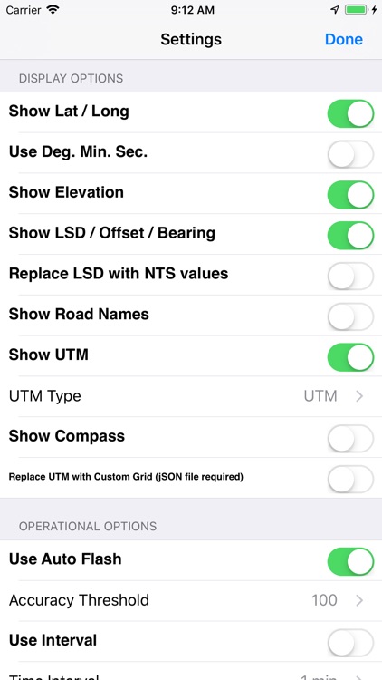
It has many user selectable options for the position display. The most distinguishing and useful feature is that it displays the Legal Township information. It shows LSD-Sec-Twp-Rge-M (Legal Subdivision, Section, Township, Range, and Meridian) and offset distances from its Quarter Section boundaries.
If you have to deal with the township system then you will appreciate NAV Photo 2.
If you are confused by UTM and geographic outputs then you will love this App.
The cellular option for the iPad is required for getting the location information. This app can not be purchased and will not install on devices without a gps.
Disclaimer:
AppAdvice does not own this application and only provides images and links contained in the iTunes Search API, to help our users find the best apps to download. If you are the developer of this app and would like your information removed, please send a request to takedown@appadvice.com and your information will be removed.
AppAdvice does not own this application and only provides images and links contained in the iTunes Search API, to help our users find the best apps to download. If you are the developer of this app and would like your information removed, please send a request to takedown@appadvice.com and your information will be removed.