You are using an outdated browser. Please
upgrade your browser to improve your experience.
Navi HUD is a navigation tool that supports all means of transportation (car, walking, bike, plane, train etc

Navi HUD
by DAECO AS
What is it about?
Navi HUD is a navigation tool that supports all means of transportation (car, walking, bike, plane, train etc.) and combines the functionality of a navigation aid with the usefulness of a head up display (HUD).
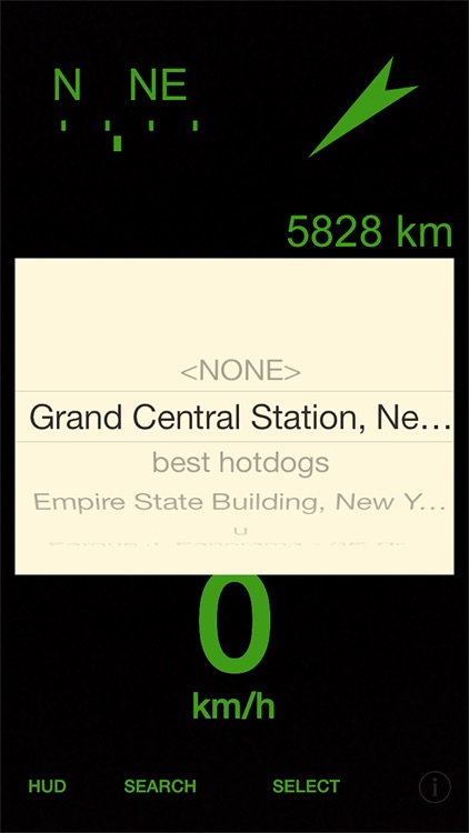
App Screenshots

App Store Description
Navi HUD is a navigation tool that supports all means of transportation (car, walking, bike, plane, train etc.) and combines the functionality of a navigation aid with the usefulness of a head up display (HUD).
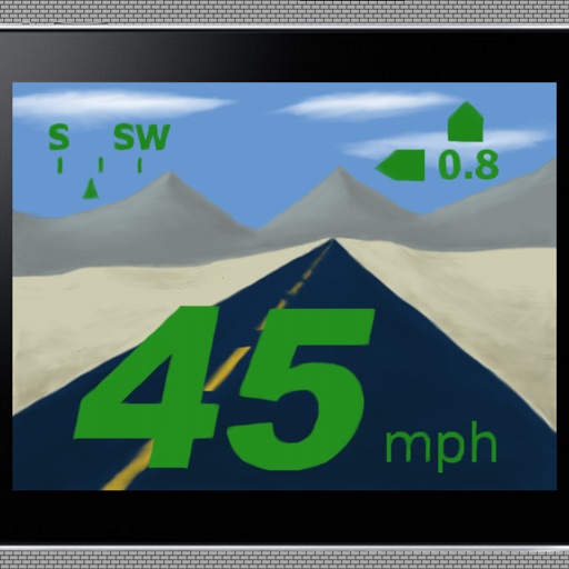
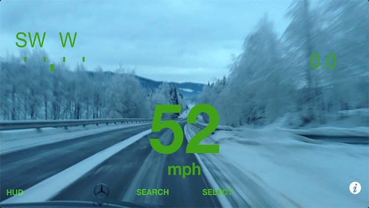
It displays speed and compass direction, and points towards your destination if one is selected. The tool supports both camera mode showing the information directly on screen, and HUD mode for projection onto a car windscreen.
The destination is shown with distance and direction, which allows the tool to be used with any mode of transportation (car, walking, biking, bus, taxi etc.) as it is not tied to the road network as most navigation tools. This makes Navi HUD also a a very useful tool for hiking, biking and general navigation around unfamiliar areas.
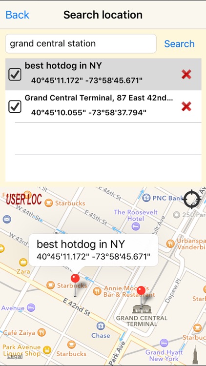
Navi HUD allows selecting a destination either by searching, clicking on the map, directly entering coordinates or selecting the current position. The latter is very useful for for finding your way back to e.g. your car in a large carpark, or your hotel in an unfamiliar city.
Multiple destinations can be defined, and it is quick and easy to switch between them. Destinations can be given a user defined name to simplify selection.
Have you ever looked at a BMW 7 series and thought it would be nice if your 1987 Toyota Corolla also had a head-up-display? Or do you own a bike, and find it unfair that only cars and fighter planes come with head-up-displays?
Maybe you want a simple way to find your way back to the car in large car-parks or when you are out hiking, or your way back to the hotel when you are traveling to unfamiliar cities?
If so, Navi HUD is the tool for you
Functionality:
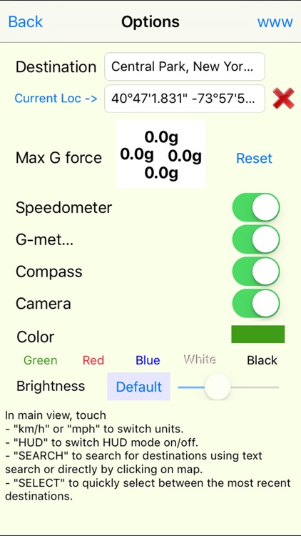
* Speedometer displaying speed in mph or km/h
* Compass
* G-meter displaying cornering and breaking/acceleration forces.
* Orientation arrow showing direction and distance to target (replaces G-meter when destination is set)
* Search for destinations using text string search. Visualize the search result on a map, and select one or multiple destinations from the list.
* Place a user defined destination location by tapping directly on the map.
* Type in destination coordinates directly, or easily select current position as destination. (Very useful to find your way back to for example your car or hotel in unfamiliar areas)
* Give user defined destinations names (like "Car parked at Giants Stadium") to simplify handling of multiple destinations
* Delete the destination (remove it from the list) when it is no longer relevant.
* Map usage requires internet access, and Navi HUD will warn if carrier network is used (to avoid large roaming costs). This warning can be temporarily or permanently turned off.
* Fully configurable, all tools can be individually turned on and off
* Camera can be turned off to save battery power.
* Separate Head-up display (HUD) mode (mirrored) for viewing the reflection of Navi HUD in a car windscreen.
* All settings are permanently stored, and is reloaded at restart. Up to 15 locations are remembered (the 15 most recent).
* Navi HUD supports coordinates in both degree, minute, second and decimal degrees with optional N,S,E,W specification.
* Selectable colors for display to ensure good visibility
* Manually adjust the screen brightness in app to get best visual result. HUD mode may require a brighter screen than normal mode to get good reflection.
* Easy switch betwen US (miles, feet, mph) and metric (meters, km/h) units for speed and distance.
* Stores maximum cornering and acceleration/breaking G forces
* Navi HUD does not require internet connection and have no additional cost even when traveling abroad. (Map search will require internet access, but is not required for the app to work.)
* Supports all versions of iPad and iPhone
* Note: The tool turns off screen lock, so it must be manually closed to avoid draining the battery when not in use.
For support and more information on use please refer to http://daeco.no/iosapps/navihud.
Disclaimer:
AppAdvice does not own this application and only provides images and links contained in the iTunes Search API, to help our users find the best apps to download. If you are the developer of this app and would like your information removed, please send a request to takedown@appadvice.com and your information will be removed.
AppAdvice does not own this application and only provides images and links contained in the iTunes Search API, to help our users find the best apps to download. If you are the developer of this app and would like your information removed, please send a request to takedown@appadvice.com and your information will be removed.