You are using an outdated browser. Please
upgrade your browser to improve your experience.

Enhance your maritime experience with the NOAA Buoy Data Viewer, an indispensable tool for boaters, sailors, anglers, and divers

NOAA Buoys - Charts & Weather
by Flytomap

What is it about?
Enhance your maritime experience with the NOAA Buoy Data Viewer, an indispensable tool for boaters, sailors, anglers, and divers. Access a wealth of real-time information directly from NOAA's National Data Buoy Center, ensuring you stay informed about crucial details such as tides, wave height and period, wind speed and direction, air and water temperature, humidity, dew point, atmospheric pressure, visibility, and even tsunami and typhoon warnings.
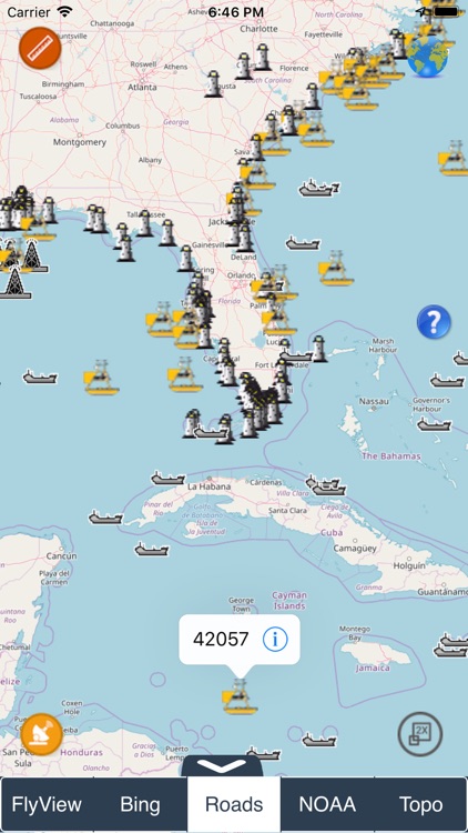
App Screenshots
App Store Description
Enhance your maritime experience with the NOAA Buoy Data Viewer, an indispensable tool for boaters, sailors, anglers, and divers. Access a wealth of real-time information directly from NOAA's National Data Buoy Center, ensuring you stay informed about crucial details such as tides, wave height and period, wind speed and direction, air and water temperature, humidity, dew point, atmospheric pressure, visibility, and even tsunami and typhoon warnings.
Key Features:
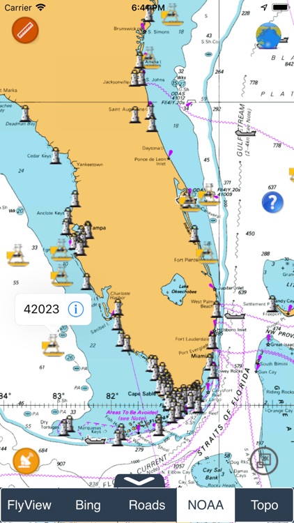
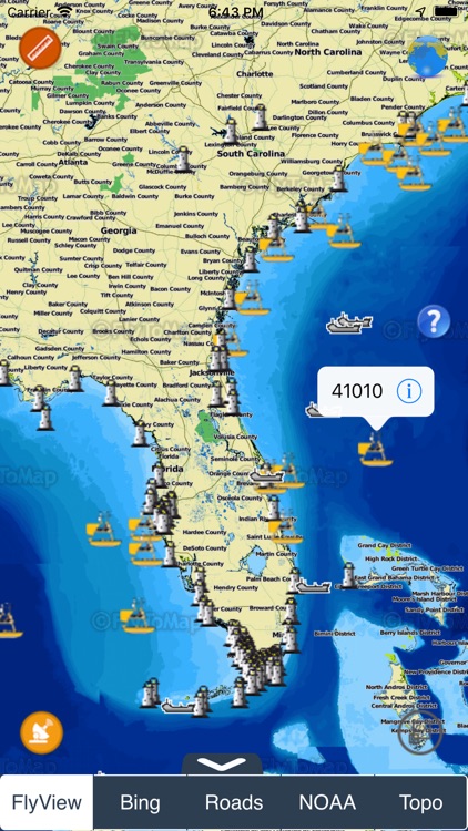
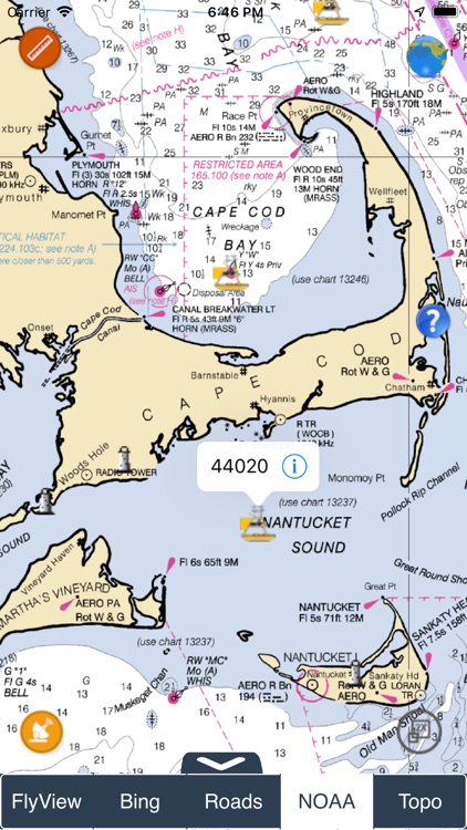
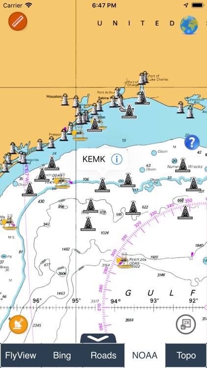
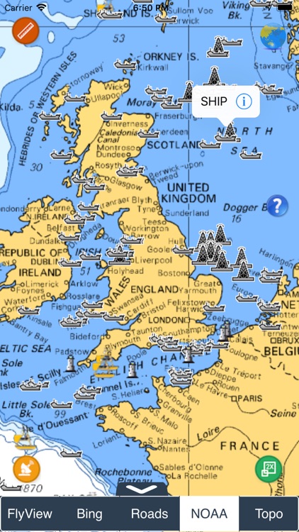
Global Overview: Explore an interactive world marine map that showcases all NOAA stations, buoys, and ships. Effortlessly locate the nearest stations and access comprehensive NOAA data with just a tap.
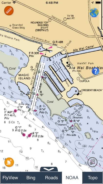
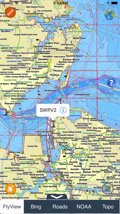
Detailed Marine Charts: Immerse yourself in detailed marine charts available at viewer.flytomap.com. The charts provide a visual representation of key information, making it easier for users to interpret and plan their maritime activities effectively.
Location-Specific Data: Whether using GPS or manually entering your preferred location, receive accurate and location-specific forecasts. The app ensures that you are well-informed about buoy data relevant to your chosen area.
Versatile Compatibility: Compatible with all iPhone, iPod, and iPad versions, the NOAA Buoy Data Viewer guarantees a seamless experience across various iOS devices.
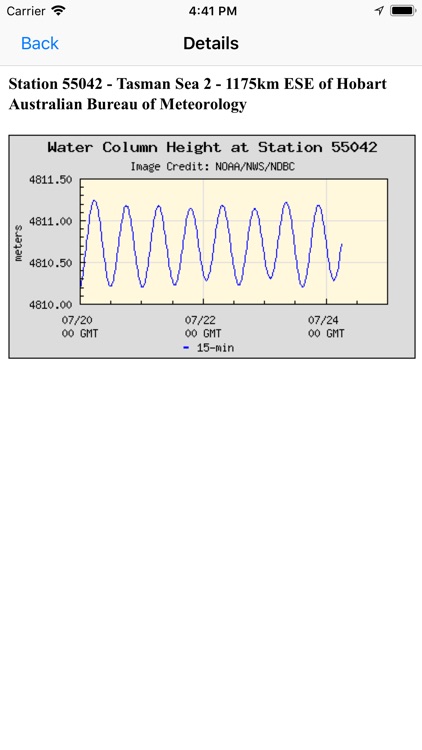
Live Buoy Data: Stay updated with live buoy data, including information on wave conditions, wind dynamics, and atmospheric details. The app categorizes buoys based on proximity to your selected location for quick and easy access.
Tide Predictions and Moon Phases: Plan your maritime activities efficiently with tide predictions and moon phase information available at your fingertips.
For a complete list of buoy locations supported by the NOAA Buoy Data Viewer, visit http://www.ndbc.noaa.gov/.
Download now and empower your nautical adventures with the most comprehensive NOAA buoy data at your disposal.
Disclaimer:
AppAdvice does not own this application and only provides images and links contained in the iTunes Search API, to help our users find the best apps to download. If you are the developer of this app and would like your information removed, please send a request to takedown@appadvice.com and your information will be removed.
AppAdvice does not own this application and only provides images and links contained in the iTunes Search API, to help our users find the best apps to download. If you are the developer of this app and would like your information removed, please send a request to takedown@appadvice.com and your information will be removed.